IGN map or GPS.
A good sleeping bag with a hood for cool nights (+ possibly a groundsheet).
Good walking shoes.
There are numerous mountain huts along the route.
Circular route around the Grande Casse
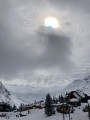
Four-day hike around the Grande Casse in the Vanoise National Park, starting from Pralognan. Highlights: crossing the rocks of Lac des Vaches, views of the Grande Casse and the Leisse Valley, all in an idyllic setting and in the company of marmots.
Details
Creation:
Last update:
Last review:
-
 Activity: Walking
 -
 Distance: 39.92 mi
 -
 Average duration: 4 days
 -
 Difficulty: Difficult
 -
-
 Back to start: Yes
 -
 Ascent: + 13,061 ft
 -
 Descent: - 13,045 ft
 -
-
 Highest point: 9,019 ft
 -
 Lowest point: 4,610 ft
-
 Country:
France
Country:
France
-

-
 City:
Pralognan-la-Vanoise (73710)
City:
Pralognan-la-Vanoise (73710) -
 Start/End: N 45.38262° / E 6.71934°
 -


 Hour-by-hour weather
Photos


Stages of the route
This route needs several days, find the details below:
Notes
Reviews and comments
4.6 / 5
Based on 7 reviews
Reliability of the description
4.7 / 5
4.7 / 5
Ease of following the route
4.6 / 5
4.6 / 5
Route interest
4.6 / 5
4.6 / 5
User 24417290
Overall rating : 5 / 5
Date of your route : Aug 02, 2025
Reliability of the description : ★★★★★ Very good
Ease of following the route : ★★★★★ Very good
Route interest : ★★★★★ Very good
Very busy route : No
A very pleasant four-day hike that I did starting from Pralognan. A wonderful discovery of the Vanoise, the first two stages are truly magnificent. However, the stages are very uneven: stages 2 and 3 are much easier and too short for my taste, but some people may appreciate these two days with little walking.
Machine-translated

DenisBrouillet
Overall rating : 5 / 5
Date of your route : Nov 18, 2024
Reliability of the description : ★★★★★ Very good
Ease of following the route : ★★★★★ Very good
Route interest : ★★★★★ Very good
Very busy route : No
As the shelters are unmanned, you have to bring your own food, which makes your rucksack heavier and therefore requires you to be well trained and in good physical condition.
Please note that not all shelters had water.
Machine-translated

Mbar2
Overall rating : 4.3 / 5
Date of your route : Sep 11, 2023
Reliability of the description : ★★★★★ Very good
Ease of following the route : ★★★★★ Very good
Route interest : ★★★☆☆ Average
Very busy route : No
Circular route completed entirely independently (couple of good walkers, aged 60, 14kg rucksacks).
Please note that you can only camp near the refuges and that places are (very) limited. It is therefore advisable to book a place during busy periods.
Most refuges close in mid-September.
Some passes are at an altitude of 2,700 metres. Therefore, there is a risk of snow and snowfields in early summer. Please check before setting off.
The stages planned for days 2 and 3 are short. We have therefore extended these two stages and finished at midday on the fourth day.
Our stages:
Stage 1: Pralognan - Refuge de la Leisse (stage from the guidebook)
Stage 2: Refuge de la Leisse - Refuge de la Glière
Stage 3: Refuge de la Glière - Refuge du Grand Bec
Stage 4: Refuge du Grand Bec - Return to Pralognan at 12 noon
More detailed information can be found on each route sheet.
Machine-translated
Alix44
Hello everyone,
I'm planning to do the circular route solo with my dog in early May.
I see that your reports mention hikes during the summer, but do you think the circular route is passable so early in the season? And do I need to bring any special equipment (crampons, etc.)?
Thank you,
Alix
Machine-translated
isabelle.megard
Overall rating : 4.3 / 5
Date of your route : Jul 29, 2017
Reliability of the description : ★★★★★ Very good
Ease of following the route : ★★★★☆ Good
Route interest : ★★★★☆ Good
Duration of days 2 and 3 too short: arrival at the refuge at 12 noon. Otherwise, the La Leisse and Col du Pale refuges are very welcoming, run by dynamic young people with excellent cuisine.
Machine-translated
matall86
Overall rating : 4.3 / 5
Date of your route : Aug 13, 2016
Reliability of the description : ★★★★☆ Good
Ease of following the route : ★★★★☆ Good
Route interest : ★★★★★ Very good
Great hike, magnificent scenery, very warm welcome at the various mountain huts (La Laisse, Le Palet and Grand Bec). We came across a family of ibex and lots of marmots.
Perhaps some directions are needed for the departure from Pralognan.
Otherwise, choose your mountain huts carefully to balance the daily distances to be covered.
Machine-translated
gerarddelgove@orange.fr
Overall rating : 4.3 / 5
Date of your route : Jul 14, 2016
Reliability of the description : ★★★★☆ Good
Ease of following the route : ★★★★☆ Good
Route interest : ★★★★★ Very good
The fresh snow disrupted the circular tour somewhat. It's always difficult to find space in the shelters, but it's a very beautiful tour with plenty of variety. Highly recommended. Gérard
Machine-translated
noisettes
Overall rating : 5 / 5
Date of your route : Jul 11, 2016
Reliability of the description : ★★★★★ Very good
Ease of following the route : ★★★★★ Very good
Route interest : ★★★★★ Very good
A very beautiful hike that we completed in six days due to the weather (rain and snow).
Some of the passes were quite snowy (Col de la Leisse, Col de Léchaux).
There are plenty of refuges along the route, allowing you to adjust the length of each stage.
Nothing but good things to say.
Highly recommended.
Machine-translated
GwadaStFelix
I am planning a 4-day circular trip in September. I hope the weather, the opening of the mountain huts, etc. will be fine. A real estate agency in Pralognan informed me that there is no public transport during this period. How can I get there from the nearest railway station and vice versa?
As a resident of Guadeloupe, I would like to take a few weeks (in September) to revisit this region, which I had the opportunity to discover (a long time ago with my children...).
If anyone would like to join me, I'd be delighted! And if you have any accommodation recommendations in the area, I'd love to hear them.
See you soon
Ph.Mini
06 90 45 69 22 Please note there is a 6-hour time difference (6 a.m. here, noon where you are).
Machine-translated
Other walks in the area
Pralognan - Leisse Refuge
Day1 of the Grande Casse circular route, from Pralognan to the Refuge de la Leisse, passing close to the impressive Grande Casse, all in a wild setting dotted with lakes.
Rocher de Villeneuve via La Montagne

This hike takes you through the beautiful mountain pastures of La Montagne and Le Golet to Rocher de Villeneuve, where you can enjoy a 360° view of the Aiguilles de Portetta, the ridges of Mont Charvet, Col de Leschaux and even Courchevel 1850.
Napremont

Beautiful promontory facing Pralognan, with stunning views of the entire area, including the Portetta breach and the Aiguille d'Août, which dominate the route. Unfortunately, this is now a round trip since the path (still shown on the map) through the Bois de Chollière is closed. (2008, order renewed every year since then, given the danger).
The ridges of Mont Charvet via the Col de la Grande Pierre

Another classic route from Pralognan with the very distinctive ridges of Mont Charvet. Magnificent views both towards Pralognan and its glacial domes and towards Courchevel. The path is exposed, sometimes narrow, and should not be used in wet weather. Schist peaks and dissolution cones dot this long ridge trail. Easy return via the mountain pastures.
Le Napremont

This circular route offers beautiful views and 360° panoramas of the surrounding area and peaks. In terms of difficulty: there is a difference in altitude in the undergrowth; there is a passage through a chimney, but this has been made easier by the installation of steps and a handrail.
A trail with beautiful flora dominated by the Dents de Portetta and the Aiguille d'Août.
A pleasant descent in the sunshine before returning to the undergrowth. A very beautiful route, even in hot weather.
Refuge de la Vallette via the Pas de l’Âne

A challenging hike that passes through the Cirque du Petit Marchet, crosses the Roc du Tambour to reach the Refuge de la Vallette and ends at the hamlet of Le Prioux.
Tip: only undertake this hike when there is no snow and in dry weather.
Lac de la Patinoire

A very pleasant hike with a vast panorama from the Rosset Pass opening onto the Grande Casse and the Vanoise glaciers. The final point of the climb is the lake and its feeding glacier, which you will discover in the last few steps.
See § practical information
The 3-Pass Circular: Leschaux, Rosset and Vanoise, starting from Pralognan

A superb route with a particularly varied character.
A high-mountain atmosphere, depending on the areas you pass through.
Lush and green, with flora unique in Europe.
Wildlife is ever-present, with marmots, chamois and ibex to be spotted with a keen eye.
Its mountain lakes: the iconic Lac des Vaches, Lac de la Patinoire and Lac du Long.
Spectacular views of the surrounding peaks: the Grande Casse, to name but one.
Beautiful panoramic views of the valley and the various surrounding glaciers.
For more walks, use our search engine .
The GPS track and description are the property of this route's author. Please do not copy them without permission.

