From Gavarnie to the Col de Tentes via the Cabane des Soldats

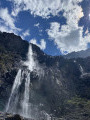
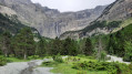
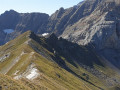
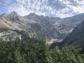
A very beautiful walk that takes in a variety of very different sections of trail. The spectacular view from the Bellevue plateau – which certainly lives up to its name – is particularly memorable: the Marboré, the Pics de la Cascade, the Tour and the Casque, the great waterfall, with the Hôtellerie du Cirque at its base.

Details

n°3135101
Creation:
Last update:
Last review:
  • Walking
    Activity: Walking
  • ↔
    Distance: 6.01 mi
  • ◔
    Average duration: 5h 20 
  • ▲
    Difficulty: Moderate

  • ⚐
    Back to start: No
  • ↗
    Ascent: + 2,979 ft
  • ↘
    Descent: - 223 ft

  • ▲
    Highest point: 7,441 ft
  • ▼
    Lowest point: 4,485 ft

Photos

Description of the walk

You’ll need two cars for five walkers. Leave one car at the Col de Tentes and return to Gavarnie with the second. Paid car parks are available on either side of the D 128 at the village entrance.

(S) Enter the village, pass the Maison du Parc on your left and you’ll immediately come to a Fork in the road.

(1) Turn right onto the street leading to the church. This street becomes a wide track until it reaches the foot of a series of hairpin bends, known as the Entortes.

(2) The track climbs due west via several hairpin bends before veering due south. The gradient eases off, leading to a second series of hairpin bends, again heading due west, before reaching the Bellevue plateau.

(3) Continue along the path, passing the Pouey Aspé hut on your right. Cross the plateau heading south-west and make your way towards the Peyre Nère escarpment.

(4) Follow the ledge path to reach a second plateau (elevation 1,873).

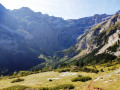
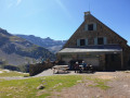
(5) Carry on straight ahead, leaving the path to the Brèche refuge on your left. Continue to the Cabane des Soldats (1,954 m). Views of the Taillon and the Gabiétous.

(6) Continue along the well-marked path, following the Gave des Tourettes, until you reach a junction at 2,048 m.

(7) It is possible to go straight on, but this is much more strenuous and the path is poorly marked towards the end as you approach the Port de Boucharo. Therefore, turn right. The path through the scree climbs in two hairpin bends, then becomes a long straight stretch before ending with a few bends at the Port de Boucharo.

The Port de Boucharo is one of the oldest passes between the southern and northern slopes of the Pyrenees. Several road projects were considered but never came to fruition. A path descends on the Spanish side and leads to Saint-Nicolas de Bujaruelo.

(8) Turn right onto the road closed to traffic. It follows a contour line, winding its way in places between large boulders, before reaching the Col de Tentes (E).

Waypoints

  1. S : mi 0 - alt. 4,488 ft - Car park - Village de Gavarnie
  2. 1 : mi 0.27 - alt. 4,521 ft - Fork in the road, turn right. Near the - Gave de Pau
  3. 2 : mi 1.08 - alt. 4,872 ft - Les Entortes
  4. 3 : mi 1.64 - alt. 5,449 ft - Bellevue Plateau
  5. 4 : mi 2.43 - alt. 5,892 ft - Peyre Nère
  6. 5 : mi 3.08 - alt. 6,165 ft - Plateau
  7. 6 : mi 3.49 - alt. 6,375 ft - Cabane des Soldats
  8. 7 : mi 4.17 - alt. 6,726 ft - Junction, turn right
  9. 8 : mi 5 - alt. 7,441 ft - Port de Boucharo
  10. E : mi 6.01 - alt. 7,244 ft - Col de Tentes

This route passes through a protected area, which may be subject to special regulations:

Worth a visit

(E) From the Col de Tentes, it takes 20 minutes – without any uphill climb – to reach the lovely Lac des Espécières or Lac de Luhos.

Reviews and comments

4.7 / 5
Based on 1 review

Reliability of the description
5 / 5
Ease of following the route
5 / 5
Route interest
4 / 5
randolionel
randolionel

Overall rating : 4.7 / 5

Date of your route : Apr 19, 2021
Reliability of the description : ★★★★★ Very good
Ease of following the route : ★★★★★ Very good
Route interest : ★★★★☆ Good
Very busy route : No

I’m organising a holiday in this region for this summer
That’s why I’ve picked out a few routes
Although I know the region like the back of my hand
I’m using your descriptions to check the details, information, reviews, timetables…
and I’d like to thank you for that
Lionel LOISTRON

Machine-translated

Other walks in the area

For more walks, use our search engine .

The GPS track and description are the property of this route's author. Please do not copy them without permission.