Circular walk in the Vallée de la Chaluppe

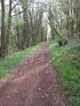
Combining forest tracks and paths through fields, this short walk offers a mix of woodland and open countryside.

Details

n°28348425
Creation:
Last update:
Last review:
  • Walking
    Activity: Walking
  • ↔
    Distance: 2.98 mi
  • ◔
    Average duration: 1h 25 
  • ▲
    Difficulty: Easy

  • ⚐
    Back to start: Yes
  • ↗
    Ascent: + 66 ft
  • ↘
    Descent: - 72 ft

  • ▲
    Highest point: 427 ft
  • ▼
    Lowest point: 361 ft

Photos

Description of the walk

Park at the ‘parking de chasse’ sign, located at the end of a track that starts from a small road running perpendicular to the D35. You can park on the grass verge beside the footpath.

(S/E) Set off north-west along the hiking trail and, after about a hundred metres, take the first path on the left into the woodland. At the T-junction, take the first turn right then left and continue through the woodland towards the west. Leave the woodland and you’ll immediately come to a grassy crossroads at the bottom of the Vallée de la Chaluppe.

(1) Follow the path leading uphill opposite. You’ll come out onto a small road (elevation 124) and follow it to the left until you reach a crossroads.

(2) In the hamlet of Les Champs, turn right. Continue along the path across the fields until you reach another junction.

(3) Then turn right. After about a hundred metres, take a path on the right at the edge of the woods. Further on, the path enters the woods and leads to a T-junction.

(4) Take the wide path branching off to the left and follow it to the end of the small wood on your right. Then turn right and cross the small road again. Carry on straight ahead and head downhill to reach the Vallée de la Chaluppe.

(5) At the junction, head up into the woods opposite. At a Fork in the road, keep left and carry on straight ahead along the main path until you reach the starting point (S/E).

Waypoints

  1. S/E : mi 0 - alt. 413 ft - Hunting car park
  2. 1 : mi 0.53 - alt. 367 ft - Chaluppe Valley – Crossroads
  3. 2 : mi 1.06 - alt. 423 ft - Les Champs – Crossroads
  4. 3 : mi 1.48 - alt. 427 ft - Junction
  5. 4 : mi 1.83 - alt. 420 ft - T-junction
  6. 5 : mi 2.5 - alt. 374 ft - Chaluppe Valley – Crossroads
  7. S/E : mi 2.98 - alt. 413 ft - Hunting car park

Notes

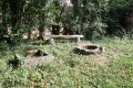
- Shaded sections in the woodland, ideal for summer.
- Water bowls are provided throughout the walk (handy for dogs).

Reviews and comments

4.7 / 5
Based on 1 review

Reliability of the description
5 / 5
Ease of following the route
5 / 5
Route interest
4 / 5
kiki86
kiki86

Overall rating : 4.7 / 5

Date of your route : Dec 31, 2022
Reliability of the description : ★★★★★ Very good
Ease of following the route : ★★★★★ Very good
Route interest : ★★★★☆ Good
Very busy route : No

A short, pleasant route, mostly through woodland.

Machine-translated

Other walks in the area

For more walks, use our search engine .

The GPS track and description are the property of this route's author. Please do not copy them without permission.