


 Country:
 City:


Car park at Manternach Town Hall, opposite the church.
(S/E) Leave the town hall car park via the car entrance. Pass the replica of the Lourdes Grotto and the church on your left, then turn right. Walk down to the CR134 road. Turn left. Walk past a chapel attached to a house. Then turn right onto the road towards Mertert – Wasserbillig. You’ll come across another chapel along the way. Walk down the road and pass some old agricultural machinery.
(1) Turn right into Rue Am Burfeld. Go under the railway line and cross the Syre via the bridge. On your left, between two buildings, you’ll see the walking trail signpost. We’ll come back this way. Carry on to the Fork in the road and turn left.
Marked ‘C’ on a white arrow
The road turns into a grassy track. Walk uphill to the tarmac road. Carry on straight ahead. At thefirst junction, turn left. Further on, ignore the road on your right and carry on.
(2) At the bend, turn left. Descend with care; a small stream may run alongside the path, making it muddy and slippery. Enter the woodland. Descend the steps with care as they are very slippery. Change of signposting.
Markings: SH (white) on a mauve rectangle
(3) At the bottom of the path, turn right; a viewing platform awaits you. Continue along the path. Pass through the ravine woodland and past its information board. Walk down to the junction. Turn left and cross the bridge. Head towards another information board on the left.
(4) Take the path to the left of the information board. When you reach the road, turn left. Pass under the railway bridge towards the ruins of the timber mill. There are information boards a little further along the road. Retrace your steps and take the path on the left after the shelter. Walk uphill for a short while.
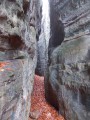
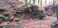
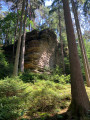
(5) Turn onto the path on your left. Walk uphill until you come to the vineyard. Take the hairpin bend to the right and continue through the forest. Ignore the path on your right and carry on. Pass the rock formations at Michelslay
(6) At the junction, turn left. Climb the steps. At the top, you’ll find a viewpoint; at the forest track, turn right. At the junction, carry straight on. Walk alongside the property’s fence on your right. At the entrance to the property, turn left. Walk downhill and, when you reach a path leading back towards the property, take the path on your left. Follow it to the footbridge crossing the Schlammbaach. Cross it and continue to the left. Cross a pontoon bridge over a tributary of the river (not shown on the map).
(7) At the junction, turn left, cross a stream at a ford (not shown on the map) – which may or may not be easy depending on the flow – and a little further on, cross the bridge over the main river. Continue along the path to the right and, further on, climb the steps. Leave the forest and walk along the meadows.
(8) At thefirst path leading into the forest on the left, next to a wooden deckchair, turn off. Follow it to the road. Carry on to the left. At thefirst track, turn right and, at the junction, carry on straight ahead.
(9) At the bend, take the path on the left and head downhill. Pass a viewpoint overlooking the valley and continue along the path. Pass thefirst footbridge and head downhill to your left. At thesecond footbridge, cross over and, a little further on, begin the descent down the terraced land via the steps built into the low walls. At the bottom, turn left. Walk past La Renardière, the Manternach Tourist Information Centre. Take the path leading down to your right until you reach the CR134 road. Follow the road to the right.
(10) Depending on the progress of the roadside redevelopment, either take the path on your right, which allows you to pass under the road through a tunnel, or cross over to take the metal steps and use the footbridge spanning the Syre. On the other bank, turn right and go under the railway bridge. Cross the stream at the ford – which may or may not be easy depending on the flow – and continue along the path. Walk past the old 19th-century dam.
(11) At the end of the path, ignore the footbridge on the right and head left, then immediately turn right. Follow the path, go through a gate and make sure you close it properly behind you. Carry on, go through two gates in quick succession and cross the orchards. The path leads to a track that loops back, behind some buildings, to the start of the walk. End of signposting.
Back on the road, turn right, cross the bridge over the Syre and then go under the railway bridge.
(1) At the end of the road, turn left and return to the town hall car park via the same route you took on the way out (S/E).

 Visorando Member
 Easy

 Difficult
 Very difficult

