Country:
 City:


Signposting: dark red ‘M’ on a white background
(S) From the Market Square opposite the Denzelt, head to the left. Turn right and take the pedestrian street. At the fountain, take the small street on the left, Rue du Charly. When you reach the main road, cross with care.
(1) Continue along the grassy path opposite, running alongside the corner house. Turn onto thefirst path on your right. Walk uphill, past the chapel. When you reach the road, continue to your right until you come to a wide left-hand bend
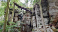
(2) Just before the end of the bend, near a bench, take the path up to your right. At the top, there’s a view of Echternach. Follow the path, ignoring the one leading behind the shelter, as well as the next one. Carry on straight ahead, ignoring the path leading uphill on your right. At the Y-junction, turn left and go up the stairs. This is where the Loup Gorges begin. Once at the top, there are three viewpoints to enjoy.
(3) To the right, a viewpoint overlooking the valley with a passage between two rocks and a concrete footbridge. Once back down, start climbing the steps opposite to reach the other two viewpoints. Head first towards the furthest viewpoint with the picnic table. View of the valley and a compass rose. Retrace your steps, cross the footbridge on your right and head towards the other viewpoint, from where you can see thefirst viewpoint and its concrete footbridge below. Head back down into the gorge and follow the path on the left. Go down a flight of steps until you reach a path again, then follow it straight on. Once you reach the road, head towards the shelter.
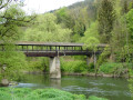
(4) Cross the bridge in front of the shelter and follow the path up the steps. Continue along the path overlooking the road and cross the ‘Labyrinth’. Further on, cross a bridge, continue for about a hundred metres until you reach some steps on the right.
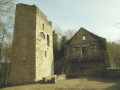
(5) Take the steps to cross the road carefully and go and see the Perekop Fault (currently closed). Retrace your steps and follow the path to the right, running alongside the Aesbach. Cross the bridge and climb the steps, passing the Malakoff Tower. Follow a series of bridges and staircases, at varying distances from one another, until you reach the junction with the signpost.
(6) Head up to the right towards Hohlay. Go through the cave and continue up the steps on the right. Pass through Piteschkummer. Turn left to explore the amphitheatre formed by two caves, Breechkaul and Flombkaul. Return to the path and head up to the junction. Continue to the left until you reach the next path on the left.
(7) Take this path on the left for a short round trip to see a ‘Zür-Mutter-Gottes’ shrine. Once back on the path, continue to the left. At the T-junction, turn right. Leave the woods, take the road through the fields and enter the village. You’ll arrive at the crossroads near the fire station.
(8) Turn right and walk past the church. Turn left towards Beaufort along Rue de Grundhof. After the bend, take thefirst right, “Um Millewee”. Then take the footpath on your right, “Neie Schoulwee”. Ignore the path on your right and continue through the woods. At the signpost, turn left. Ignore the footbridge on your right and continue along the path on the left.
Diversion Signage
At the steps on your right (the original Mullerthal Trail Route 2), a diversion has been put in place. Carry on straight ahead. Stay on the main path for approximately 750 metres.
(9) At the fork in the road, take the less well-marked path on the right, ignoring the hairpin bend behind the bench. The path then turns sharply to the left.
(10) At the sunken junction, turn right. At the next junction, turn right again.
Markings: Dark red ‘M’ on a white background
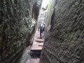
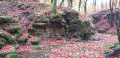
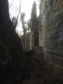
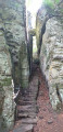
At the junction with the signpost, take the steps leading down to your left. Pass between the rocks at Binzeltschluff, continue to the road and cross with care. In the car park, there is a view of Predigtstull to the right. Head right towards the steps between the rocks. Climb a few steps. Ignore the steps on your left (unless you wish to visit Werschrummschluff and have a go at the crevices). At the top, where the rock face widens, leave the steps and head towards the gate. When you reach it, continue to the right and follow the path down.
(11) Halfway down, turn left. At the Fork in the road (not shown on the map), take the left-hand path and begin a long stretch of approximately 800 metres with no junctions, consisting of steps and rocky sections.
(12) At the signpost, turn slightly to the right. Go down the steps, ignore the path that winds sharply to your right and carry on straight ahead. Enter the Schnellert Nature Reserve. Follow the path, passing under a rock. You may spot the Saint-Jean cave on your left, followed by the Salamander cave.
(13) At the Fork in the road, take the left-hand path. Look out for the Sainte-Barbe Cave up on the hillside. At the steps on your left, climb up and head towards the entrance to the Grotte des Celtes. It isn’t blocked off, but you’ll need to squeeze through a narrow passage. After leaving the cave, if you feel up to it, climb up to the top of the cave on the right to discover the dolmen. Otherwise, head back down and follow the path to the left.
At the crossroads, carry on straight ahead. Go down the stairs to the road and take the forest track on the left.
(14) At the Fork in the road, turn right. Leave the forest and cross the stream. Follow the path uphill and, when you reach the road, take the path on your right. Cross the footbridge and, after a right-hand bend, turn left onto the road. At the T-junction, turn right towards Waldbillig and you’ll reach Heringer Millen (E).

 Visorando Member
 Difficult