Country:
 City:
City:


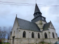
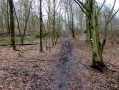
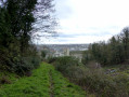
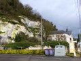
Car park at the judo club hall, Rue des Martyres de la Résistance in Grand Quevilly.
(S/E) Head north, go through the gates at the end of the block of flats and carry on straight ahead along Rue du 19 Mars. Follow the road as it bends right onto Rue Albert Thomas until you reach the traffic lights.
(1) Turn left onto Boulevard Maurice Ravel and, at the roundabout, turn left onto Boulevard de Verdun. At the next roundabout, carry straight on down Boulevard Pierre Brossolette. Pass another roundabout, go under a railway bridge, pass a set of traffic lights, a T-junction, a railway line, and arrive at a set of traffic lights at the large junction on Boulevard de Stalingrad.
(2) Cross the boulevard and continue straight ahead onto Rue du Bac. At the roundabout, go straight ahead, take the ferry across the Seine to reach the right bank. Exit the ferry via the pedestrian access on the right. Cross the road (Quai du Danemark), turn right and walk to the École Hector Malot.
(3) Turn left just after the school onto Rue du Cimetière, just before the Sainte-Barbe convent. Walk up the slope and, further up opposite the cemetery, turn right. Go up the steps, turn left and follow the path uphill to the Y-junction. Take the right-hand branch to reach the first path on the right, just before the road, Route de Sahurs.
(4) Turn onto the path on the right, before the road. There is a gate on this path. Go round it on the right, passing over the electrified wires (there is a right of way, but do not venture onto it during the hunting season; instead, go from point 4 to point 6, taking care of traffic) and continue to the left to reach a field. Turn right to join thefirst path on the left in the residential area, Sentier d’Houdeville.
(5) Follow this path to the T-junction, Route de Sahurs. Turn left, cross the road well before the bend for safety, and continue to the bend.
(6) At the bend, take the path on the right and carry on until you reach the road, just past a high-voltage power line – Route forestière de la Mare de Fer. Turn right and head for the first X-junction.
(7) Turn left and go up the slope, Ligne au Blaireau. Cross the road and continue straight ahead. At the next T-junction, turn left onto the Route forestière de Saint-Georges à Dieppedalle (this is a track). Cross the road shortly afterwards (Route forestière Charmante) and continue straight ahead until you reach the next road, Carrefour des Treize Chênes.
(8) Cross the Route de Sahurs and continue along the path opposite. Stay on the main path and head downhill to the road, Cavée de Dieppedalle.
(9) Follow it to the left, go down Rue Hardel and take thefirst left, Rue Centrale, just before the traffic lights. Follow this lane to the end to reach the road, Quai du Danemark.
(10) Turn left at the traffic lights, then turn right and head for the ferry landing stage. Cross the Seine to reach the left bank and, via the road you took on the way there, head to the first set of traffic lights.
(2) Cross Boulevard Stalingrad and continue straight on along Boulevard Pierre Brossolette. Pass thefirst T-junction and turn right onto Rue Jean et Pierre Navarre. Take thefirst left and continue to the T-junction.
(11) Turn left onto Rue de l’Église and go past the T-junction. At the next Y-junction, turn left, still staying on Rue de l’Église. At the next T-junction, turn right with your back to the church, then immediately left, and go up the steps on the left-hand side of the chemist’s to reach Rue Sadi Carnot.
(12) Cross the road and continue straight ahead along Rue Marcellin Berthelot. Take thefirst right into Allée Marcellin Berthelot. At the T-junction, turn left onto Rue des Martyres de la Résistance, pass the cemetery and the bridge over the motorway, and continue to the traffic lights.
(13) Cross Avenue Général Leclerc, continue straight ahead and return to the starting car park (S/E).


 Visorando Member
 Difficult
 Very difficult
 Easy
Easy