Country:
 City:
City:


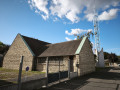
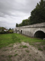
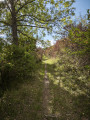
The starting point is the car park at the Espace Culturel et Sportif, Rue de la Petite Vitesse.
(S/E) Opposite the Espace Culturel et Sportif, turn right onto Rue de la Petite Vitesse, passing behind the Henri Leconte Hall. At the end of this street, cross the road and continue along the Voie Verte until you reach another street.
(1) Turn left, cross a junction and head up a small street, Chemin de Beauregard. Continue along this path until you reach a T-junction. Turn slightly left. Ignore the turn-offs to the right, then go down a flight of steps on the left until you come out onto a road. Cross the road and carry on straight ahead. Further on, ignore a turn-off to the left and head down a stony path until you reach the D163 road opposite the cemetery.
(2) Cross it at the pedestrian crossing. Walk along the edge of the cemetery to the right and climb a flight of steps near a bench. Then follow the road to the left, which leads into the forest. Go through a gate and carry on until you come to another gate. Go through it and continue with the fields on your right. Ignore a turn-off to the left (marked by a ‘No Motor Vehicles’ sign) and carry on to the next turn-off to the left (marked by another ‘No Motor Vehicles’ sign). Walk on for about 80 metres.
(3) At a bend, just before a Fork in the road, head down to the left along a small track which will curve to the right. Follow it along the edge of the woodland until you reach a crossroads.
(4) Leave the woods. Turn left onto a path which immediately turns right to re-enter the forest. Ignore the left-hand turn-offs and you’ll come to a gate (marked with a yellow marker). Then turn left and cross a road. Pass under some high-voltage power lines and continue to a crossroads.
(5) Leave the PR® and take the sharp left-hand bend (marked by a Yellow Cross), passing under the high-voltage power lines once more. At a Fork in the road, turn right. Continue, ignoring all side paths, until you reach a T-junction. Turn left to reach a crossroads (elevation 124).
(6) Turn left, following a straight PR® path along the Route de St-André. Cross two large junctions and you’ll reach a third.
(7) Let the PR® head off to the left and carry on straight ahead along a straight track. Ignore the turn-offs to the left. Then head downhill to a junction and go straight up the opposite side for about 400 m until you reach a crossroads.
(8) Take the path on the right, heading south-west. Ignore all side paths until you reach the Ézy water reservoir.
(9) Immediately afterwards, on your left, head down a small path. At the T-junction that follows straight away, turn right. Further on, take a sharp left-hand bend (marked by a Yellow Cross on a sign opposite). Ignore any side paths until you come out onto a road opposite some playgrounds. Walk down to the ‘give way’ sign and head left onto Chemin des Vignes. Then take the first right until you reach the Eure Valley Greenway.
(10) Turn right onto it. A little further on, cross a road and continue to a junction (give way sign).
(11) Take the dirt track on the left, running alongside the houses. Cross the D143 with care. Follow this road to the left, then turn into the first street on the right. Turn into the first dirt track on the left between nos. 19 ter and 20. Continue straight on and climb up the earthen embankment to Rue du Pont Saint-Jean.
(12) Cross it carefully and carry on straight ahead, following the River Eure to the footbridge and its park. Continue along a path until you reach Rue de la Digue on the left. You’ll come to a T-junction.
(13) Turn left onto Rue Aristide Briand and walk for about 50 metres, then take a footpath on the right (marked by a ‘No Motor Vehicles’ sign). Walk past the church and turn right. Turn right again onto Rue Isambard. Then turn left onto Rue Aristide Briand, and walk past a wash house on your right. Continue along Quai de l’Eure, then Rue Frédéric Passy.
(14) Turn left onto the path between numbers 5 and 7 on this street. Then first turn left then right to walk alongside the stadium. At the next junction, turn left onto Rue Maurice Elet, then right. Take the second left onto Boulevard Gambetta, and walk past the Museum of Combs and Ornaments, then the Henri Leconte Hall, before returning to the starting point.
 Tourism professional
 Easy
Easy 
 Visorando Member