Urçay circular loop via the Pont du Vernet

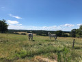
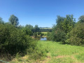
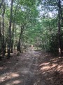
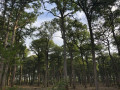
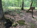
A shaded family walk in the Cher valley. You’ll be on the border between the Cher and Allier departments.

Details

n°1762013
Creation:
Last update:
Last review:
  • Walking
    Activity: Walking
  • ↔
    Distance: 3.35 mi
  • ◔
    Average duration: 1h 40 
  • ▲
    Difficulty: Easy

  • ⚐
    Back to start: Yes
  • ↗
    Ascent: + 190 ft
  • ↘
    Descent: - 184 ft

  • ▲
    Highest point: 702 ft
  • ▼
    Lowest point: 545 ft
  • ⚐ Country: France
  • ⚐ City: Urçay (03360)
  • ⚑
    Start/End: N 46.626842° / E 2.589789°
  • ❏
    IGN map(s): Ref. 2426SB, 2427SB
  • Hour-by-hour weather

Description of the walk

Parking at the church square in Urçay.

(S/E) Take the D2144 national road towards Montluçon until you reach the Fork in the road.

(1) Ignore the return route on the left, carry on straight ahead for about a hundred metres, then turn right onto the Chemin de Tizais, which runs parallel to the River Cher. Head towards the hamlet of Le Vernet.

(2) Pass the Vernet bridge on your right and continue left along the tarmac road for about 600 metres.

(3) Turn left onto the track and follow it straight on, ignoring the first track on the left.

(4) Just as the track turns right towards the D2144 main road, carry on straight ahead, running alongside it before joining it.

(5) At the junction, turn left onto the road and follow it carefully, keeping to the left-hand verge for 150 metres.

(6) Cross the road for safety’s sake (due to the blind bend) and continue along the right-hand verge until you reach the junction with Rue des Sabotiers.

Turn right and follow this street until you reach the junction with the D2144, ignoring all the streets on the right.

(1) Turn right to return to the starting point (S/E).

Waypoints

  1. S/E : mi 0 - alt. 551 ft - Église Saint-Martin (Urçay)
  2. 1 : mi 0.14 - alt. 554 ft - Crossroads at the end of the circular loop
  3. 2 : mi 1.54 - alt. 558 ft - Vernet Bridge - Le Cher
  4. 3 : mi 1.87 - alt. 646 ft - Crossroads
  5. 4 : mi 2.33 - alt. 663 ft - Path running parallel to the D2144
  6. 5 : mi 2.68 - alt. 597 ft - Junction with the D2144
  7. 6 : mi 2.79 - alt. 581 ft - Crossing the D2144
  8. S/E : mi 3.35 - alt. 551 ft - Église Saint-Martin (Urçay)

Worth a visit

In the village:
- Maison de la Dentelle. Opening days: from 1 June to 30 September, weekends only, from 2.30 pm to 6 pm.
- The listed church of Saint-Martin (11th–17th centuries) with its octagonal bell tower clad in chestnut wood shingles.

Reviews and comments

4.7 / 5
Based on 1 review

Reliability of the description
4 / 5
Ease of following the route
5 / 5
Route interest
5 / 5
David GUILLAUME
David GUILLAUME
• Edited:

Overall rating : 4.7 / 5

Date of your route : Jun 27, 2020
Reliability of the description : ★★★★☆ Good
Ease of following the route : ★★★★★ Very good
Route interest : ★★★★★ Very good
Very busy route : No

As a resident of the neighbouring town, I discovered some local areas I hadn’t known about before. The walk is very pleasant all the way along the route. There are no particular difficulties, apart from the fact that the first kilometre is the most challenging, with a steep hill…

Machine-translated

Other walks in the area

For more walks, use our search engine .

The GPS track and description are the property of this route's author. Please do not copy them without permission.