Circular Éclaron route via the old canal and the Blaise

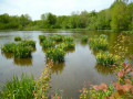
A countryside walk starting from the village hall in Éclaron, taking in the wooded banks of the old Wassy Canal, the Ruisseau des Fabriques and the banks of the Blaise.

Details

n°3093152
Creation:
Last update:
Last review:
  • Walking
    Activity: Walking
  • ↔
    Distance: 2.02 mi
  • ◔
    Average duration: 0h 55 
  • ▲
    Difficulty: Easy

  • ⚐
    Back to start: Yes
  • ↗
    Ascent: + 13 ft
  • ↘
    Descent: - 13 ft

  • ▲
    Highest point: 459 ft
  • ▼
    Lowest point: 436 ft

Photos

Description of the walk

Park in the car park of the village hall in Éclaron.

(S/E) Leave the car park and turn right onto Rue de la République. Continue straight on along Rue de la Gare, crossing the disused Saint-Dié to Wassy Canal. You’ll arrive at the water tower.

(1) Turn right – you’re still on Rue de la Gare. Continue along the path that follows it. Cross the iron canal bridge over the River Blaise, then follow the canal to the junction with the tarmac road, which is Rue Quartier de la Gare.

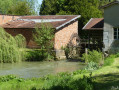
(2) Turn right. Before the gate to the property, turn right onto the footpath and cross the footbridge over the Ruisseau des Fabriques. Follow the stream along its left bank. At the confluence with the Ruisseau de la Grande Noue, turn left. Take the path between the two fields. You will reach the mill on the banks of the Blaise.

(3) Continue along the River Blaise, via Rue des Promenades, until you reach the NapoleonI Bridge.

(4) Cross the bridge on the right and turn onto Rue Napoléon1er. Head towards Place Pelletier, walk straight on past the town hall to reach the car park for the village hall (S/E).

Waypoints

  1. S/E : mi 0 - alt. 446 ft - Car park at the village hall
  2. 1 : mi 0.55 - alt. 456 ft - Water tower
  3. 2 : mi 0.97 - alt. 456 ft - Crossroads, Rue Quartier de la Gare - Canal de Saint-Dizier à Wassy
  4. 3 : mi 1.64 - alt. 440 ft - Mill
  5. 4 : mi 1.83 - alt. 440 ft - Napoleon I Bridge over the - Blaise (rivière) - Affluent de la Marne
  6. S/E : mi 2.02 - alt. 446 ft - Car park at the village hall

Notes

Wear sturdy shoes; some paths may be muddy if it rains.
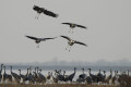
Binoculars for those who want to go birdwatching – there are plenty of birds along the canal and the river, as well as the storks’ nest.
Water available at the mini-market, bakery and café on the square.
Toilets at the town hall.

Worth a visit

(3) The Blaise reservoir: You can visit the sluice gate and see the mill pond by turning right.
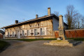
(4) Napoleon Bridge: opposite this bridge, see the monument dedicated to NapoleonI’s visit, during which he spent a night in the house to the right of the bridge.
(Between 4 and S/E) You can spot the white stork’s nest on the roof behind the mini-market, as well as on the roof of the old school on Rue de Guise. The church is worth a visit.
Lake Der is 2 km away.

Reviews and comments

4.7 / 5
Based on 1 review

Reliability of the description
5 / 5
Ease of following the route
4 / 5
Route interest
5 / 5
mipaho
mipaho

Overall rating : 4.7 / 5

Date of your route : Oct 24, 2021
Reliability of the description : ★★★★★ Very good
Ease of following the route : ★★★★☆ Good
Route interest : ★★★★★ Very good
Very busy route : Yes

A short, very pleasant walk where you can listen to the birdsong and sense the wildlife around you, even if you don’t actually see it. The colours were beautiful on this sunny autumn’s day, thanks to the rays of sunlight trying to make their way through the still-dense foliage, particularly along the wooded banks of the old canal.

Machine-translated

Other walks in the area

For more walks, use our search engine .

The GPS track and description are the property of this route's author. Please do not copy them without permission.