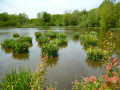
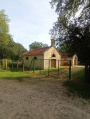
The two canals from Allichamps

Explore the disused Fabriques Canal, from Wassy to Saint-Dizier, the interesting canal bridge over the River Blaise, the village of Éclaron and its church, the canal feeding water from the River Blaise to Lac du Der, the old mill at Éclaron, the village of Allichamps with its church and the former foundry which manufactured piano frames for Gaveau and Playel until 1990.

Details

2589421
Creation:
Last update:
Last review:
  • Walking
    Activity: Walking
  • ↔
    Distance: 6.30 mi
  • ◔
    Average duration: 2h 55 
  • ▲
    Difficulty: Easy

  • ⚐
    Back to start: Yes
  • ↗
    Ascent: + 30 ft
  • ↘
    Descent: - 30 ft

  • ▲
    Highest point: 479 ft
  • ▼
    Lowest point: 440 ft
  • ⚐ Country: France
  • ⚐ City: Allichamps (52130)
  • ⚑
    Start/End: N 48.562714° / E 4.898075°
  • ❏
    IGN map(s): Ref. 3016SB
  • Hour-by-hour weather

Description of the walk

Allichamps school car park.

(S/E) Join the D185 and follow it towards Éclaron.

(1) At a cluster of three large walnut trees, take the path on the left which runs alongside the Canal des Fabriques. The path, lined with hazel bushes, joins a gravel farm track. Continue straight ahead along it.

(2) Pass under the Éclaron bypass and continue along the canal.

(3) Just after crossing the canal bridge (take care – there are no guardrails), join Rue de la Gare (D24). Follow it to the left until you reach the centre of the village of Éclaron.

(4) At the end of this street, turn left towards the old mill and cross the River Blaise: note the magnificent stretch of water formed by the leat.

(5) At the next junction, turn right and follow the left bank of the Blaise until you reach the D384a. Follow it to the left for just over 500 m.

(6) Then turn left onto the old Allichamps road, pass under the bypass and, 100 m further on, reach a crossroads.

(7) Turn right onto the track to head back up along the Blaise feed canal and follow it to the left.

(8) Cross the old railway line and continue along the canal until you reach a road junction.

(9) Cross the bridge on the right, then turn left and walk through Allichamps. Join the D185, turn left and return to the school car park (S/E).

Waypoints

  1. S/E : mi 0 - alt. 469 ft - Allichamps school car park
  2. 1 : mi 0.33 - alt. 466 ft - The walnut trees. Follow the - Canal de Saint-Dizier à Wassy
  3. 2 : mi 1.37 - alt. 453 ft - Passage under the bypass
  4. 3 : mi 2.08 - alt. 459 ft - Rue de la Gare
  5. 4 : mi 2.59 - alt. 443 ft - Three-way road junction
  6. 5 : mi 2.83 - alt. 440 ft - The mill leat - Blaise (rivière) - Affluent de la Marne
  7. 6 : mi 3.34 - alt. 443 ft - Old Allichamps road
  8. 7 : mi 4.18 - alt. 449 ft - Passage under the Éclaron bypass
  9. 8 : mi 5.03 - alt. 472 ft - Railway line
  10. 9 : mi 5.59 - alt. 472 ft - The bridge
  11. S/E : mi 6.3 - alt. 469 ft - Allichamps school car park

Notes

Refreshment points in Éclaron: pub, bakery, grocery shop.

Note: this route can be used even during the hunting season.

Reviews and comments

4.7 / 5
Based on 2 reviews

Reliability of the description
5 / 5
Ease of following the route
5 / 5
Route interest
4 / 5
Claude-Meignen
Claude-Meignen

Overall rating : 4.7 / 5

Date of your route : Nov 10, 2023
Reliability of the description : ★★★★★ Very good
Ease of following the route : ★★★★★ Very good
Route interest : ★★★★☆ Good
Very busy route : No

A lovely, easy, peaceful walk through the countryside – we were able to admire the autumn colours of the trees!

Machine-translated

lumbin38
lumbin38

Overall rating : 4.7 / 5

Date of your route : Aug 04, 2023
Reliability of the description : ★★★★★ Very good
Ease of following the route : ★★★★★ Very good
Route interest : ★★★★☆ Good
Very busy route : No

An easy route, with the first section through the woods and the second in the sun. Don’t forget your sun cream if it’s sunny.
The instructions are clear, as is the route.
There’s no risk of getting lost.
Enjoy your walk.

Machine-translated

Other walks in the area

For more walks, use our search engine .

The GPS track and description are the property of this route's author. Please do not copy them without permission.