Ajou Circular Route via Champignolles

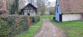
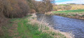
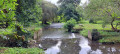
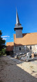
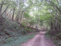
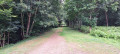
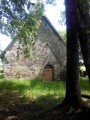
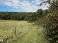
A lovely walk that starts at the Ajou tennis courts, follows the GR®224 to Champignolles, then returns via the Chemin du Gouffre, which runs alongside the River Risle. The first part takes you through fields, whilst the second part is through the woods.

Details

71707796
Creation:
Last update:
Last review:
  • Walking
    Activity: Walking
  • ↔
    Distance: 5.57 mi
  • ◔
    Average duration: 2h 45 
  • ▲
    Difficulty: Easy

  • ⚐
    Back to start: Yes
  • ↗
    Ascent: + 236 ft
  • ↘
    Descent: - 217 ft

  • ▲
    Highest point: 594 ft
  • ▼
    Lowest point: 423 ft
  • ⚐ Country: France
  • ⚐ City: Ajou (27410)
  • ⚑
    Start/End: N 48.97821° / E 0.781042°
  • ❏
    IGN map(s): Ref. 1913SB, 1914SB
  • Hour-by-hour weather

Photos

Description of the walk

(S/E) From the tennis court car park on Route de la Barre, follow the D35 towards La Barre-en-Ouche until you reach a junction with a path on the left.

(1) Take the track on the left (GR®224) which heads towards the Risle.

(2) Turn left, cross the footbridge and carry on straight ahead. 

(3) Turn right, follow the GR®224 as it is circular and reach the Route du Manet.

(4) Follow it to the right for about 150 m.

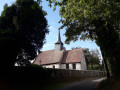
(5) Turn right and continue along a small path which takes you to Champignolles. Pass the cemetery and turn right.

(6) Turn right, cross the bridge over the Risle, then follow the valley road towards Le Souillard.

(7) Turn right onto the Chemin du Gouffre and follow it along the banks of the Risle as far as the Moulin de Saint-Aubin.

(8) Pass through the mill, come out onto the Chemin du Moulin (turn right) and rejoin the route you took on the way there.

(2) Follow this route in the opposite direction to the car park at the Ajou tennis courts (Route de la Barre) (S/E). 

Waypoints

  1. S/E : mi 0 - alt. 423 ft - Ajou tennis courts car park (Route de la Barre)
  2. 1 : mi 0.23 - alt. 433 ft - Junction with the GR224
  3. 2 : mi 0.99 - alt. 430 ft - Footbridge over the Risle - Risle (rivière)
  4. 3 : mi 1.16 - alt. 433 ft - Le Pot de Vin
  5. 4 : mi 2.34 - alt. 594 ft - Route de Manet
  6. 5 : mi 2.42 - alt. 594 ft - Path towards Champignolles
  7. 6 : mi 2.71 - alt. 449 ft - Bridge over - Risle (rivière)
  8. 7 : mi 3.13 - alt. 525 ft - Chemin du Gouffre
  9. 8 : mi 4.54 - alt. 433 ft - Saint-Aubin Mill
  10. S/E : mi 5.57 - alt. 423 ft - Ajou tennis courts car park

Always be cautious and plan ahead when you're outdoors. Visorando and the author of this route cannot be held responsible for any accidents occurring on this route.

The GR® and PR® markings are the intellectual property of the Fédération Française de Randonnée Pédestre.

Reviews and comments

4.5 / 5
Based on 2 reviews

Reliability of the description
4.5 / 5
Ease of following the route
4.5 / 5
Route interest
4.5 / 5
User 28670169

Overall rating : 5 / 5

Date of your route : Mar 08, 2026
Reliability of the description : ★★★★★ Very good
Ease of following the route : ★★★★★ Very good
Route interest : ★★★★★ Very good
Very busy route : Yes

A very pleasant walk, with Normandy landscapes, meadows, orchards and forest along the Risle river. Varied terrain, which is quite rare in this area.

Machine-translated

JoPhi
JoPhi

Overall rating : 4 / 5

Date of your route : Jul 29, 2025
Reliability of the description : ★★★★☆ Good
Ease of following the route : ★★★★☆ Good
Route interest : ★★★★☆ Good
Very busy route : No

Your walks are always interesting and very detailed – I really enjoy them.

Machine-translated

Other walks in the area

For more walks, use our search engine .

The GPS track and description are the property of this route's author. Please do not copy them without permission.