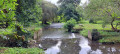
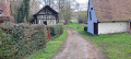
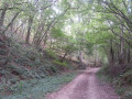
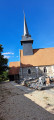
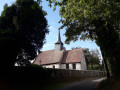
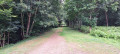
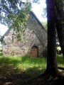
Along the banks of the Risle

A picturesque route that takes you from La Houssaye to Val Gallerand via Moulin Chapelle, playing hide-and-seek with the River Risle. The return journey takes you via Haut-Buisson and then through the Bois de la Noë.

Details

61074293
Creation:
Last update:
Last review:
  • Walking
    Activity: Walking
  • ↔
    Distance: 7.34 mi
  • ◔
    Average duration: 3h 35 
  • ▲
    Difficulty: Moderate

  • ⚐
    Back to start: Yes
  • ↗
    Ascent: + 226 ft
  • ↘
    Descent: - 226 ft

  • ▲
    Highest point: 518 ft
  • ▼
    Lowest point: 351 ft
  • ⚐ Country: France
  • ⚐ City: La Houssaye (27410)
  • ⚑
    Start/End: N 48.994811° / E 0.800891°
  • ❏
    IGN map(s): Ref. 1913SB
  • Hour-by-hour weather

Photos

Description of the walk

Park in the car park at La Houssaye Town Hall.

(S/E) On leaving the car park, turn left onto Route de Romilly and continue to the junction with Route du Moulin Chapelle.

(1) Turn left onto this road, pass through the hamlet of Moulin Chapelle, then cross the bridge over the Risle. Continue along the road until you reach the junction with theGR®224.

(2) Leave the road and follow theGR® to the right, marked in white and red; this is also the Vallée trail. Continue through the woods until you reach the D23

(3) Turn right onto this road – proceed with caution,as theGR® also runs along this road. About 400 m further on, at the edge of the woods, you’ll reach a crossroads of paths.

(4) Turn right onto theGR®, follow the edge of the woodland alongside the River Risle, and arrive at the bottom of this gentle descent.

(5) Stay on theGR®, still following the edge of the woodland, until you reach a gate.

(6) Go through it – make sure to close it behind you – and continue into the woods. A few metres further on, you’ll reach the bank of the Risle, then turn 90° to the left to reach a road.

(7) Turn right onto the road, pass through the hamlet of Maison Blanche, then reach the hamlet of Val Gallerand.

(8) Leave theGR® here, turn right and head for the hamlet of Haut-Buisson.

(9) Continue along the road until you reach a four-way junction in a left-hand bend.

(10) Take the path opposite, marked in blue, through the Bois de la Noë. At the next junction, keep to the right and you’ll reach another five-way junction.

(11) Carry on straight ahead, following the blue markings, skirting a meadow at a place called Les Buttes, cross the road and take the path straight ahead for 300 metres. You’ll reach the Bois des Annetes.

(12) Carry on straight ahead along the fields until you reach the Côte de Grammont.

(13) Turn right, reach a gate, turn left onto the Chemin de la Bergerie, and at the end turn left. Turn right onto the D35, then return to the junction you passed on the way out.

(1) Turn left and follow the route taken on the way out in the opposite direction to return to the car park at La Houssaye Town Hall (S/E).

Waypoints

  1. S/E : mi 0 - alt. 502 ft - La Houssaye Town Hall car park
  2. 1 : mi 0.26 - alt. 512 ft - Crossroads marking the end of the circular loop
  3. 2 : mi 1.08 - alt. 417 ft - Entrance to the Vallée footpath
  4. 3 : mi 1.64 - alt. 518 ft - D23
  5. 4 : mi 1.91 - alt. 505 ft - Start of the GR224
  6. 5 : mi 2.81 - alt. 381 ft - Bottom of the descent
  7. 6 : mi 3.43 - alt. 364 ft - Le Gué (the barrier)
  8. 7 : mi 3.97 - alt. 374 ft - Turn right onto the GR224
  9. 8 : mi 4.56 - alt. 354 ft - Val Gallerand
  10. 9 : mi 5.05 - alt. 479 ft - Haut-Buisson
  11. 10 : mi 5.3 - alt. 495 ft - Entrance to the Bois de la Noë
  12. 11 : mi 5.72 - alt. 469 ft - Junction with the Route du Gué
  13. 12 : mi 6.28 - alt. 518 ft - Bois des Annetes
  14. 13 : mi 6.6 - alt. 505 ft - Côte de Grammont
  15. S/E : mi 7.33 - alt. 502 ft - La Houssaye Town Hall car park

Notes

Large puddles after heavy rain.
Take care during the hunting season.

Always be cautious and plan ahead when you're outdoors. Visorando and the author of this route cannot be held responsible for any accidents occurring on this route.

The GR® and PR® markings are the intellectual property of the Fédération Française de Randonnée Pédestre.

Reviews and comments

4.7 / 5
Based on 2 reviews

Reliability of the description
4.5 / 5
Ease of following the route
5 / 5
Route interest
4.5 / 5
GILLESEVELYNE
GILLESEVELYNE

Overall rating : 4.3 / 5

Date of your route : Jul 28, 2025
Reliability of the description : ★★★★☆ Good
Ease of following the route : ★★★★★ Very good
Route interest : ★★★★☆ Good
Very busy route : No

A pleasant route without too many hills

Machine-translated

Dionisi Yves
Dionisi Yves

Overall rating : 5 / 5

Date of your route : Apr 06, 2025
Reliability of the description : ★★★★★ Very good
Ease of following the route : ★★★★★ Very good
Route interest : ★★★★★ Very good
Very busy route : No

A pleasant walk, without any major difficulties.
The path between points 5 and 7 is sometimes muddy, or even flooded. Having walked this route frequently at different times of year, I’ve noticed that it’s almost always in this condition, even during dry spells (perhaps due to seepage from the River Risle).
Good to know: there’s a picnic area at Le Nouveau Monde (off the route, 1 km return from point 11, taking the wide path on the left).

Machine-translated

Other walks in the area

For more walks, use our search engine .

The GPS track and description are the property of this route's author. Please do not copy them without permission.