Around La Haisette in Sébécourt

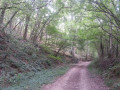
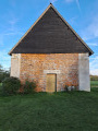
A lovely walk that will take you through the fields and woods of the centre of Sébécourt, with its 15th-century church, to the calvary at the Chapel of Saint Blaise in the heart of the forest.

Details

62688276
Creation:
Last update:
Last review:
  • Walking
    Activity: Walking
  • ↔
    Distance: 5.25 mi
  • ◔
    Average duration: 2h 30 
  • ▲
    Difficulty: Easy

  • ⚐
    Back to start: Yes
  • ↗
    Ascent: + 56 ft
  • ↘
    Descent: - 56 ft

  • ▲
    Highest point: 558 ft
  • ▼
    Lowest point: 499 ft
  • ⚐ Country: France
  • ⚐ City: Sébécourt (27190)
  • ⚑
    Start/End: N 48.971806° / E 0.83735°
  • ❏
    IGN map(s): Ref. 1913SB, 1914SB
  • Hour-by-hour weather

Photos

Description of the walk

Park in the car park at Sébécourt Town Hall.

(S/E) Opposite the town hall, turn left onto Rue de l’Église. After about 200 metres, you will reach the entrance to the cemetery.

(1) Enter the cemetery through the gate, then exit via the gate at the far end: please remember to close them properly. Follow the path to the departmental road.

(2) Walk carefully along the right-hand side of the road for about 400 m, until you reach the Prieuré bend.

(3) Leave the road, follow the path to the right and turn left at the next junction. Return to the county road.

(4) Cross the road carefully and continue straight ahead until you reach the road (Rue du Pont de Rancourt).

(5) Turn right, then immediately left, skirting a small wooded area. Once you’ve come out of the bend, take the path into the forest on the right. Keep to the right at the three-way junction, and join theGR® Tour du Pays d’Ouche.

(6) Follow it by turning left. Cross the Ligne de Bougy, and continue straight ahead. Carry on straight until you reach the junction at the Chapelle Saint-Blaise.

(7) Turn left and walk up Rue de la Chapelle towards Les Clos. Continue to the junction after the retention basin.

(8) Turn left onto Rue de la Forêt. Cross the Ligne de Bougy a second time, and carry on straight ahead. As you leave the forest, head for the junction at the bend in the road.

(9) Turn right and continue along the road to the Vente Renard junction, shortly after a right-hand bend followed by a left-hand bend.

(10) Cross the road to the path opposite, then continue across the fields towards Sébécourt. You’ll come out onto Rue de la Vallée; turn left and follow it to the car park (S/E).

Waypoints

  1. S/E : mi 0 - alt. 502 ft - Town hall car park
  2. 1 : mi 0.08 - alt. 512 ft - Cemetery - Église Saint-Nicolas (Sébécourt)
  3. 2 : mi 0.33 - alt. 518 ft - Route de Quincarnon
  4. 3 : mi 0.56 - alt. 512 ft - The Priory
  5. 4 : mi 0.87 - alt. 505 ft - Route de Quincarnon
  6. 5 : mi 1.12 - alt. 502 ft - Rue du Pont de Rancourt
  7. 6 : mi 1.81 - alt. 528 ft - GR°°®°° junction on the Tour du Pays d’Ouche
  8. 7 : mi 2.95 - alt. 535 ft - Chapelle Saint-Blaise (La Houssaye)
  9. 8 : mi 3.34 - alt. 558 ft - Les Clos
  10. 9 : mi 4.2 - alt. 518 ft - Exit from the forest
  11. 10 : mi 4.55 - alt. 531 ft - Le Vente Renard
  12. S/E : mi 5.25 - alt. 502 ft - Town hall car park

Notes

Please take care during the hunting season.

Worth a visit

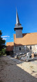
(1) Saint-Nicolas Church
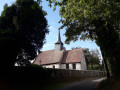
The church, dating from the second half of the 15th century, is listed as a Historic Monument. It is built of white stone and black flint. It features, a rarity in this day and age, a porch preceded by an atrium that was damaged during the war. The interior furnishings have been more or less scattered. Some of the altarpieces are now believed to be in L’Isle-Adam. Two paintings dating from the reign of Louis XIII hang beneath the altarpieces. The Easter candlestick dates from the reign of François I.
The church was restored between 2010 and 2016 by volunteers from the Association Chantiers Histoire et Architecture Médiévales.

Always be cautious and plan ahead when you're outdoors. Visorando and the author of this route cannot be held responsible for any accidents occurring on this route.

The GR® and PR® markings are the intellectual property of the Fédération Française de Randonnée Pédestre.

Reviews and comments

4.4 / 5
Based on 3 reviews

Reliability of the description
4.7 / 5
Ease of following the route
4.3 / 5
Route interest
4.3 / 5
User 23159855

Overall rating : 4.7 / 5

Date of your route : Apr 27, 2026
Reliability of the description : ★★★★★ Very good
Ease of following the route : ★★★★★ Very good
Route interest : ★★★★☆ Good
Very busy route : No

A mix of woodland and fields

Machine-translated

User 4037311

Overall rating : 3.7 / 5

Date of your route : Sep 08, 2025
Reliability of the description : ★★★★☆ Good
Ease of following the route : ★★★☆☆ Average
Route interest : ★★★★☆ Good
Very busy route : Yes

beautiful, peaceful route, not much road and very little traffic, but the signposting is more or less non-existent

Machine-translated

Myriam.le.K
Myriam.le.K

Overall rating : 5 / 5

Date of your route : Dec 24, 2024
Reliability of the description : ★★★★★ Very good
Ease of following the route : ★★★★★ Very good
Route interest : ★★★★★ Very good
Very busy route : No

Through fields, along the road and through the forest, passing by Saint Blaise Chapel. It’s a good idea to wear footwear suitable for the weather, as there can be quite a lot of mud and large puddles. A very pleasant walk that doesn’t take the 2 hours 30 minutes stated, but rather 1 hour 45 minutes if taken at a fairly leisurely pace (I completed it in 1 hour 20 minutes at a brisk pace).

Machine-translated

Other walks in the area

For more walks, use our search engine .

The GPS track and description are the property of this route's author. Please do not copy them without permission.