Country:
 City:
City:


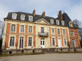
Park in the car park at the community hall in Saint-Aubin-le-Cauf, 915 Rue Claude Groulard.
(S/E) Turn left towards Arques-la-Bataille, moving away from Saint-Aubin church. Then turn left onto the street leading down towards Avenue Verte.
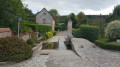
(1) Turn right to join the Avenue Verte, following the flow of the River Béthune towards Arques-la-Bataille.
(2) Cross the road at the overpass and continue along Avenue Verte, which later runs parallel to the road you crossed earlier, before eventually joining it at the junction with the path leading to the leisure centre.
(3) Carry on straight ahead along the road until you reach the Arques-la-Bataille sports hall.
(4) Before reaching the sports centre, turn left to pass between the pond and the blocks of flats. Walk round the blocks, keeping them on your right, cross the Varenne via the footbridge and continue to the right until you reach the steps.
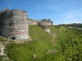
(5) Take the steps on the left to climb up towards the castle. Cross the road at the pedestrian crossing, head straight ahead and join the next street. Turn left and follow it to the cemetery, walk alongside it, then turn right to climb up towards the Quévremont plateau.
(6) Once on the plateau, turn left to walk alongside the woodland towards Quévremont. At the entrance to the hamlet, leave the road and take the path on the left to descend through the cutting to the sewage treatment plant.
.(7) Turn right onto the Chemin Vert. Join the road much further on, and follow it in the same direction.
(8) Further up, at the junction of the two roads, turn left towards Beaumaine. In the hamlet, take a left-right bend and continue for about twenty metres.
(9) Before leaving the hamlet, turn left onto the Chemin du Mont Blanc to head down into the valley. Join the Chemin du Fond de Varenne and follow it to the left until you reach the D154.
(10) Cross the road with care and continue straight on towards La Varenne. Cross the river via the Pont de Pierre and carry on towards the fishing ponds.
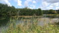
(11) Before entering the hamlet of La Varenne, turn left towards the reserved fishing ponds. Take the municipal footpath which runs between two ponds: on the right, an open public pond; on the left, a fenced-off private pond.
(12) Cross the Béthune via the footbridge, then continue along the path which bends sharply to the right (90°) before joining the D149.
(13) Turn left, pass the sports ground, then follow the Avenue Verte Retrouvée to the left. Turn right straight away towards the church, come out onto Rue Claude Groulard and turn left to return to the car park at the community hall (S/E).


 Visorando Member

 Easy
Easy