


 Country:

 City:
City:


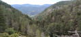
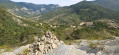
At Eyguians, leave the D1075 and take the D949 towards Trescléoux. After this village, continue for a further 4.8 km, then turn left onto the D194 towards Chanousse. Park at Place de la Fontaine, opposite the church.
YellowPR® signposting
(S/E) Leave Place de la Fontaine heading downhill, head towards the 8 May 1945 crossroads, then turn left up Chemin de Bandourière, heading south-west for 80 m.
(1) Turn left immediately after the sign for “Saint-Cyrice, Orpierre”. Follow the path as it climbs through grey marl to reach a small pass on the Crête de la Pignée.
(2) Take the path on the right, which continues on level ground to reach the hamlet of Le Sauze.
(3) Turn right onto the track and follow it until you reach a wide bend to the left. Take the path on the right and climb the track beneath the beech forest to reach a major crossroads of tracks with a DFCI water tank (elevation 1089).
(4) Continue straight ahead and descend the path to the Saint-Vincent junction.
(5) Head back up to the right, cross a forest track and continue climbing straight ahead to the Col de Lèbre-Cuite (alt. 1160 m).
(6) Follow the track which descends on the other side until you reach a junction.
(7) Take the track furthest to the right and head uphill to a three-way junction. Take the middle track, first traversing, then descending, to join a recently re-cut track (alt. 1,085 m).
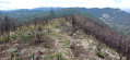
(8) Follow it up to the right to reach the ridge (elevation 1,119 m). Follow the path to the left which runs along this ridge, through the forest ravaged by a fire in August 2023, and reach a small clearing (Gaudissard, elevation 1,095 m).
(9) Turn left, then right, and follow the path downwards. Reach a ravine (Ravin du Verger), cross the stream and continue straight on, passing a water reservoir, until you reach the houses and then the junction from the outward journey.
(1) Carry on straight ahead to return to the Place de la Fontaine (S/E).

 Visorando Member

 Association / Club / Walk leader
 Easy
Easy 
