The three Céans passes

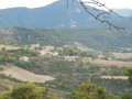
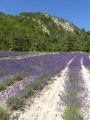
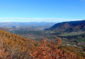
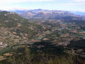
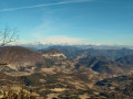
A walk through fields of lavender and marl, then largely through a beautiful pine forest, offering a bird’s-eye view of Villebois-Les-Pins, Étoile Saint-Cyrice, the Céans valley and the ridges of the Montagne de Chabre.

Details

320290
Creation:
Last update:
Last review:
  • Walking
    Activity: Walking
  • ↔
    Distance: 3.80 mi
  • ◔
    Average duration: 2h 30 
  • ▲
    Difficulty: Moderate

  • ⚐
    Back to start: Yes
  • ↗
    Ascent: + 866 ft
  • ↘
    Descent: - 883 ft

  • ▲
    Highest point: 3,379 ft
  • ▼
    Lowest point: 2,710 ft

Photos

Description of the walk

The walk starts in the centre of the village of Étoile-Saint-Cyrice, near Orpierre.

(S/E) Follow the D130A road and, as you come out of a hairpin bend to the left, turn right onto the Route des Granges.

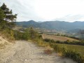
(1) Follow the DFCI track south-west.

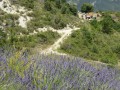
(2) After about 1 km, turn onto a path on the right (marked by a wooden signpost). The path climbs towards the Col d’Étoile through magnificent fields of lavender and marl (a slightly tricky section; you can help each other with a rope, but this isn’t essential).

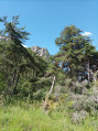
(3) At the Col d’Étoile, head off to the left (south-west) and climb through the woodland. Reach the ridge and descend through a pleasant forest towards the Collet de Martin.

(4) Turn sharply left and descend via a few hairpin bends through the forest before reaching an open area.

(5) Turn left towards the Col de l’Adrechon (signpost). Climb south-east, in open country, for about 1 km.

(6) Descend, heading north-west and then quickly north.

(2) At the junction, take the DFCI track again to return to the village (S/E).

Waypoints

  1. S/E : mi 0 - alt. 2,936 ft - Étoile Saint-Cyrice
  2. 1 : mi 0.14 - alt. 2,923 ft - Les Granges
  3. 2 : mi 0.5 - alt. 2,930 ft - Bois signpost – Junction
  4. 3 : mi 0.8 - alt. 3,205 ft - Col d’Étoile
  5. 4 : mi 1.48 - alt. 3,255 ft - Small pass of Martin
  6. 5 : mi 2.25 - alt. 2,717 ft - Wooden post – turn left
  7. 6 : mi 2.75 - alt. 3,074 ft - Col de l’Adrechon
  8. S/E : mi 3.8 - alt. 2,936 ft - Étoile Saint-Cyrice

Notes

(S) Water point in the village. Easy parking at the village entrance.
(4) A lovely, shaded clearing ideal for a picnic.

Worth a visit

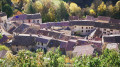
(S) At the start of the walk, don’t miss a visit to the lovely (small) village of Étoile-Saint-Cyrice.
Lavender fields and marl formations characteristic of the region.
(3) Col d’Étoile. A lovely, sometimes windy viewpoint overlooking the village of Villebois.
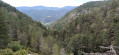
(6) A lovely view over the Céans valley towards Orpierre and Étoile-Saint-Cyrice.

Reviews and comments

4 / 5
Based on 3 reviews

Reliability of the description
4.3 / 5
Ease of following the route
4.3 / 5
Route interest
3.3 / 5
fbessou
fbessou

Thank you for your review. Have a lovely holiday.

Machine-translated

bdkfmn
bdkfmn

Overall rating : 4.7 / 5

Date of your route : Aug 23, 2022
Reliability of the description : ★★★★★ Very good
Ease of following the route : ★★★★★ Very good
Route interest : ★★★★☆ Good
Very busy route : No

In 2022, walking through the marl and scree slopes posed NO PROBLEM AT ALL, even after rain, and for us – who are elderly and only moderately fit – I suppose the path has been marked out better and better.
The scenery is a bit monotonous around the small pass of Martin and up to the Col de l’Adrechon, but it’s still a very pleasant walk, and easy even with children.

Machine-translated

lesrandosdujeudi
lesrandosdujeudi

Overall rating : 4.3 / 5

Date of your route : Jul 06, 2017
Reliability of the description : ★★★★★ Very good
Ease of following the route : ★★★★★ Very good
Route interest : ★★★☆☆ Average

There aren’t many lavender fields along the route. A very beautiful pine forest. No walkers at this time of year; best done in the morning, before the heat of the day sets in.

Machine-translated

Caludine0513
Caludine0513

Overall rating : 3 / 5

Date of your route : Sep 06, 2016
Reliability of the description : ★★★☆☆ Average
Ease of following the route : ★★★☆☆ Average
Route interest : ★★★☆☆ Average

The route starts at the bottom of the village (the last hairpin bend before the village entrance) and not in the centre of the village.

The road through the centre of the village is very narrow, and a slightly wide light vehicle won’t fit through. There’s nowhere to turn round except near the lodge or the church. The access road to the village from Orpierre is very narrow, with little room for vehicles to pass each other. If there are too many tourists, you’re in for a real struggle!

At the start of the route, is there nowhere to park the car?

We had trouble finding the right path on the right marked ‘Col de l’Étoile’; we took the path through the lavender field a little earlier, as the GPX track indicated… However, you have to carry on along the DFCI path to find the famous wooden sign.
In the middle of the lavender fields, after several attempts to spot the ‘yellow’ markings, we found the right path through the woods towards the Col de l’Étoile.

Be careful: the path is very, very stony and unstable (making it difficult to walk down).
Very quickly, we reached the famous section across a marly scree slope described in the guide as ‘a somewhat tricky crossing’. The narrow path hugs the dusty slope; it does not appear to be ‘reasonably level’. The risk of slipping 50 metres down was too great, so we turned back. The descent was difficult due to the multitude of small stones on the path.

We decided to do the route the other way round, via the DFCI track. It was a track in full sun, with little to offer. We turned back at the Col de l’Adrechon as we didn’t want to face that marl scree section again!

Machine-translated

Other walks in the area

For more walks, use our search engine .

The GPS track and description are the property of this route's author. Please do not copy them without permission.