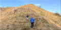
Circular walk around the Itzulegi and Itesti rivers in Amaiur/Maya

On the road to Elizondo and Bertiz Park, the picturesque village of Amaiur/Maya is an unmissable stop in the Baztan Valley.

Details

n°63258570
Creation:
Last update:
Last review:
  • Walking
    Activity: Walking
  • ↔
    Distance: 6.62 mi
  • ◔
    Average duration: 4h 30 
  • ▲
    Difficulty: Moderate

  • ⚐
    Back to start: Yes
  • ↗
    Ascent: + 1,637 ft
  • ↘
    Descent: - 1,604 ft

  • ▲
    Highest point: 2,507 ft
  • ▼
    Lowest point: 938 ft

Description of the walk

Coming from France via Dantxaria, go up and then down the Col d’Otsondo. After the sign for the village of Amaiur/Maya, take the left turn and park alongside the church.

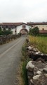
(S/E) Walk through Amaiur. Follow the main street to the Hermitage of Our Lady of the Pillar.This street is lined with old houses that have been carefully restored: it’s splendid!

(1) To the right of the chapel, take the road that climbs uphill, pass the cemetery and carry on until the tarmac gives way to concrete.

(2) Turn right onto the dirt track that climbs and carry on, passing a sheepfold.

(3) Ignore the dirt track that branches off opposite and turn left onto the path where the black gravel quickly turns to cobbles.

(4) Follow the black gravel track to the right and go straight on at the junction.

(5) At the sheepfold, go through the gate and head uphill, now on the other side of the barbed wire. The track winds its way through the ferns: more difficult when the ferns are tall --> secateurs are useful. You’ll emerge onto a pasture which you climb diagonally to the left: if there is livestock, keep to the right-hand side of the meadow until you reach the gap in the fence.

(6) Go through the fence, turn left and then immediately right onto the track which climbs straight up alongside the power line. Pass in front of a house with a wind turbine and climb slowly but steadily, without leaving the track, until you reach the tarmac road.

(7) Turn left to follow the tarmac road for over 1 km until you reach a post on the left marked in white and yellow.

(8) Turn left onto the dirt track, which climbs steeply. At the edge of a tree plantation, turn right and head down between the hunting hides until you reach the corner of a pasture fence, beyond which you can see some buildings.

(9) Look out for the mechanism to get over the fence and head down to the left across the field, following the barbed wire. When you see a gate at the bottom of the slope, head towards it. Get over the barbed wire to the left of the gate and you’ll come out onto a small road. Follow it to the left for about fifty metres.

(10) Take the dirt and grass track on the left. Easy at first, the long descent becomes more difficult due to rutted ground, clay and scree. Caution: gorse and risk of slipping! The track then becomes passable again and winds its way for some time through the woodland.

(11) As you emerge from the woodland, leave the farm on your left and continue along the path to the right.

(12) Cross the footbridge on the left and follow the concrete farm track which runs some distance alongside the Amaiurku Erreka, returning to the hermitage you passed at the start.

(1) Walk back through the village to the car park (S/E).

Waypoints

  1. S/E : mi 0 - alt. 938 ft - Amaiur Church, car park
  2. 1 : mi 0.35 - alt. 1,079 ft - Ermitage, junction of the circular loop
  3. 2 : mi 0.66 - alt. 1,230 ft - Turn right at the fork
  4. 3 : mi 0.87 - alt. 1,388 ft - Junction, turn left
  5. 4 : mi 1.04 - alt. 1,503 ft - Junction, turn right
  6. 5 : mi 1.23 - alt. 1,627 ft - Sheepfold
  7. 6 : mi 1.47 - alt. 1,821 ft - Go through the gate
  8. 7 : mi 2.65 - alt. 2,290 ft - Tarmac road, on the left
  9. 8 : mi 3.3 - alt. 2,454 ft - Path on the left
  10. 9 : mi 3.56 - alt. 2,310 ft - Closing
  11. 10 : mi 3.77 - alt. 2,123 ft - Path on the left
  12. 11 : mi 5.07 - alt. 1,125 ft - Edge of the village, on the right
  13. 12 : mi 5.23 - alt. 1,079 ft - Canadian Pass
  14. S/E : mi 6.62 - alt. 942 ft - Amaiur Church, car park

Notes

There are fountains as you walk through the village, but no information is available on the water quality.

Worth a visit

Read the tourist information boards in the car park at the entrance to the village.

Admire the entrance archway to the village and the houses lining the high street; look out for the coats of arms that sometimes adorn the façades.

In season, a small archaeological museum may be open (on the main street).

At the Ermitage, you can climb up to the ruins of Amaiur Castle. The site is marked by a column and flags.

Reviews and comments

4.7 / 5
Based on 1 review

Reliability of the description
5 / 5
Ease of following the route
4 / 5
Route interest
5 / 5
Lannemi
Lannemi

Overall rating : 4.7 / 5

Date of your route : Apr 16, 2026
Reliability of the description : ★★★★★ Very good
Ease of following the route : ★★★★☆ Good
Route interest : ★★★★★ Very good
Very busy route : No

A lovely circular walk that I’d recommend, with a gradual climb to the highest point. There’s 1.2 km of tarmac at the start, but you pass through the village of Amaiur-Maya with its beautiful houses and fountains. The rest of the walk is along paths and through fields until you reach a road just before the summit, which you’ll need to follow for 1 km. But you can walk along the wide grassy verges. We only came across cyclists on this stretch of road. After that, it’s all downhill, with a slightly steep and rutted section for 100 metres. There are 1.5 km of concrete and tarmac at the finish. There are four ‘game gates’ to pass through to get over the fences.
We have lovely views all along the route.

It’s a shame that in this lovely village there isn’t a bar to grab a coffee at the start and a drink at the finish. We’ll have to make do with water from the various fountains.

Machine-translated

Other walks in the area

For more walks, use our search engine .

The GPS track and description are the property of this route's author. Please do not copy them without permission.