Country:
 City:


Parking is available on Rue de la Crête-Saint-Jean in Fontaine-Étoupefour, specifically in the side lane leading to the schools.
(S/E) With your back to the schools, walk back down the side lane towards Rue de la Crête-Saint-Jean, cross it carefully and turn into Rue du Moulin opposite. Pass a cul-de-sac on the right, then Rue du Four, which also branches off to the right.
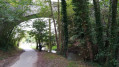
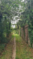
(1) You will now be on theGR® 221C; follow the signposts until you leave the route. Continue to the end of Rue du Moulin, ignoring Rue des Prés de l’Odon on the right and Rue du Vivier on the left, and turn onto the tree-lined path opposite. Follow this path until you pass under three high-voltage power lines and reach the crossroads of paths just after that.
(2) Leave theGR® 221C here, take the wooded path that climbs to the left (Caution! This path is damp and slippery; a trickle of water runs along it) and continue along the Chemin du Duc Guillaume. Ignore Rue de la Bruyère on the left and carry on until you reach the D 214 and the statue of the Virgin Mary. Cross the D 214 very carefully and carry on straight ahead along the Chemin Haussée until you reach the four-way junction.
(3) Pass the entrance to the village of Baron-sur-Odon and the Chemin du Pataras on your right, then turn left towards the hamlet known as Le Pré aux Bœufs. Follow the track straight on, then the footpath, until you reach the D147A.
(4) Cross the D147A with care and take the path opposite towards the castle (15th–16th centuries). Ignore the path on the right, pass under the three high-voltage power lines, walk past the Château de Fontaine-Étoupefour and continue to the village of Éterville.
(5) Ignore the road on the left, cross it carefully to take the pavement on the left, then, at the next bend, take the Chemin des Pépinières opposite. Continue straight on, skirting the housing estates until you reach the next junction. Cross Rue du Moulin with great care.
(6) Turn left and, after the hedge, take the cycle path that runs alongside Rue du Moulin on the right. At the end of the path, continue straight ahead onto Rue du Moulin, ignoring Chemin de Bout du Mesnil on the right and, a little further on, Rue du Bois des Trentaines, and carry on for a further 20 metres.
(7) Cross Rue du Moulin with care and turn left onto Chemin de la Frênée, following the Chemins du Mont Saint-Michel. At the first Fork in the road, keep right; then, at the second Fork in the road, keep left to rejoin theGR® 221C and its signposting. Follow this path to the route d’Éterville.
(8) Cross with great care, turn straight ahead onto Chemin de Rocreuil and continue to the D214. Cross with the utmost caution, then turn left towards Fontaine-Étoupefour.
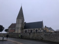
(9) After about 50 m, turn right to leave the D214 and join Rue du Bois de l’Île. Then continue straight on along Rue du Four until you reach Rue aux Herveu. Cross Rue aux Herveu with care, leave theGR® 221C here, turn left and head up towards the church.
Turn right into Rue Saint-Martin, cross it carefully to take the left-hand pavement, continue along Rue de la Crête-Saint-Jean then the side lane, and head to the car park (S/E).


 Visorando Member
 Moderate