Country:
 City:
City:


Park in the car park near the sports ground behind Baron-sur-Odon Town Hall
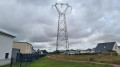
(S/E) With your back to the town hall, walk alongside the sports ground, head towards the woods and turn right into the woods. Follow the path for about 300 metres, ignoring any side paths, pass under the high-voltage pylon and then, a few dozen metres further on, turn left onto Chemin de la Pierrette.
Walk for just under 100 metres, turn right into the woods and follow the path (GR® 221 C) for about 600 metres, ignoring the first path on the right. At the corner of the fence by the last house on the right, turn right onto the second path and leave theGR® 221C. Follow the path for about 400 m, ignoring any side paths so that you walk alongside the fences of the houses on your right and the woodland on your left. At the end of the path, emerge onto Chemin de la Liberté and reach the Carrefour des Cinq Chemins.
(1) Turn left onto the Chemin des Écossais, follow it for about 350 m and negotiate the right-hand bend. Carry on to the end of the tarmac section, passing the houses at nos. 3 and 5 on the road, then continue along the footpath. Ignore the first path on the right, carry on to the next junction and turn right before the extra-high-voltage power lines. Take the Chemin du Duc Guillaume and follow it for about 300 m until you reach the road on the left.
(2) Turn left onto Rue de la Bruyère, pass under the three high-voltage power lines for the first time and turn right onto Chemin des Goulais. Pass under the three high-voltage power lines for a second time and carry on to the road. Turn left, walk down Rue de l’Égalité on the left-hand pavement to reach the pedestrian crossing. Cross Rue de l’Égalité (D214) carefully, continue along the curved, gravel-surfaced lane, then cross Rue des Sources. Continue along the gravel-surfaced side lane, passing under the three high-voltage power lines for a third time, and head down to the road on the right.
(3) Turn right onto Rue du Courtelet, pass under the three high-voltage power lines for the fourth time, and carry on to the bend. Carry on along the path opposite, pass to the right of the mobile phone mast and continue to the end of the path. At the junction, turn right, follow the path for about 300 metres, cross Chemin Haussé and continue straight on along Chemin du Pataras until you reach the edge of the D214 road (towards Gavrus).
(4) Turn left onto Chemin du Pré d’Oisy, follow it for about 800 metres, passing the housing estates on your right and the fields on your left.
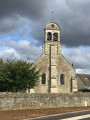
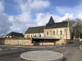
(5) At the end of Chemin du Pré d’Oisy, ignore Chemin de la Petite Graville on the right and carry on straight ahead along Chemin de la Plaine. Continue alongside the residential area on your right and the fields on your left until you reach the Church of Notre-Dame-de-la-Nativité and Chemin Constantin James.
(6) Pass to the left of the church, walk for just under a hundred metres and, at the right-hand bend, take the tree-lined path on the left which goes round the houses and runs alongside the fields. At the end of the path, turn right and head down to the wayside cross, near the D214 road. Turn right and follow the side lane running alongside the road until you reach the next junction.
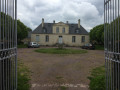
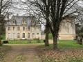
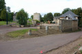
(7) Turn left, cross the D214 road with care and turn onto the Chemin des Murailles. Follow the path downhill for about 600 metres, turn right at the corner of the wall, follow the Chemin du Ponchet and ignore the Chemin du Moulin Foulon on your left. Walk past the wash house below the castle outbuildings, then head back up to the entrance gate to the grounds of the Château de Baron.
(8) Leave the Chemin du Ponchet, take the path on the left opposite the castle’s entrance gate and walk for about fifty metres to the crossroads. Turn right, follow the path uphill for about 250 metres and, at the corner of the fence around the first pavilion, ignore the very narrow grassy path branching off to the right. Walk for about a hundred metres, keeping the houses on your right, until you reach the car park (S/E).

 Visorando Member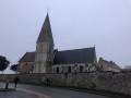

 Moderate