From the Barony to Éterville via Le Mesnil and Le Rocreuil

On this walk, combine the pleasure of a countryside stroll across the plain with the romantic charm of the Odon valley.

Details

n°7583549
Creation:
Last update:
Last review:
  • Walking
    Activity: Walking
  • ↔
    Distance: 4.30 mi
  • ◔
    Average duration: 2h 05 
  • ▲
    Difficulty: Easy

  • ⚐
    Back to start: Yes
  • ↗
    Ascent: + 112 ft
  • ↘
    Descent: - 112 ft

  • ▲
    Highest point: 151 ft
  • ▼
    Lowest point: 36 ft

Photos

Description of the walk

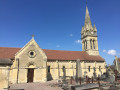
Park in the car park behind Saint-Pierre Cemetery, Rue du Viquet, in Bretteville-sur-Odon.

(S/E) With your back to the Baronnie and the cemetery on your right, leave the car park, take the small road on the right and then cross the bridge over the Petit Odon. Turn right (Chemin du Moulin d’Ardennes) and follow the course of the Petit Odon on your right until you reach the bridge over the old Caen–Vire railway line.

(1) Just before the bridge, turn left onto the narrow, wooded path that climbs up to the old railway line and follow it for about 800 metres.

(2) At the junction with the D8, near Le Mesnil, turn right towards Éterville. After a few hundred metres, ignore the two paths on the right – including the one leading to Ferme Eustache – then turn right onto Chemin du Huitième Recce. Pass the golf course on your left and continue to the next junction.

(3) Cross the Chemin du Moulin d’Ardennes, carry on straight ahead towards the western Caen ring road and take the footbridge to cross to the other side.

(4) Turn left, take the path running alongside the boulevard on your left, negotiate the right-angle bend to the right and carry on to the residential area at the entrance to Éterville.

(5) Turn right before the hedge towards Rocreuil and take the cycle path that runs alongside Rue du Moulin. Follow the path to its end for about 1 km. At the end of the track, turn right onto Chemin du Bout au Mesnil towards the Bois des Trentaines, take the sharp left-hand bend and continue along Rue du Bout au Mesnil. Cross Rue du Bois des Trentaines, continue straight ahead, and carry on until you reach the left-hand bend. Note the beautiful blue cedar on the right-hand side as you round the bend.

(6) Between numbers 17 and 15 on Rue du Bout au Mesnil, turn right and take the wooded path. Ignore the path on the right and carry on to the next junction. As you approach Caen’s western ring road, turn left, walk along the right-hand side of the ring road and continue between the River Odon and the ring road. Pass under the ring road and continue to follow the ring road on your right until you reach the next junction. At the footbridge you crossed earlier, turn left for the first time; you will now be on theGR® 36, where the signposting will guide you.

(3) Turn left a second time to join the Chemin du Moulin d’Ardennes.

(7) Cross the Odon, pass by the Moulin d’Ardennes, cross a second branch of the Odon and continue to the bridge over the old Caen–Vire railway line, where you’ll rejoin the Petit Odon.

(1) Go under the bridge, then carry on straight ahead along the Chemin du Moulin d’Ardennes to reach the car park (S/E).

Waypoints

  1. S/E : mi 0 - alt. 39 ft - Car park at Saint-Pierre Cemetery, Rue du Viquet
  2. 1 : mi 0.16 - alt. 56 ft - Bridge over the former Caen–Vire railway line
  3. 2 : mi 0.63 - alt. 43 ft - The D8 at Le Mesnil
  4. 3 : mi 1.29 - alt. 56 ft - Chemin du Moulin d’Ardennes. Return journey
  5. 4 : mi 1.51 - alt. 98 ft - Exit the footbridge that crosses the ring road.
  6. 5 : mi 2.21 - alt. 148 ft - Éterville
  7. 6 : mi 3.05 - alt. 79 ft - Rue du Bout, Mesnil-au-Rocreuil
  8. 7 : mi 3.94 - alt. 36 ft - Footbridge over the - Odon (rivière)
  9. S/E : mi 4.3 - alt. 39 ft - Car park at Saint-Pierre Cemetery, Rue du Viquet

Worth a visit

The Barony

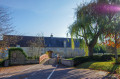
In the early 11th century, Gonnor, widow of Richard I, Duke of Normandy, bequeathed her estate at Bretteville-sur-Odon and the rights attached to it to the Abbey of Mont-Saint-Michel. Her son, Richard II, supplemented this bequest by adding the parish of Verson. The estate came to be known as the Barony of Bretteville-sur-Odon, a seigneury of the Abbey of Mont-Saint-Michel. The granary was at the heart of the estate’s economic activity. It was there that the tenants brought their field rent and tithes (taxes). During the Revolution, the buildings and lands owned outright by the abbey were sold as national property. Since 1989, they have been the property of the municipality of Bretteville-sur-Odon and constitute an exceptional architectural complex.

Always be cautious and plan ahead when you're outdoors. Visorando and the author of this route cannot be held responsible for any accidents occurring on this route.

The GR® and PR® markings are the intellectual property of the Fédération Française de Randonnée Pédestre.

Reviews and comments

3.7 / 5
Based on 2 reviews

Reliability of the description
4 / 5
Ease of following the route
4.5 / 5
Route interest
2.5 / 5
jeangazon
jeangazon

Overall rating : 3 / 5

Date of your route : Feb 09, 2025
Reliability of the description : Not used / Not applicable
Ease of following the route : ★★★★★ Very good
Route interest : ★☆☆☆☆ Very disappointing
Very busy route : Yes

From the start to the 2: it’s absolutely lovely.
From 2 to 3: a road, then you cycle alongside a golf course… Absolutely nothing to see.
Then we reach the ring road… and cycle alongside it. A noisy nightmare.
You come to vast, uninteresting farmland all the way to the 6 (+ the housing estates).
From marker 6 onwards it’s lovely, but we’re back on the ring road…
After that, it’s quite lovely until we get back to the start.
Three-quarters of the ride is unattractive.

Machine-translated

Emma14
Emma14

Overall rating : 4 / 5

Date of your route : Sep 02, 2024
Reliability of the description : ★★★★☆ Good
Ease of following the route : ★★★★☆ Good
Route interest : ★★★★☆ Good
Very busy route : No

A lovely walk, with plenty of paths and trails; a pleasant walk. Not very difficult

Machine-translated

Other walks in the area

For more walks, use our search engine .

The GPS track and description are the property of this route's author. Please do not copy them without permission.