Country:
 City:
City:


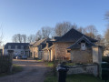
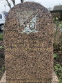
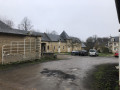
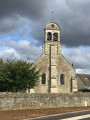
Parking is available at the car park by the church in Baron-sur-Odon.
(S/E) Leave the church car park, turn right onto Chemin de l’Église and walk along the cemetery wall until you reach Chemin de la Plaine. Turn right onto Chemin Constantin James, walk round the church for about 50 metres and turn left onto the path that crosses the plain. Walk for about 300 m, then turn right and walk for about 600 m until you reach the D89 road. Cross the main road carefully, pass under the high-voltage power line, ignore the path on the right a few metres past the pylon and continue for about 250 m to the crossroads (note the large yellow gas marker post nearby).
(1) Turn left, walk for about 250 m, take the left-hand bend and continue to the D89 road.
(2) Cross this road carefully, pass under the high-voltage power line, walk for about 500 m, continue straight ahead at the first crossroads (“note that the church is exactly in line with the path on the left”) and walk for another 500 m or so until you reach a second crossroads. Turn left, towards the houses (“note that you can see a large white building directly ahead”) and follow the path for about 700 m until you reach a junction of paths and roads.
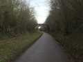
(3) At the junction, turn right onto the Chemin du Pré d’Oisy, walk past the houses on your left, leave the small road and continue along the tree-lined path until you reach a junction where paths and roads meet. Cross the road (Chemin du Pataras) carefully and continue straight ahead, towards Fontaine-Étoupefour (D214), until you reach the next junction. Cross the Chemin des Hautes Sentes. Carry on until you reach the pedestrian crossing.
(4) Turn left to cross the Route de Fontaine (D214) with care, turn onto the Chemin des Hautes Sentes and walk for about 500 m until you reach the five-way junction. Turn right onto the Chemin de la Rivière and walk for about 400 m until you reach the Chemin du Duc Guillaume. Turn left, walk for about 80 metres, then turn right onto the small sunken track that leads downhill, following the high-voltage power lines, until you reach the next crossroads (“note that the small sunken track is quite rutted and that a trickle of water may make it rather slippery”).
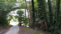
(5) Turn left, join the path and theGR® 221 C, then follow the River Odon on your right for about 800 m. Negotiate the left-hand bend before the small stream and follow the path uphill for about 200 m until you reach a Fork in the road. Take the right-hand fork, cross the stream, head uphill and continue for about 800 m until you reach the Chemin de la Pierrette.
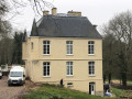
(6) Turn right, then left about a hundred metres further on, so as to go round the quarry on the left, until you reach the high-voltage power line (“note that this section is rather rugged”). Follow the high-voltage power line, keep to the left after the pylon, leave theGR® 221 C briefly before rejoining it a little under 100 metres further on, cross a junction of paths (“note that you can clearly hear the sound of an underground stream here”) and continue to the Chemin du Ponchet, near the Château de Baron.
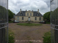
(7) Turn right onto the Chemin du Ponchet, walk past the Château de Baron on the right and continue for about 150 m until you reach the end of the wall on the right. Do not follow Chemin du Moulin Foulon to the right – which would take you off theGR® 221 C – but carry on straight ahead for about 150 m until you reach the end of the wall on the left.
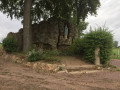
(8) Turn left at the corner of the wall and follow the path for about 600 metres until you reach the D214 road (“note the wayside cross on the right, clearly visible across the fields”). Cross the D214 carefully, turn left onto Rue de l’Église (D214), walk for about a hundred metres, then turn right onto Chemin de l’Église and head for the car park (S/E).


 Visorando Member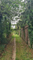

 Moderate