Circular loop around the Baronnie de Bretteville-sur-Odon

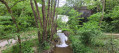
Following the circular course of the River Odon between the Baronnie de Bretteville-sur-Odon and Le Rocreuil, this short walk is easy and pleasant, allowing you to enjoy the countryside with your family just a stone’s throw from the town.

Details

74441600
Creation:
Last update:
Last review:
  • Walking
    Activity: Walking
  • ↔
    Distance: 3.14 mi
  • ◔
    Average duration: 1h 30 
  • ▲
    Difficulty: Easy

  • ⚐
    Back to start: Yes
  • ↗
    Ascent: + 69 ft
  • ↘
    Descent: - 56 ft

  • ▲
    Highest point: 98 ft
  • ▼
    Lowest point: 36 ft

Photos

Description of the walk

(S/E) From the car park at the socio-cultural centre, take the path towards the Baronnie gatehouse as far as the Petit-Odon stream and follow it behind the Baronnie estate to the cemetery.

(1) Turn left, cross the stream and continue to the railway bridge (greenway).

(2) Go under the bridge and carry on to the River Odon.

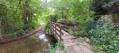
(3) Cross the footbridge over the river and turn right at the junction towards the ring road.

(4) Cross over the ring road and carry on straight on to the village of Rocreuil. Turn right twice.

(5) Just after the mill, turn right onto the GR®221C marked walking trail, which follows the circular bends of the Odon in a pleasant way.

(6) Go through the underpass beneath the ring road and follow the path on the right back up towards the previous bridge.

(4) Turn left and head back along the same route you took on the way there.

(2) After passing under the railway bridge, take the footbridge on the left and follow the path which passes under the railway bridge, returns to the opposite bank and joins the greenway; follow this to the left for about thirty metres.

(7) At the picnic area, head down to the left to pass under the railway bridge (greenway) and join Rue de Bas Manoir; walk past the riding centre and La Baronnie to reach the car park (S/E). 

Waypoints

  1. S/E : mi 0 - alt. 39 ft - Car park at the socio-cultural centre
  2. 1 : mi 0.18 - alt. 36 ft - Bridge over the Petit Odon
  3. 2 : mi 0.27 - alt. 36 ft - Railway bridge – Greenway
  4. 3 : mi 0.47 - alt. 36 ft - Footbridge - Odon (rivière)
  5. 4 : mi 0.73 - alt. 92 ft - Bridge over the ring road
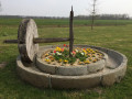
  6. 5 : mi 1.33 - alt. 56 ft - Watermill
  7. 6 : mi 1.98 - alt. 46 ft - Passage under the ring road
  8. 7 : mi 2.84 - alt. 69 ft - Picnic area
  9. S/E : mi 3.14 - alt. 43 ft - Car park at the socio-cultural centre

Notes

This walking route is also perfectly suitable for cycling.

Worth a visit

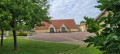
The route skirts the Domaine de la Baronnie, featuring the tithe barn and the manor house, both listed buildings. It is possible to cross the estate during the opening hours of the municipal library, which occupies one wing of the building.

Always be cautious and plan ahead when you're outdoors. Visorando and the author of this route cannot be held responsible for any accidents occurring on this route.

The GR® and PR® markings are the intellectual property of the Fédération Française de Randonnée Pédestre.

Reviews and comments

4.7 / 5
Based on 3 reviews

Reliability of the description
5 / 5
Ease of following the route
5 / 5
Route interest
4 / 5
jeangazon
jeangazon

Overall rating : 4.5 / 5

Date of your route : Aug 26, 2026
Reliability of the description : Not used / Not applicable
Ease of following the route : ★★★★★ Very good
Route interest : ★★★★☆ Good
Very busy route : Yes

This walk has just one drawback: it runs alongside the ring road, and you can hear all sorts of vehicles almost the whole way… I reckon you need to do it whilst listening to music on headphones to make it enjoyable.
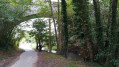
Otherwise, it takes you past rivers, fields and woodland – it’s rather lovely and not far from Caen!

Machine-translated

User 27431618

Overall rating : 4.7 / 5

Date of your route : Aug 25, 2025
Reliability of the description : ★★★★★ Very good
Ease of following the route : ★★★★★ Very good
Route interest : ★★★★☆ Good
Very busy route : No

the only tricky part to understand is how to get around the picnic area to go back down under another railway bridge (it looks like you're turning around)
otherwise, it's parish specific to Brittany. The climb along the ring road is the least pleasant part.
Otherwise, thank you, it was very parish specific to Brittany with lots of shaded areas.

Machine-translated

Aveyron14
Aveyron14

Overall rating : 4.7 / 5

Date of your route : Jun 09, 2025
Reliability of the description : ★★★★★ Very good
Ease of following the route : ★★★★★ Very good
Route interest : ★★★★☆ Good
Very busy route : No

Short hike almost entirely in the woods. The only downside is a short stretch near the motorway.

Machine-translated

Other walks in the area

For more walks, use our search engine .

The GPS track and description are the property of this route's author. Please do not copy them without permission.