Circular route around Braillans-Est

A short walk east of Braillans, through its game-rich woods and past the memorial stone honouring the memory of Honoré Gressenbucher, known as Nono, who died for France at Les Combottes in 1944.

Details

20114880
Creation:
Last update:
Last review:
  • Walking
    Activity: Walking
  • ↔
    Distance: 3.31 mi
  • ◔
    Average duration: 1h 40 
  • ▲
    Difficulty: Easy

  • ⚐
    Back to start: Yes
  • ↗
    Ascent: + 125 ft
  • ↘
    Descent: - 125 ft

  • ▲
    Highest point: 1,178 ft
  • ▼
    Lowest point: 1,073 ft
  • ⚐ Country: France
  • ⚐ City: Braillans (25640)
  • ⚑
    Start/End: N 47.309064° / E 6.093517°
  • ❏
    IGN map(s): Ref. 3323ET
  • Hour-by-hour weather

Photos

Description of the walk

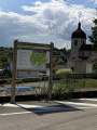
Park in the car park along the RD486.

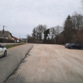
(S/E) Leave the car park heading east via Rue Rufille, a tarmac forest track.
You will immediately enter a spruce forest on your right; follow this path for about a hundred metres.
Take a marked path branching off to the left into the woods. Follow this path to the edge of the woodland and turn naturally to the right, skirting it from the inside.
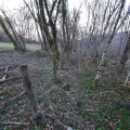
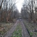
Continue along a well-marked woodland track, which already offers some lovely views: rocks, rugged terrain, a variety of tree species, and occasionally the first signs of wildlife. Join a beautiful, white-coloured forest track suitable for vehicles.

(1) Keep to the right and continue straight on until you reach a clearly visible junction of paths.

(2) Turn 90° left onto the path on the left, heading north, and follow it to the top.
From there, you’ll look out over the Combottes once you reach a new T-junction of paths (high point).

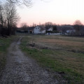
(3) Turn immediately right and walk gently down the path, flanked by beautiful vegetation and fences enclosing meadows.
Continue along the path, which gradually becomes a tarmac road, passing the stunning Combottes site. You’ll reach the junction between the road and the cycle route; this is a shared space where you must observe the rules of use and safety requirements.

(4) Turn left towards an imposing farmhouse, until you cross the RD486 via the short tunnel.

(5) Then take thefirst dirt track on the right at the fork for a round trip of a few hundred metres to reach the clearly visible memorial stone.
Retrace your steps, head back west along the original track, and walk briefly along the edge of the woodland, keeping the electrified wires to the right of your path.
Enter the woodland, go through the barrier restricting access, and continue along the well-trodden paths through the undergrowth. You’ll reach a line of barbed wire marking the boundary of a field.

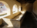
(6) Follow this line until you reach the edge of the woods. You will then come to a small, clear track passing under the electrified line; head westwards. Approach the village via its pretty fountain and washhouse; at the crossroads, turn left onto Rue de la Fontaine until you reach the junction with Rue de la Mairie. Turn left and cross the RD486 safely at the pedestrian crossing. You will then reach the car park on the RD486 (S/E).


Waypoints

  1. S/E : mi 0 - alt. 1,168 ft - Car park alongside the RD486
  2. 1 : mi 0.52 - alt. 1,152 ft - Crossroads of forest paths
  3. 2 : mi 0.73 - alt. 1,115 ft - Layon crossroads
  4. 3 : mi 1.02 - alt. 1,178 ft - Top of the hill
  5. 4 : mi 1.49 - alt. 1,073 ft - Cycle route junction
  6. 5 : mi 1.92 - alt. 1,089 ft - Crossroads with memorial stone
  7. 6 : mi 2.64 - alt. 1,142 ft - End of trail
  8. S/E : mi 3.31 - alt. 1,168 ft - Car park alongside the RD486

Notes

Possible water sources: L’Olivier restaurant – opposite the car park; Les Combottes farm and the Braillans fountain.
Possible shelters: L’Olivier restaurant, Braillans fountain and washhouse.
Recommended equipment: mobile phone, walking shoes, walking poles, binoculars; personal water and food supplies, small first-aid kit, bin bags.

Worth a visit

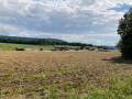
Between (3) and (4) in the meadows, it is not uncommon to spot a few large animals. The sky can also provide a beautiful spectacle, as you may catch sight of birds of prey circling overhead.
Between (3) and (4) at the Combottes site, take in this beautiful private estate and its visible outbuildings, have a look at the natural pond at the bend in the road and admire an oak tree several hundred years old just a few metres further on.
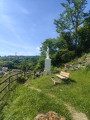
After (4), as you emerge from the tunnel, at the edge of the woods, facing the walker, a French flag is already visible: it marks the memorial stone to Honoré Gressenbucher, known as Nono, a young French Resistance fighter who died for France in July 1944. This memorial is maintained by Le Souvenir Français, Marchaux and Surrounding Areas Committee, with the support of the municipalities of Braillans and Marchaux.
The historic site of Thise aerodrome with its two Eiffel-type hangars.
Numerous other walks: Thise and its forest; Montfaucon Castle.

Reviews and comments

4.8 / 5
Based on 2 reviews

Reliability of the description
5 / 5
Ease of following the route
5 / 5
Route interest
4.5 / 5
HNS 25220
HNS 25220
• Edited:

Hello. Thank you for your comment and the review you posted. (Annual commemoration by Le Souvenir Français at the Nono memorial in early September).
NB: From the restaurant car park, you can head straight into the Thise Forest (Ruffile Farm – a former Resistance site during the Second World War) via the gently ascending forest road; further on, you can follow the new signposted local footpaths or enjoy other Visorando routes already mapped out in this forest. These offer stunning views of the slopes overlooking the Doubs valley… An area teeming with game (wild boar and deer), with skies ideal for spotting numerous species of falcons…
Do, however, be mindful of the current state of the forest and the risk of falling branches.
Enjoy your walks!

Machine-translated

Henri brunel
Henri brunel

Overall rating : 5 / 5

Date of your route : Sep 23, 2024
Reliability of the description : ★★★★★ Very good
Ease of following the route : ★★★★★ Very good
Route interest : ★★★★★ Very good
Very busy route : No

A lovely, easy walk. Perfect for beginners like us. We walked from the woods to the memorial stone at the edge of the forest.

Machine-translated

HNS 25220
HNS 25220
• Edited:

Overall rating : 4.7 / 5

Date of your route : Mar 26, 2022
Reliability of the description : ★★★★★ Very good
Ease of following the route : ★★★★★ Very good
Route interest : ★★★★☆ Good
Very busy route : No

A good length for a short walk that’s fun, scenic and evocative.
A great spot to finish the walk, with a very pleasant place to eat.
Highly recommended.

Machine-translated

Other walks in the area

For more walks, use our search engine .

The GPS track and description are the property of this route's author. Please do not copy them without permission.