Ten kilometres of fast-paced, invigorating trail running

Fancy a quick route? This lovely route awaits you, taking around 1 hour to 1 hour 15 minutes at an average pace.
For a walk, allow twice as long.
So come and enjoy this smooth, flowing route on terrain that’ll let you stride freely, whether you’re out for a stroll or a trail run. This 10-kilometre route is for you.
Can be run in the opposite direction.

Details

n°4760337
Creation:
Last update:
Last review:
  • Walking
    Activity: Walking
  • ↔
    Distance: 6.73 mi
  • ◔
    Average duration: 3h 40 
  • ▲
    Difficulty: Moderate

  • ⚐
    Back to start: Yes
  • ↗
    Ascent: + 696 ft
  • ↘
    Descent: - 682 ft

  • ▲
    Highest point: 1,509 ft
  • ▼
    Lowest point: 820 ft
  • ⚐ Country: France
  • ⚐ City: Thise (25220)
  • ⚑
    Start/End: N 47.284201° / E 6.081841°
  • ❏
    IGN map(s): Ref. 3323ET
  • Hour-by-hour weather

Photos

Description of the walk

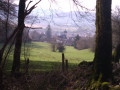
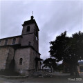
Park in the car park at the Thise presbytery, behind the Church of Saint-Hilaire-de-Poitiers, built in 1827.

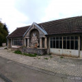
(S/E) Turn left for a few metres and then turn right onto Rue du Paret. Walk past the pretty fountain and washhouse known as ‘Le Cygne’, dating from 1848, and head straight up the Chemin rural du Parret. Pass the Water Services building (GBM) on your right. The tarmac road gradually turns into a track as it climbs into the communal woodland.
At the bend in the road, let the Chemin du Parret continue its hairpin bend to the right whilst you take the rocky path winding through the woods, directly opposite.
At the top, you’ll rejoin the Chemin du Parret, which comes in from the right, and continue to the junction with the Chemin du Facteur, which you should let pass on your left.

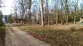
(1) Continue straight ahead along the lovely path to the beech forest, where there is a car park. Then turn left onto a lovely straight stretch known as the Grande Sommière. Cross the Bois du Coutelot and the Bois du Grand Cotard. You’ll reach a crossroads with a footpath.

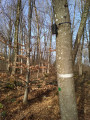
(2) Turn left here and follow it beneath the high forest canopy. From here, follow this undulating path with soft ground: it is not uncommon to encounter wildlife here (such as roe deer, does or wild boar, for example).
The path ends where it meets the Chemin de Rufille (a tarmac road): follow it to the right until you cross the Chemin Ferré again on your right.

(3) Continue straight ahead. Pass through the beautiful Rufille farm building (private property) and head back up the rocky forest track, running alongside the woodland, to reach the top of the Bois des Bruyères near the site of a telecoms mast.
Then follow the lovely white path, which is somewhat winding and stony, as it descends through various stands of trees and woods with a variety of species. When you reach the bottom of the path, do not go past the small Place Forestière des Brocards on this path (a turning area) on the left, which forms a junction with a south-facing path.
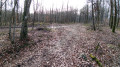
Turn into the woods onto a dirt track that bends in the opposite direction to the previous route. This winding path, flanked by trees, winds through pleasant woodland. It is marked here and there, on the right, by several stone boundary markers indicating the inter-municipal boundary.

(4) Further on, at a clear fork where three paths diverge – the widest of which climbs to the right towards the Place des Écureuils and then on to the Moray equestrian centre – take the central path.
This well-marked path winds gently uphill amongst the trees and shrubs. It joins a wider forest track coming from the left.

(5) Follow this path. Pass through the clearing, under a power line, and further on you’ll reach a picnic and playground area (parking available).

(6) Go through the turnstile at the gate, then head down the Route des Vaux (tarmac road) until it meets the Route de Beaupré.
Cross safely and continue straight ahead onto the Route du Boillon, which is tarmac-surfaced for a few hundred metres, until you reach the next junction (Chemin de la Vaivre). Turn right at the electricity substation and follow this path (with the railway line to the left of the route).

(7) After the meadows, pass right in front of an old building, the Ferme de la Vaivre (private property), and follow the country lane at a leisurely pace. After the bend in the road, keep to the right, skirting the property.

(8) When you reach the beautiful gatehouse bearing the Franche-Comté coat of arms, stop for a moment to admire the old drawbridge.
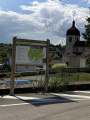
There are two tourist information posts providing details of the area.
Now make your way to the Route de Beaupré, cross it carefully and take the unpaved track leading uphill until you reach the Route des Vaux at the Prieuré de Beaupré.

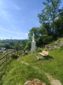
(9) Follow this tarmac road down towards the bell tower of Thise church, taking in the sight of a pretty wrought-iron wayside cross overlooking the alluvial plain. Continue to the presbytery car park (S/E)..


Waypoints

  1. S/E : mi 0 - alt. 902 ft - Car park at the Thise presbytery - Église Saint-Hilaire (Thise)
  2. 1 : mi 0.49 - alt. 1,135 ft - junction of the Ferré and Facteur paths
  3. 2 : mi 1.67 - alt. 1,240 ft - Entrance to the ‘wildlife’ trail
  4. 3 : mi 2.16 - alt. 1,378 ft - Junction with the Rufille tarmac road
  5. 4 : mi 3.69 - alt. 1,037 ft - Junction of radiating trails
  6. 5 : mi 4.34 - alt. 1,073 ft - Junction of the ‘piste blanche’ and ‘layon’ trails
  7. 6 : mi 4.95 - alt. 968 ft - At the entrance to Roche-lez-Beaupré, cross the road
  8. 7 : mi 5.38 - alt. 850 ft - Electrical transformer and VF
  9. 8 : mi 5.77 - alt. 837 ft - La Vaivre private farm
  10. 9 : mi 6.25 - alt. 827 ft - Beaupré Priory
  11. S/E : mi 6.73 - alt. 902 ft - Rectory car park – St Hilaire Church, Thise

Notes

(S/E) Car park: 33 spaces.
Between (1) and (2) The walk through the woods along the Allée de la Grande Sommière offers walkers and trail runners the chance to enjoy a smooth, fast stride.
- Potential shelters: Rufille farm; Roche-lez-Beaupré picnic and play area.
- Potential water source: Rufille farm.
- Equipment: walking boots and poles; trail running shoes; personal food and drink; mobile phone.
- Camera for photographing local flora and fauna.

Worth a visit

- (S/E) Saint-Hilaire Church in Thise and the Virgin and Swan fountains.
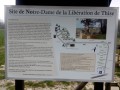
- (S/E) Notre-Dame de la Libération site (1946).
Between (7) and (8) Beaupré Priory (not open to visitors).
(9) Climbing the hill, you can take in the historic airfield site and its two Eiffel-style hangars (5,000 m² dating from 1938, listed as historic monuments and renovated in 2019–2020).
- Former Royal Road or Chemin du Roi (north of the town, running parallel to the RD 486). Cycle path.
- EuroVelo Route No. 6.
- Five further walks in the vicinity of Thise are available++ on ‘Visorando’ and on the Thise town website.

Reviews and comments

3.8 / 5
Based on 2 reviews

Reliability of the description
3.5 / 5
Ease of following the route
4 / 5
Route interest
4 / 5
HNS 25220
HNS 25220

Hello.
Thank you for sharing your thoughts on this route.
It’s possible that it has changed over time – since 2021 – due to tree felling or local development work that has been carried out. However, the course remains deliberately simple and fast-paced for running. I’ll be returning there soon to take another look at what could be improved. Kind regards.

Machine-translated

Benny1954
Benny1954

Overall rating : 3 / 5

Date of your route : May 29, 2023
Reliability of the description : ★★★☆☆ Average
Ease of following the route : ★★★☆☆ Average
Route interest : ★★★☆☆ Average
Very busy route : No

The description wasn’t very clear, especially in the second half of the route, where I couldn’t find my way. I ended up using my phone and Google!

Machine-translated

HNS 25220
HNS 25220

Hello
Thank you for your interest in this trail run and for your feedback.
A few corrections will be made to the description shortly.
Kind regards, HNS 25220

Machine-translated

perblan
perblan

Overall rating : 4.7 / 5

Date of your route : Apr 13, 2021
Reliability of the description : ★★★★☆ Good
Ease of following the route : ★★★★★ Very good
Route interest : ★★★★★ Very good
Very busy route : Yes

At point 2, at the car park, I turned right onto the path; after the first clearing, I took the first path on the left, which very quickly runs alongside the clearing at Rufille Farm.

Machine-translated

Other walks in the area

For more walks, use our search engine .

The GPS track and description are the property of this route's author. Please do not copy them without permission.