
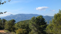
Circular route starting from Les Cadets du Pigeonnier

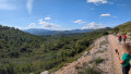
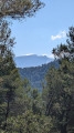
A family-friendly walk as it is not too long and has a reasonable elevation gain, with lovely views of Sainte-Victoire, the Étoile range, Sainte-Baume and Garlaban. Most of the route follows good tracks; only the final section is stony. In its first section, the walk follows the GRP® Sentier Provence Mines d’Énergies trail.

Details

n°110818037
Creation:
Last update:
Last review:
–
  • Walking
    Activity: Walking
  • ↔
    Distance: 6.50 mi
  • ◔
    Average duration: 3h 25 
  • ▲
    Difficulty: Moderate

  • ⚐
    Back to start: Yes
  • ↗
    Ascent: + 495 ft
  • ↘
    Descent: - 518 ft

  • ▲
    Highest point: 1,795 ft
  • ▼
    Lowest point: 1,283 ft
  • ⚐ Country: France
  • ⚐ City: Peynier (13790)
  • ⚑
    Start/End: N 43.418675° / E 5.60987°
  • ❏
    IGN map(s): Ref. 3244ET, 3344OT
  • Hour-by-hour weather

Photos

Description of the walk

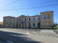
The route starts from the car park at the junction of the D908 and the D45e at the top of Le Pigeonnier, in the Bouilladisse neighbourhood.

(S/E) Leave the car park and turn left to walk carefully alongside the D908 for about 200 m: the path running parallel to the road is blocked.

(1) Leave the road and take the DFCI track opposite, continuing eastwards. Walk for about 1 km.

(2) The track bends to the right and you join the GRP® proper, continuing to descend to the right. Pass a ruin and carry on straight ahead.

(3) Ignore the wide path on the right and carry on until you reach the three-way junction.

(4) Turn right, then further on take a hairpin bend to the right and walk for about 600 m to reach a three-way junction.

(5) Leave the GRP® and follow the track furthest to the right. Begin a long descent and come out onto another track at a water tank.

(6) Continue to the right and reach another junction with four paths.

(7) Take the middle track and arrive at a hairpin bend at the bottom of the Vallon de l’Homme Mort.

(8) Take the path branching off to the right, heading north, to climb up the valley. You’ll reach a junction.

(9) Continue to the left and rejoin the DFCI track and the D908.

(1) Turn left and walk alongside the road , taking the same care, to return to the car park (S/E).

Waypoints

  1. S/E : mi 0 - alt. 1,562 ft - Car park
  2. 1 : mi 0.11 - alt. 1,558 ft - Junction of the circular loop
  3. 2 : mi 1.01 - alt. 1,637 ft - Junction – Ruins
  4. 3 : mi 1.65 - alt. 1,739 ft - Junction
  5. 4 : mi 1.94 - alt. 1,765 ft - Fork
  6. 5 : mi 2.59 - alt. 1,788 ft - Trident
  7. 6 : mi 3.69 - alt. 1,296 ft - Citerne
  8. 7 : mi 4.28 - alt. 1,345 ft - Trident
  9. 8 : mi 5.34 - alt. 1,283 ft - Hairpin bend – Start of the path
  10. 9 : mi 6.02 - alt. 1,486 ft - Crossroads
  11. S/E : mi 6.5 - alt. 1,558 ft - Car park

Other walks in the area

For more walks, use our search engine .

The GPS track and description are the property of this route's author. Please do not copy them without permission.