


jeanlucm88

 Visorando Member
- Gender: man
Sign up:
Published route(s)
 Circular forest above Auxelles Haut
 5.53 mi
 +1,677 ft
 -1,677 ft
 4h 00
4h 00
 Moderate
 Departure from Auxelles-Haut (Territoire-de-Belfort)
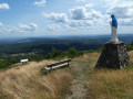
The hike begins with a forgotten path that deserves to be preserved. Access to the Querty grassland is very regular in a magnificent forest. Climb towards La Planche des Belles Filles then descend to Auxelles via the superb panorama of Mont Ménard.
Le Bois Noir and the Croix de Jaume starting from Lans-en-Vercors
9.44 mi
+1,424 ft
-1,437 ft
5h 35
Moderate
Departure from Lans-en-Vercors (Isère)
A route starting from the village with lovely forest paths and magnificent views from the Crête de Jaume.
(Pleasetake great care on this circular route): it crosses the Vercors plateau’s departmental roads four times. These roads are:
- Lans-en-Vercors towards Villard-de-Lans,
- Lans-en-Vercors towards Autrans,
are extremely busy and vehicles crossing the route all travel at high speed.
Hikers mustbe extremely vigilant when crossing these roads.