Circular route starting from the Saint-Jean Chapel

A pleasant walk starting from the Saint-Jean Chapel. No signposting.

Details

n°3923851
Creation:
Last update:
–
Last review:
  • Walking
    Activity: Walking
  • ↔
    Distance: 5.77 mi
  • ◔
    Average duration: 3h 00 
  • ▲
    Difficulty: Moderate

  • ⚐
    Back to start: Yes
  • ↗
    Ascent: + 374 ft
  • ↘
    Descent: - 381 ft

  • ▲
    Highest point: 741 ft
  • ▼
    Lowest point: 459 ft
  • ⚐ Country: France
  • ⚐ City: Edern (29510)
  • ⚑
    Start/End: N 48.112183° / W 3.937537°
  • ❏
    IGN map(s): Ref. 0618OT
  • Hour-by-hour weather

Photos

Description of the walk

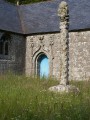
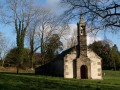
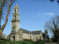
Park near the pretty Saint-Jean Chapel, which is shaped like a Latin cross.

(S/E) Head towards the crossroads, turn right towards Saint-Jean for about 100 metres and, opposite the houses, turn left onto the road towards Menez Saint-Jean. Walk to the fountain, passing in front of a house.

(1) Return to the road and take the grassy path on the left, which you follow for about 500 metres. At the end of this path, you’ll come out onto a small road; turn left onto it.

(2) At the Stivellou crossroads, follow the gravel road to the right for about 1 km, passing the Ty Nevez Gurvennou farm.

(3) Cross the D72 with care (no pedestrian crossing) and head opposite towards Kergadiou Farm. Continue straight on.

(4) Turn left towards Goarem Bella and continue on this road until you reach the junction of the Edern–Ty Fléhan road, where you’ll see the wayside cross.

(5) Retrace your steps for about 100 metres and, at Kéraël, turn right onto the tarmac road, passing through the hamlet of Guillaouic. Continue along the stony track, following it straight on through the hamlet of Kergadiou Nevez until you reach a crossroads at Ponchou Glaz.

(6) Turn right towards Kerganaben.

(7) Pass the memorial dedicated to the crew of the B-17 aircraft shot down during a bombing raid on the town of Lorient in 1943 and continue along the road to the junction at Roudou Floc’h. Turn left to reach the D72.

(8) Follow this road to the left for a few dozen metres, then cross carefully and take the first road on the right. Keep to the right at the junction just after this and continue straight on.

(9) Take the road going uphill to the left to return to your car at the Chapelle Saint-Jean (S/E).

Waypoints

  1. S/E : mi 0 - alt. 722 ft - Chapelle Saint-Jean (Edern)
  2. 1 : mi 0.25 - alt. 709 ft - Menez Saint-Jean fountain
  3. 2 : mi 0.74 - alt. 610 ft - Stivellou
  4. 3 : mi 1.16 - alt. 568 ft - D72 road
  5. 4 : mi 1.91 - alt. 673 ft - Crossroads
  6. 5 : mi 2.62 - alt. 738 ft - Ty Fléhan – Calvary
  7. 6 : mi 3.73 - alt. 561 ft - Ponchou Glaz
  8. 7 : mi 3.9 - alt. 558 ft - Kerganaben – Memorial stone
  9. 8 : mi 4.5 - alt. 459 ft - D72 road
  10. 9 : mi 5.4 - alt. 604 ft - Crossroads
  11. S/E : mi 5.77 - alt. 722 ft - Chapelle Saint-Jean (Edern)

Notes

No water sources noted, no shelters; bring rain gear in case of bad weather!

No signposting.

Worth a visit

Saint-Jean Chapel, Menez Saint-Jean fountain, the granite wayside cross at Ty Fléhan and the Kerganaben memorial.

Reviews and comments

4.7 / 5
Based on 1 review

Reliability of the description
5 / 5
Ease of following the route
5 / 5
Route interest
4 / 5
Roger Flao
Roger Flao

Thank you for your comment... Have a lovely day.

Machine-translated

Odile F
Odile F

Overall rating : 4.7 / 5

Date of your route : Dec 17, 2020
Reliability of the description : ★★★★★ Very good
Ease of following the route : ★★★★★ Very good
Route interest : ★★★★☆ Good
Very busy route : No

A very pleasant walk, well described. It’s very easy to follow, even without signposts.
Stunning views.

Machine-translated

Other walks in the area

For more walks, use our search engine .

The GPS track and description are the property of this route's author. Please do not copy them without permission.