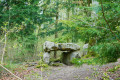
Woods, valleys and hills from Courmononcle

A walk through the forest and over the hills above Saint-Benoist-sur-Vanne, passing through the Vallée au Loup.

Details

n°3089912
Creation:
Last update:
Last review:
  • Walking
    Activity: Walking
  • ↔
    Distance: 6.09 mi
  • ◔
    Average duration: 3h 30 
  • ▲
    Difficulty: Easy

  • ⚐
    Back to start: Yes
  • ↗
    Ascent: + 781 ft
  • ↘
    Descent: - 774 ft

  • ▲
    Highest point: 764 ft
  • ▼
    Lowest point: 374 ft

Photos

Description of the walk

Park in the car park at the picnic area by the bridge over the Vanne, opposite the Moulin du Château in Saint-Benoist-sur-Vanne.

(S/E) Cross the bridge over the Vanne and follow the road which crosses and then runs alongside the Ruisseau des Abîmes.

(1) At the Chapelle Saint-Gengould, turn right to head up towards the Tête au Loup.
Follow the road to the entrance to the building site. Turn left and walk alongside the woodland for 150 metres, without entering it.

(2) Turn right to head up into the woods along the forest track heading south. After just over a kilometre, the track veers to the right, then after 300 metres, it turns left, leaves the woodland and joins theGR®2.

(3) Turn left onto thisGR® path, which descends gently into the Vallée au Loup before climbing back up towards the Bois du Petit Chevrais.

(4) Continue along theGR® as it turns left, heading north-east.

(5) Leave theGR® when it veers sharply to the right. Enter the forest, following the path north-west.

(6) At the second junction, turn right, then immediately left, and walk past a hunting lodge.

(7) At the junction, turn left onto the path that descends towards the edge of the Bois de Saint-Étienne. Continue downhill, keeping the forestry track on your right.

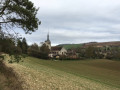
(8) At the hunting lodge, enjoy the view over Saint-Benoist-sur-Vanne.
Turn left to walk along the edge of the woodland, following the farm track that zigzags along the field.

(9) After 150 m, the track turns right and heads down alongside the hedge. Do not enter the forest. Follow the edge of the Bois Buisson (still on the farm machinery track) and rejoin the route taken on the way there.

(2) Follow the route back in the opposite direction to reach the Saint-Gengould Chapel and then the mill at the Château de Saint-Benoist-sur-Vanne (S/E).

Waypoints

  1. S/E : mi 0 - alt. 377 ft - Picnic area at the Pont du Moulin - La Vanne (rivière)
  2. 1 : mi 0.63 - alt. 427 ft - The Chapelle Saint-Gengould junction
  3. 2 : mi 1.16 - alt. 630 ft - Start of the forest path
  4. 3 : mi 2.13 - alt. 574 ft - Junction of the forest path with the GR2
  5. 4 : mi 2.75 - alt. 692 ft - Junction
  6. 5 : mi 3.43 - alt. 725 ft - Junction of the GR2 with the forest track
  7. 6 : mi 3.69 - alt. 738 ft - Junction
  8. 7 : mi 4.1 - alt. 719 ft - Junction
  9. 8 : mi 4.39 - alt. 597 ft - Hunting lodge on the edge of the woods
  10. 9 : mi 4.48 - alt. 564 ft - Turn right at the fork
  11. S/E : mi 6.09 - alt. 377 ft - Picnic area at the Pont du Moulin - La Vanne (rivière)

Notes

The small car park at the picnic area by the bridge over the Vanne, opposite the Moulin du Château in Saint-Benoist-sur-Vanne, is a very convenient place to start the walk.

But you can start it further up. For example, at the Chapelle Saint-Gengould, or even at the Tête au Loup. This saves you 2 km.

During the hunting season, from mid-October to the end of February, particularly on Saturdays and Sundays, the forest paths may be affected by hunting activities.

Always be cautious and plan ahead when you're outdoors. Visorando and the author of this route cannot be held responsible for any accidents occurring on this route.

The GR® and PR® markings are the intellectual property of the Fédération Française de Randonnée Pédestre.

Reviews and comments

4.7 / 5
Based on 1 review

Reliability of the description
5 / 5
Ease of following the route
5 / 5
Route interest
4 / 5
SYLDEH
SYLDEH

Overall rating : 4.7 / 5

Date of your route : Mar 09, 2021
Reliability of the description : ★★★★★ Very good
Ease of following the route : ★★★★★ Very good
Route interest : ★★★★☆ Good
Very busy route : No

An easy and enjoyable walk, despite a nice little steep stretch! Thank you for the well-marked route – it’s easy to get lost, but that wasn’t the case for us.
We were lucky enough to spot two lovely hares.

Machine-translated

Other walks in the area

For more walks, use our search engine .

The GPS track and description are the property of this route's author. Please do not copy them without permission.