


 Country:
 City:
City:


Parking is available at the Parc André Monnié car park in Villemoustaussou, accessible via Avenue du Parc.
(S/E) From the car park, cross the park and head towards Avenue Léo Lagrange. Turn right, go through the road tunnel and first turn left then right (at the pedestrian crossing) to reach the Voie Verte.
(1) Leave the return route on your right and take the Voie Verte on your left. At the roundabout, continue along thesecond street on the right (Chemin du Pont Neuf). You’ll reach a multi-way junction just after a right-hand bend in the road.
(2) Carry on to the left; the road narrows and crosses the bridge over the Ruisseau de Trapel. Immediately afterwards, turn left and continue to the boundary with the commune of Villegailhenc, near the Villegailhenc wastewater treatment plant.
(3) Go round it on the right and carry on straight ahead along the tarmac road, heading due north alongside the vineyards until you reach the large building housing the Brin d’Éveil nursery.
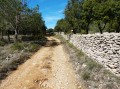
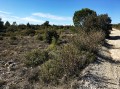
(4) Turn right and follow the unpaved track eastwards, passing under a high-voltage power line; continue until you reach, at the top of a small hill, a plantation of conifers, then carry on to the junction of several paths.
(5) Take the path opposite; ignore the two on the left and the one running perpendicular to the right. Then ignore all the turnings on both the left and right until you reach the D38.
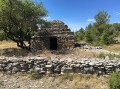
(6) Turn left and walk carefully along the D38 for about a hundred metres, then turn right onto Rue des Azeroliers, heading towards the Parcours des Crêtes. Follow the path to thesecond shed on the right, at the side of the path near some trees.
(7) Turn right onto the footpath until you reach a housing estate and the tarmac road known as Chemin de Septet. It turns 90° to the left and, at No. 89, joins the junction with Chemin Gaston Phoebus.
(8) Follow it to the left, then at the end of the street continue to the right onto Chemin de Villejean. When you reach the Domaine de Brau, carry on straight ahead for a few dozen metres until the next junction with the D38.
(9) Follow the road carefully to the left, cross the bridge over the Trappel; at the bend, ignore the path on the right and, after a few metres, join Chemin du Trappel.
(10) Follow it to the right; at the roundabout, go straight on then keep right to reach the ‘Stop’ sign on Avenue du Minervois. On the right, you’ll come to the junction you passed on the way out.
(1) Follow the outbound route in the opposite direction until you return to Parc André Monnié and its car park (S/E).
 Visorando Member
 Moderate
