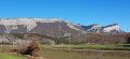
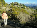
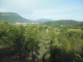
Laragnais Balcony

A walk above Laragne, featuring marl formations and the ruins of old Arzeliers; it is possible to extend the walk to old Eyguians from the point (7). It is also possible to shorten the walk at (5).

Details

n°110275052
Creation:
Last update:
Last review:
–
  • Walking
    Activity: Walking
  • ↔
    Distance: 6.56 mi
  • ◔
    Average duration: 3h 40 
  • ▲
    Difficulty: Moderate

  • ⚐
    Back to start: Yes
  • ↗
    Ascent: + 791 ft
  • ↘
    Descent: - 768 ft

  • ▲
    Highest point: 2,733 ft
  • ▼
    Lowest point: 2,149 ft

Description of the walk

From Laragne, follow signs for Arzeliers and park by the cemetery.

(S/E) Continue along the road towards L’Écluse to the north-east.

(1) At the junction, carry on straight ahead, leaving the signposted route to Lazer on your right.

(2) Pass to the right of the farm, then 20 m further on turn left onto the marl path, then follow a track to a T-junction.

(3) Turn left, up a short slope, then cross a narrow path along the side of the marl cliffs (take care with children). Continue south towards the old church.

(4) Go straight on to visit it.

(5) Retrace your steps (the castle marked on the map is no longer visible; however, the church, its foundations, a wall and a beautiful window are still standing).

(4) Follow the track to the left

(6) Leave the track on the left and continue along the path opposite.

(7) Turn left onto the track and follow the main GRP®-marked track until you reach a junction.

(8) Turn left and join the road, then head up to the left until you reach the cemetery car park (S/E).

Waypoints

  1. S/E : mi 0 - alt. 2,238 ft - Car park at the cemetery
  2. 1 : mi 0.97 - alt. 2,270 ft - Junction
  3. 2 : mi 1.25 - alt. 2,395 ft - Behind the farm
  4. 3 : mi 1.79 - alt. 2,628 ft - T-junction
  5. 4 : mi 2.8 - alt. 2,552 ft - Junction
  6. 5 : mi 2.86 - alt. 2,533 ft - Château d'Arzeliers
  7. 6 : mi 3.25 - alt. 2,543 ft - Junction
  8. 7 : mi 4.05 - alt. 2,543 ft - Track
  9. 8 : mi 5.42 - alt. 2,198 ft - Track junction
  10. S/E : mi 6.56 - alt. 2,244 ft - Car park at the cemetery

Other walks in the area

For more walks, use our search engine .

The GPS track and description are the property of this route's author. Please do not copy them without permission.