Roaillannaise walk past the mill and castle

An easy walk around the village of Roaillan, passing close to the Masseilles mill and offering views of Roquetaillade Castle.

Details

3621014
Creation:
Last update:
Last review:
  • Walking
    Activity: Walking
  • ↔
    Distance: 2.23 mi
  • ◔
    Average duration: 1h 10 
  • ▲
    Difficulty: Easy

  • ⚐
    Back to start: Yes
  • ↗
    Ascent: + 154 ft
  • ↘
    Descent: - 135 ft

  • ▲
    Highest point: 295 ft
  • ▼
    Lowest point: 141 ft
  • ⚐ Country: France
  • ⚐ City: Roaillan (33210)
  • ⚑
    Start/End: N 44.500179° / W 0.2863°
  • ❏
    IGN map(s): Ref. 1638SB
  • Hour-by-hour weather

Photos

Description of the walk

(S/E) From the car park at Roaillan’s municipal stadium, take the path that runs alongside the stadium behind the stands. Cross the departmental road (Route de Sauternes) and take the vineyard path opposite, slightly to the right. Go behind the housing estate and turn right onto Chemin de Sarraute.

(1) Once you reach the D222 Roaillan–Langon departmental road, turn right, then after 50 metres, turn left onto the Route du Moulin de Masseilles.

(2) In front of the mill entrance, take the path on the right which leads into the forest. Once you reach the Roaillan–Mazères departmental road, turn right, continue for 100 m, then turn left.

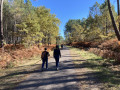
(3) After 100 m, turn right onto the path leading uphill through the woods. There’s a lovely view to the left of Roquetaillade Castle. At the next three-way junction, take the path on the left until you reach the departmental road (Route de Préchac D222).

(4) Cross the road, then after 500 m, turn right to reach the car park at Roaillan Municipal Stadium (S/E).

Waypoints

  1. S/E : mi 0 - alt. 276 ft - Car park at Roaillan Municipal Stadium
  2. 1 : mi 0.65 - alt. 240 ft - Junction with the D222
  3. 2 : mi 1.07 - alt. 141 ft - Masseilles Mill
  4. 3 : mi 1.44 - alt. 200 ft - View of Roquetaillade Castle
  5. 4 : mi 1.84 - alt. 266 ft - Crossing the D222
  6. S/E : mi 2.23 - alt. 276 ft - Car park at Roaillan Municipal Stadium

Notes

Shaded car park at the start and finish.
“Le Taiile Roc” restaurant in the village centre.
Full-service grocery shop in the village centre.

Worth a visit

Visit to Roquetaillade Castle nearby.
Langon–Mios and Langon–Bazas–Captieux cycle routes nearby.

Reviews and comments

4.1 / 5
Based on 4 reviews

Reliability of the description
5 / 5
Ease of following the route
4.3 / 5
Route interest
3 / 5
bx86
bx86

Overall rating : 4.7 / 5

Date of your route : Nov 01, 2024
Reliability of the description : ★★★★★ Very good
Ease of following the route : ★★★★★ Very good
Route interest : ★★★★☆ Good
Very busy route : No

Hello
A short walk today on All Saints’ Day in glorious sunshine.
No trouble finding my way. Lovely views over the town of Bazas and its cathedral.
It’s a shame the church in Sauvais wasn’t open…

Of course, there were a few stretches along the road, though there was very little traffic today.
Thank you for this lovely route.

Machine-translated

RP33
RP33

Overall rating : 4 / 5

Date of your route : May 07, 2022
Reliability of the description : ★★★★★ Very good
Ease of following the route : ★★★☆☆ Average
Route interest : ★★★★☆ Good
Very busy route : No

A pleasant walk; please note that in (2) of the description, there is a discrepancy with the GPS route.

Machine-translated

Bluesquetaire
Bluesquetaire

Overall rating : 4.3 / 5

Date of your route : Apr 25, 2021
Reliability of the description : ★★★★★ Very good
Ease of following the route : ★★★★★ Very good
Route interest : ★★★☆☆ Average
Very busy route : No

A short, leisurely stroll along a few short stretches of road and path. Much of the route takes you through housing estates under construction. As mentioned in some reviews, there’s a signpost for the path leading down into the woods near the Masseilles mill. The view of Roquetaillade Castle is superb, even from a distance.

Machine-translated

ainhoa1
ainhoa1
• Edited:

Overall rating : 3.3 / 5

Date of your route : Aug 05, 2020
Reliability of the description : ★★★★★ Very good
Ease of following the route : ★★★★☆ Good
Route interest : ★☆☆☆☆ Very disappointing
Very busy route : No

Not a particularly pleasant walk, as most of it takes you round housing estates or along the road. The Moulin de Masseilles is now a private residence, so you cannot get close to it; the sections through the woods are short and rather uninviting. Only the view of the castle is of any interest, even though you can only see it from a distance.

On the map, the path through the woods that you should take when you reach the mill is shown in the wrong place. You should actually take the very first dirt track just before the mill (in front of the sign marking it); do not rely on the map, which shows it a few metres further on.

Machine-translated

Other walks in the area

For more walks, use our search engine .

The GPS track and description are the property of this route's author. Please do not copy them without permission.