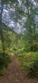
The banks of the Ciron from Bommes

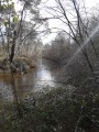
A round-trip walk through the forest along the banks of the Ciron, from Bommes to the Caussarieu rest area, near Léogeats. Several beaches along the Ciron punctuate the walk, perfect for cooling off. Picnic tables are available at the Caussarieu rest area.

Details

104019368
Creation:
Last update:
Last review:
  • Walking
    Activity: Walking
  • ↔
    Distance: 7.46 mi
  • ◔
    Average duration: 3h 30 
  • ▲
    Difficulty: Moderate

  • ⚐
    Back to start: Yes
  • ↗
    Ascent: + 98 ft
  • ↘
    Descent: - 102 ft

  • ▲
    Highest point: 226 ft
  • ▼
    Lowest point: 138 ft
  • ⚐ Country: France
  • ⚐ City: Bommes (33210)
  • ⚑
    Start/End: N 44.547377° / W 0.360582°
  • ❏
    IGN map(s): Ref. 1538SB, 1638SB
  • Hour-by-hour weather

Photos

Description of the walk

Park in the car park at the Halte Nautique de Bommes.

(S/E) Cross the car park towards the Ciron, go past the two barriers and head for a footbridge.

(1) Cross the Ciron via the footbridge. Follow the left bank and you’ll soon reach a large beach.

(2) Continue along the left bank of the Ciron, then leave it to reach the Route de Pourrière.

(3) Turn left onto this road until you reach the junction with the Chemin du Batan.

(4) Turn left onto this track, cross a stream and then pass through the hamlet of Batan. You will then come to another crossroads of paths.

(5) Take the path leading off to the left, rejoin the Ciron and follow it to the D125.

(6) Cross the road carefully, follow the left bank of the Ciron again, then veer off to the right to reach the Ruisseau de Noy.

(7) Cross it, then rejoin the Ciron and you’ll soon come to another tributary of the Ciron, the Clédon.

(8) Stay on the left bank to reach another tributary, the Ruisseau des Termes.

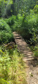
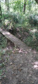
(9) Cross the footbridge over this stream and continue to the Caussarieu area, the end point of the walk.

(10) Turn round and follow the path back in the opposite direction to return to the car park at the Halte Nautique de Bommes (S/E).

Waypoints

  1. S/E : mi 0 - alt. 207 ft - Bommes Water Sports Centre car park - Ciron (rivière)
  2. 1 : mi 0.13 - alt. 200 ft - Ciron footbridge
  3. 2 : mi 0.36 - alt. 210 ft - Large beach
  4. 3 : mi 0.85 - alt. 174 ft - Junction
  5. 4 : mi 1 - alt. 167 ft - Junction
  6. 5 : mi 1.19 - alt. 210 ft - Junction
  7. 6 : mi 1.67 - alt. 177 ft - Route des Sources
  8. 7 : mi 2.36 - alt. 226 ft - Noy Stream
  9. 8 : mi 2.73 - alt. 217 ft - Clédon Stream
  10. 9 : mi 3.11 - alt. 217 ft - Footbridge over the Termes stream
  11. 10 : mi 3.76 - alt. 210 ft - Caussarieu area
  12. S/E : mi 7.46 - alt. 203 ft - Bommes Water Sports Centre car park

Notes

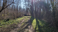
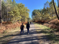
The walk is almost entirely through woodland and is refreshing in summer or during heatwaves. There is approximately 800 m in direct sunlight; the rest is shaded by trees.
There are several footbridges that are a bit wobbly and not particularly reassuring, but they are perfectly passable.
Some sections along the banks of the Ciron are narrow and showing signs of erosion.
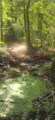
Several of the streams may be dry.
The route was walked in the summer of 2026 during a period of drought and a heatwave.

Worth a visit

Several beaches along the Ciron punctuate the walk and are perfect for cooling off.
(10) Picnic tables are available at the Caussarieu rest area.
There are several pidgeon hunting huts along the way.

Other walks in the area

For more walks, use our search engine .

The GPS track and description are the property of this route's author. Please do not copy them without permission.