Walk near Chaumont

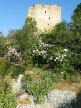
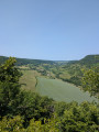
A short, picturesque circular route with a few pleasant climbs offering a beautiful view of the village of Châteauneuf. Game is often spotted here.

Details

7760063
Creation:
Last update:
Last review:
  • Walking
    Activity: Walking
  • ↔
    Distance: 2.28 mi
  • ◔
    Average duration: 1h 25 
  • ▲
    Difficulty: Easy

  • ⚐
    Back to start: Yes
  • ↗
    Ascent: + 466 ft
  • ↘
    Descent: - 472 ft

  • ▲
    Highest point: 1,558 ft
  • ▼
    Lowest point: 1,240 ft
  • ⚐ Country: France
  • ⚐ City: Châteauneuf (21320)
  • ⚑
    Start/End: N 47.216814° / E 4.643114°
  • ❏
    IGN map(s): Ref. 2923SB, 3023OT
  • Hour-by-hour weather

Description of the walk

Park in the cemetery car park.

(S/E) Return to the tarmac road and turn right to reach the wash house. Walk past the stone troughs.

(1) Turn right again to walk up Rue des Jardins to the end. Ignore the road on the left which leads back up into the village and head down the road on the right towards La Bussière-sur-Ouche.
Ignore a dirt track on your right and carry on until you reach the second one, with a stone porch (the IGN map is incorrect at this point).

(2) Head down to the right towards the Creuse, then climb up the other side, staying on the main track.

(3) At the three-way junction, turn right. Keep to the right at the next junction, staying on the main track. You may spot some game in the large field on the left. Head back down a stony track and carry straight on at the crossroads.

(4) Once you reach the road, turn right and head down to the Vieux Moulin. After passing it, follow a grassy path just after the hairpin bend and head back up to the road. Turn right towards the village and turn right again at the bend to reach the cemetery (A/D).


Waypoints

  1. S/E : mi 0 - alt. 1,414 ft - Cemetery car park
  2. 1 : mi 0.08 - alt. 1,434 ft - Crossroads, turn right
  3. 2 : mi 0.47 - alt. 1,490 ft - Stone porch
  4. 3 : mi 0.94 - alt. 1,512 ft - Three-way junction, turn right
  5. 4 : mi 1.7 - alt. 1,309 ft - Road junction, turn right
  6. S/E : mi 2.28 - alt. 1,414 ft - Cemetery car park

Notes

Elevation 436, after (3): you can follow the grassy path on the right and take a return trip to see the little Saint-Clément chapel. Return to the main path and continue along it to the right; no circular route is possible.

Reviews and comments

4.4 / 5
Based on 3 reviews

Reliability of the description
4.3 / 5
Ease of following the route
4.3 / 5
Route interest
4.7 / 5
HNS 25220
HNS 25220

Overall rating : 4.7 / 5

Date of your route : Nov 02, 2024
Reliability of the description : ★★★★★ Very good
Ease of following the route : ★★★★★ Very good
Route interest : ★★★★☆ Good
Very busy route : No

A short and easy walk in the immediate vicinity of Châteauneuf. A nice way to stretch your legs before visiting the village and the château.
Please note: the possibility of spotting wildlife may also mean that hunting is taking place (signs).

Machine-translated

FKNECHT
FKNECHT

Overall rating : 5 / 5

Date of your route : Jul 20, 2023
Reliability of the description : ★★★★★ Very good
Ease of following the route : ★★★★★ Very good
Route interest : ★★★★★ Very good
Very busy route : No

A really lovely walk. A few ‘steep bits’ as mentioned, but nothing too difficult! We did it with children aged 3 and 8. The view of the castle on the way back is brilliant!
As a bonus, we spotted a roe deer amongst the sunflowers! Highly recommended.

Machine-translated

carenage
carenage

Overall rating : 3.7 / 5

Date of your route : Aug 25, 2021
Reliability of the description : ★★★☆☆ Average
Ease of following the route : ★★★☆☆ Average
Route interest : ★★★★★ Very good
Very busy route : Yes

Châteauneuf is a lovely village that’s well worth a visit

Machine-translated

Other walks in the area

For more walks, use our search engine .

The GPS track and description are the property of this route's author. Please do not copy them without permission.