Chaudenay-le-Château circular

Starting point: “Le Cottage” guesthouse. Two-thirds of this circular walk takes place through woodland. The final third passes through the village of Chaudenay-le-Château and can be avoided (see description). A pleasant walk where you may spot does or roe deer if you remain quiet and keep a watchful eye out.

Details

4546663
Creation:
Last update:
Last review:
  • Walking
    Activity: Walking
  • ↔
    Distance: 3.99 mi
  • ◔
    Average duration: 2h 10 
  • ▲
    Difficulty: Easy

  • ⚐
    Back to start: Yes
  • ↗
    Ascent: + 390 ft
  • ↘
    Descent: - 417 ft

  • ▲
    Highest point: 1,696 ft
  • ▼
    Lowest point: 1,378 ft

Photos

Description of the walk

Park in front of the Ecomuseum.

(S/E) With your back to the museum, turn right, walk past the castle outbuildings and you’ll come to a junction.

(1) Turn left, walk past the guesthouse “Le Cottage” and continue down the road.

(2) Leave the road and take the path leading uphill on the left. Continue straight ahead along the main path. You will see the village of Crugey below you. You will then look out over the Burgundy Canal, which you will follow at a distance until you reach the junction with the Châteauneuf-en-Auxois path.

(3) Turn left onto the path leading uphill and carry on in the same direction.

(4) Follow the road to the right to complete a circular route through the village. You’ll walk alongside the castle, past the moat and the old entrance where the drawbridge once stood.

(5) At the junction, turn left. In the bend, keep to the right to discover an old washhouse and a pond. Please respect the site.

(6) Turn back and continue to the right.

(7) At the junction, turn left. Pass Saint-Pierre Church on your left and head for the car park in front of the Ecomuseum (S/E).


Waypoints

  1. S/E : mi 0 - alt. 1,457 ft - Ecomuseum
  2. 1 : mi 0.06 - alt. 1,430 ft - Junction, left
  3. 2 : mi 0.19 - alt. 1,407 ft - Path on the left
  4. 3 : mi 2.09 - alt. 1,414 ft - Crossroads, on the left
  5. 4 : mi 3.36 - alt. 1,545 ft - Road junction, turn right
  6. 5 : mi 3.61 - alt. 1,529 ft - Junction, on the left
  7. 6 : mi 3.77 - alt. 1,476 ft - Old wash house
  8. 7 : mi 3.88 - alt. 1,430 ft - Junction, on the left
  9. S/E : mi 3.99 - alt. 1,457 ft - Ecomuseum

Notes

Make sure you bring plenty to drink as there are no drinking water points along the route.
Trainers are the minimum requirement for the route, but in wet weather, walking boots are recommended for better grip.

Alternatives:

(S/E) Head towards (1) and turn into the first small road on the left. After about a hundred metres, you’ll arrive at the foot of the old keep. Turn back, turn left to reach (1) and continue with the walk as described.

(1) Turn left, then right to visit a wash house situated below. Return to the road and continue to the right towards (2).

(3) If you carry on straight ahead, you can reach the Burgundy Canal and walk upstream to Châteauneuf.

(4) If you turn left onto the road, you can head straight to the (S/E).

Worth a visit

Visits to the Museum-School are by booking only.
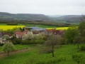
Views of the villages of Crugey, Bouey and Châteauneuf-en-Auxois.
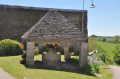
The two wash houses in the village of Chaudenay-le-Château.
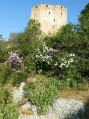
Chaudenay Castle with its outbuildings and keep.

Reviews and comments

4 / 5
Based on 3 reviews

Reliability of the description
3.7 / 5
Ease of following the route
4 / 5
Route interest
4.3 / 5
Straph
Straph

Overall rating : 4 / 5

Date of your route : Jul 26, 2026
Reliability of the description : ★★★★☆ Good
Ease of following the route : ★★★★☆ Good
Route interest : ★★★★☆ Good
Very busy route : No

A short, easy walk to do with children. Three-quarters of the route is through the woods. It’s a very pretty and picturesque village in Burgundy.

Machine-translated

NanaDidi
NanaDidi
• Edited:

Overall rating : 4 / 5

Date of your route : Aug 28, 2025
Reliability of the description : ★★★★☆ Good
Ease of following the route : ★★★★☆ Good
Route interest : ★★★★☆ Good
Very busy route : No

Indeed, the description could be improved in terms of the starting point. However, thanks to Chabanis' warning and our GPS, we didn't encounter any problems.
It's a nice route, mostly through a pretty forest, and one to add to your list of summer walks. The tour of the village is very pleasant.
We witnessed a tree falling live, which was impressive and very sad.
One downside, however: you "get" to enjoy the noise of the motorway for almost the entire outward journey.

Machine-translated

Chabanis
Chabanis

Overall rating : 4 / 5

Date of your route : Jul 17, 2023
Reliability of the description : ★★★☆☆ Average
Ease of following the route : ★★★★☆ Good
Route interest : ★★★★★ Very good
Very busy route : No

The description of the start of the walk is vague. In fact, when you enter the forest, there are two paths. We hesitated, went back and forth a few times; even the app’s GPS couldn’t help us find the right path… In the end, you need to take the path on the right, not the one on the left that goes uphill. Despite this shaky start, the walk is easy and really enjoyable along lovely forest paths. A real pleasure – thanks to the author.

Machine-translated

Other walks in the area

For more walks, use our search engine .

The GPS track and description are the property of this route's author. Please do not copy them without permission.