Country:
 City:


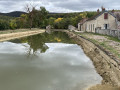
Park at the canal rest area in Veuvey-sur-Ouche, between Ouche and Canal, which is equipped with picnic tables.
(S/E) Head back towards the bridge, cross the canal, then follow the road to the right towards the end of the village, heading south. Take the first street on the left, which leads uphill towards the cemetery.
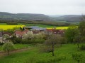
(1) Carry on straight ahead along this small tarmac road leading to Becoup. Pass a bench and then a stone wayside cross on your right. Turn round to enjoy a superb view over the Ouche valley.
(2) Carry on a little further along the road up the gentle slope of the plateau, until you reach a slight bend and a Fork in the road at Combe Peugeot.
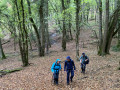
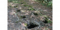
(3) Leave the road and take the path on the left which leads across the fields, towards two isolated trees a little further on. Cross this small copse and, at the end, take the path that goes straight into the forest. Follow the Combe de Chatrée uphill, beneath the trees, amongst the pebbles and the numerous low walls found along this stretch. Continue along the thalweg until the valley narrows, with two sets of cliffs that almost meet and a small stream flowing out to the right.
(4) Immediately afterwards, leave the thalweg and take the path on the right, which curves sharply. This path skirts the hillside, remaining almost level, before descending to the Source Melonde, which is easily spotted on the hillside of the valley.
(5) Continue downhill, then head up to the left along the valley floor of this unnamed valley. Follow the slope; you’ll reach a point almost level with the road before continuing along the path on a slight incline. Further up, at the large junction where four paths meet, take the one on the right to return to the road.
(6) Cross the road carefully and, after passing through a gate, take the correct white-marked forest track opposite. Continue straight on like this until you reach a large junction.
(7) Then turn left onto a small track. Follow this through the woods for about a kilometre, negotiating a few gentle ascents and descents and passing the highest point. At the end, at a crossroads, take the track leading downhill to emerge onto a good path about ten metres further on.
(8) Take a sharp right-hand bend to follow this path to a star-shaped junction at a straight, transverse track.
(9) Descend, continuing straight on along the rest of the path into the thalweg of an unnamed valley. Take care on the descent as the path is slippery in wet weather. Continue down to an underground reservoir on the right, recognisable by the small stone structure.
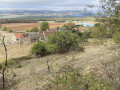
(10) Take the path on the right, which soon emerges from the woods and runs alongside a meadow on the left. This leads to a sweeping panoramic view of the Ouche valley, marked by a signpost.
(11) Continue down the slope, passing another lovely viewpoint about a hundred metres further on, and you’ll reach the road. Cross it carefully and head straight ahead into the heart of the hamlet of Bécoup.
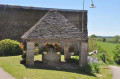
(12) At the small square, turn left to return to the road. Cross it with the same caution to reach the wash house opposite: a spot suitable for a picnic.
(13) Retrace your steps back to the small square.
(12) Take Rue des Lavières on the left. Walk through the end of the hamlet, then pass some sheds on your left. Continue in this direction, first along the road and then onto the proper path that follows just before the woods. Walk downhill, ignoring all the paths you come across and sticking to the path with the steepest gradient. At the junction with the path coming from the right, turn left and leave the forest.
(14) Walk past the Baugé farm and continue downhill: there’s a lovely view of the A6 viaduct at Pont d’Ouche. When you reach the departmental road, turn right towards the village and join the D33 (Rue de Dijon). Cross at the pedestrian crossing, then carry on straight ahead, crossing two bridges. At the bar-restaurant, turn right and follow a very narrow path alongside the building, which leads to the harbour at Pont d’Ouche.
(15) Then continue to the right to reach Lock No. 20 on the Canal de Bourgogne.
(16) Cross the canal via the lock footbridge, then turn right onto the towpath. Continue in this direction until you reach Lock No. 21 at Baugey. The house has blue shutters and was the filming location for Bertrand Blier’s 1974 film *Les Valseuses*.
(17) Then carry on straight ahead along the towpath.
(18) Walk past the Veuvey lock-keeper’s house, situated on the other side of the canal, and stay on the same side as you follow the River Ouche, which flows below on your left. Leave the canal bridge on your right and head straight for the car park (S/E).
 Visorando Member

 Very difficult
 Association / Club / Walk leader
 Easy