Nature walk starting from Campugnan

Nature walk organised as part of a ‘Green Challenge’: I am (re)discovering nature.

Details

25906101
Creation:
Last update:
Last review:
  • Walking
    Activity: Walking
  • ↔
    Distance: 5.37 mi
  • ◔
    Average duration: 2h 30 
  • ▲
    Difficulty: Easy

  • ⚐
    Back to start: Yes
  • ↗
    Ascent: + 72 ft
  • ↘
    Descent: - 72 ft

  • ▲
    Highest point: 141 ft
  • ▼
    Lowest point: 75 ft
  • ⚐ Country: France
  • ⚐ City: Campugnan (33390)
  • ⚑
    Start/End: N 45.177669° / W 0.564958°
  • ❏
    IGN map(s): Ref. 1534SB, 1535SB
  • Hour-by-hour weather

Photos

Description of the walk

Park near Campugnan Town Hall.

(S/E) Turn right at the town hall to reach the Route de la Croix des Quatre Vents. Turn right onto this road, then turn left onto the Route des Rosiers. Pass the Cité les Enclouses and continue to the junction with the Route de Camelot.

(1) Turn left onto this road and continue to the ‘Stop’ sign at the junction with the D134.

(2) Cross it and take the Route de la Maisonnette opposite. You’ll reach a Y-junction shortly after the Morillon estate; see the section: ‘During the walk or nearby’.

(3) Turn right into a woodland. Pass the Talibert farm and continue to the Six Chemins junction.

(4) Cross the D26 with care and continue straight ahead onto the Route du Candelon. Pass under the power lines. You’ll reach a T-junction before the hamlet of Candelon.

(5) Turn 90° to the left and continue along a straight track to reach the crossroads in the hamlet of Bois Rond.

(6) Turn left again at a 90° angle and cross the D18 with care. Pass under the power lines, then follow the road alongside the hamlet of Bel-Air. At Les Grands Sables, turn left onto the road leading to the hamlet of Hervais.

(7) Pass in front of Impasse des Hirondelles, then turn right onto Route des Vignes. Join Route de la Guillebonnerie and turn left onto it. At the stop sign, turn right onto the D134. Continue to Les Moulins de Romefort.

(8) Continue along the D134 for a few metres, then turn left onto the path running alongside the vineyards. Follow this path round the left-hand bend to reach the car park near the town hall (S/E).

Waypoints

  1. S/E : mi 0 - alt. 121 ft - Campugnan Town Hall
  2. 1 : mi 0.21 - alt. 105 ft - Route de Camelot
  3. 2 : mi 0.54 - alt. 125 ft - D134
  4. 3 : mi 0.77 - alt. 138 ft - Domaine de Morillon
  5. 4 : mi 1.48 - alt. 115 ft - Carrefour des Six Chemins
  6. 5 : mi 1.96 - alt. 89 ft - Candelon
  7. 6 : mi 2.59 - alt. 79 ft - Bois Rond
  8. 7 : mi 3.79 - alt. 138 ft - Hervais
  9. 8 : mi 4.62 - alt. 115 ft - Les Moulins de Romefort
  10. S/E : mi 5.37 - alt. 121 ft - Campugnan Town Hall

Worth a visit

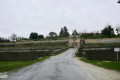
Between (2) and (3) on the left lies the Château Morillon estate. It is the former residence of the Brun de Gadeau family, powerful lords whose authority was widely recognised in the region. This great renown attracted King Saint Louis, who stayed there in 1242 following his great victories at Saintes and Taillebourg over Henry III, King of England. Today, the estate belongs to Mr and Mrs Mado, who have turned it into an organically farmed vineyard.

Reviews and comments

4.1 / 5
Based on 4 reviews

Reliability of the description
4.3 / 5
Ease of following the route
4.8 / 5
Route interest
3.3 / 5
User 15508851

Overall rating : 3.7 / 5

Date of your route : Dec 15, 2025
Reliability of the description : ★★★★☆ Good
Ease of following the route : ★★★★☆ Good
Route interest : ★★★☆☆ Average
Very busy route : No

Hike with many paved sections but quiet traffic. No elevation changes.

Machine-translated

bx86
bx86

Overall rating : 4.7 / 5

Date of your route : Jun 23, 2024
Reliability of the description : ★★★★★ Very good
Ease of following the route : ★★★★★ Very good
Route interest : ★★★★☆ Good
Very busy route : No

Good evening. Let’s start by dispelling some people’s concerns about the presence of tarmac… 
1. You simply need to take a close look at the map provided (it’s easy to see on a 1:25,000 scale) and thus rule out this sort of route.
2. In fact, this sort of route is ideal for walks after bad weather, because if you’re at all familiar with some of the forest paths in the region after a rainy spring, you’d have to really enjoy mud baths… and soggy feet. To each their own.
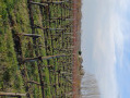
That said, this short walk on the border between Gironde and Charente-Maritime is rather lovely, precisely because it allows you to walk at a brisk pace without giving it too much thought, taking in the landscapes of the Blayais plateau, with its hamlets, vineyards, woods, meadows, restored and unrestored houses, and two mills that must have made good use of the westerly winds to be of service in the past.
Just a quick note: between Bel-Air and Hervais, the grassy path is, in this damp late spring, very grassy (sic) and only half visible. Fortunately, you just need to keep going straight on!
Thank you for these route suggestions, which are always very useful.

Machine-translated

isèrevercors
isèrevercors

Overall rating : 4 / 5

Date of your route : Jun 03, 2023
Reliability of the description : ★★★★☆ Good
Ease of following the route : ★★★★★ Very good
Route interest : ★★★☆☆ Average
Very busy route : No

Far too much tarmac. Apart from that, a lovely little walk.

Machine-translated

Yves Raulin
Yves Raulin

Overall rating : 4 / 5

Date of your route : Oct 07, 2022
Reliability of the description : ★★★★☆ Good
Ease of following the route : ★★★★★ Very good
Route interest : ★★★☆☆ Average
Very busy route : No

This is a pleasant route once you leave the tarmac road, even though there is little traffic; it might be worth pointing out all routes where more than 50 per cent of the route is on tarmac.

Machine-translated

Other walks in the area

For more walks, use our search engine .

The GPS track and description are the property of this route's author. Please do not copy them without permission.