Around Lamarque

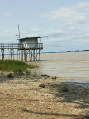
A pleasant walk exploring the town of Lamarque, its surroundings and the ferry landing stage with its view over the Garonne. As this route offers little shade, you should bring suitable protection from the sun during hot weather, as well as water.

Details

85629822
Creation:
Last update:
Last review:
  • Walking
    Activity: Walking
  • ↔
    Distance: 4.83 mi
  • ◔
    Average duration: 2h 15 
  • ▲
    Difficulty: Easy

  • ⚐
    Back to start: Yes
  • ↗
    Ascent: + 13 ft
  • ↘
    Descent: - 13 ft

  • ▲
    Highest point: 26 ft
  • ▼
    Lowest point: 10 ft
  • ⚐ Country: France
  • ⚐
    Area: Médoc
  • ⚐ City: Lamarque (33460)
  • ⚑
    Start/End: N 45.095841° / W 0.714567°
  • ❏
    IGN map(s): Ref. 1434SB, 1535SB
  • Hour-by-hour weather

Photos

Description of the walk

The car park is next to the panoramic domed church in Lamarque.

(S/E) Leave the car park by heading west along the church square, then along the Rue Principale. Pass the town hall on your left, opposite the Allée du Château de Lamarque on your right.

(1) Turn right onto Rue du Vieux Chêne and follow it until it joins the Route de Pauillac (D2).

(2) Turn right and follow this road carefully for about two hundred metres. Shortly after crossing the Jalle du Cartillon, turn right onto the farm track which runs diagonally north-east just before the Vauban fortified castle. Beyond the first houses on the left-hand side of the track, the track passes through an area of vineyard plots. Further on, the track passes through the Curade area, which is prone to flooding on the right-hand side.

(3) At the junction with the track on the left coming from Fort-Médoc, continue straight ahead into the Lisot area. Just before reaching the Jalle du Cartillon, turn right onto the track that skirts the western side of the Jalle bend. The track then passes through a wooded area on the left-hand side.

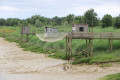
(4) At the next junction, you can take a detour of about fifty metres to enjoy the view over the Garonne. Continue along the path on the right heading south and stay on the main path until you reach the Route du Port at the Pont de la Mayre. Turn left and follow this road carefully as far as the Lamarque ferry terminal

(5) Turn right onto the road leading to the ferry car park and continue along the service track that follows it, running alongside the banks of the Garonne.

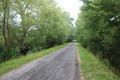
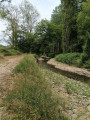
(6) Seven hundred metres from the ferry landing stage, just after the Pont de l’Estey-Moulin, turn right onto a track heading westwards alongside a seasonal stream.

(7) At the junction with a road coming from the left, carry on straight ahead along the road known as Saint-Seurin Sud towards Lamarque. Further on, as you approach Lamarque, the route passes in front of the cemetery. Continue along the Chemin de Saint-Seurin until you reach the car park next to Lamarque church (S/E).

Waypoints

  1. S/E : mi 0 - alt. 23 ft - Car park next to the domed church in Lamarque
  2. 1 : mi 0.27 - alt. 23 ft - Rue Principale x Rue du Vieux Chêne
  3. 2 : mi 0.66 - alt. 16 ft - Rue du Vieux Chêne x Route de Pauillac
  4. 3 : mi 1.95 - alt. 16 ft - Crossroads (La Mayre Nord) - Estuaire de la Gironde
  5. 4 : mi 2.44 - alt. 10 ft - Crossroads (La Mayre)
  6. 5 : mi 3.17 - alt. 13 ft - Crossroads at the Lamarque ferry landing stage
  7. 6 : mi 3.61 - alt. 13 ft - Crossroads at the Pont de l’Estey-Moulin
  8. 7 : mi 4.1 - alt. 16 ft - Road junction (Saint Seurin Sud)
  9. S/E : mi 4.83 - alt. 23 ft - Car park next to the domed church in Lamarque

Notes

The route follows good paths and a variety of minor roads. Nevertheless, it is best to wear suitable footwear.

This walk presents no difficulty in terms of navigation. In addition, it is advisable to follow the instructions in the route description and on the map, whilst also paying close attention to the landscape. The waypoints, with their GPS coordinates and the distance from the starting point, are helpful for walkers exploring the route for the first time.

Hike completed by the author on 3 June 2026

Worth a visit

LAMARQUE

Lamarque serves as a gateway to the Médoc thanks to the ferry, which provides a crossing to and from Blaye. To catch the ferry, head to Lamarque harbour. Make the most of the opportunity to admire the view of the various islands dotting the estuary: Île de Patiras, Île Nouvelle and Île Margaux. You can also see the Citadel of Blaye, which forms part of the ‘Verroudel’Estuaire’ ( Estuary Lock) alongside Fort Médoc and Fort Pâté.

The church – Lamarque’s panoramic dome

Lamarque is also home to…

vineyards and wine châteaux such as Château de Lamarque, remarkable for its architecture, which welcomes you for guided tours and wine tastings. Just like Château Malescasse, which also offers themed tours such as a picnic in the heart of the estate or wine-blending workshops!

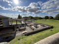
Fort Médoc

Other walks in the area

For more walks, use our search engine .

The GPS track and description are the property of this route's author. Please do not copy them without permission.