


 Country:

 City:
City:


Don’t worry: at (4), the route runs alongside the fields at the edge of a private woodland for a few hundred metres before rejoining the path a little further on.
A countryside walk between Serville and Chestruvin


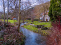
Starting from the charming hamlet of Serville, with its stream and pretty chapel, the walk heads into the forest towards Weillen. The small road linking the villages that follows is very quiet and offers beautiful views of the surrounding countryside. In Weillen, the route climbs slightly, offering lovely views of the village, its church and its castle.
This is followed by a stretch through the countryside, sometimes along the edge of the forest (off the marked path) and sometimes across fields, to the hamlet of Chestruvin, which you must go round to return to Onhaye. The route, between the old quarries and the N97, also includes a short section that is not shown on the map but is clearly visible on the ground. The return journey to the starting point at Gérin takes place entirely through the countryside.
Details
Creation:
Last update:
Last review:
–
–
-
 Activity: Walking
 -
 Distance: 11.07 mi
 -
 Average duration: 5h 40
 -
 Difficulty: Moderate
 -
-
 Back to start: Yes
 -
 Ascent: + 712 ft
 -
 Descent: - 702 ft
 -
-
 Highest point: 879 ft
 -
 Lowest point: 564 ft
Photos
Waypoints
- S/E : mi 0 - alt. 679 ft - Serville
- 1 : mi 1.29 - alt. 774 ft - Pré des Vaux
- 2 : mi 2.24 - alt. 610 ft - Weillen
- 3 : mi 3.03 - alt. 781 ft - The Towns
- 4 : mi 3.35 - alt. 837 ft - Off the trail: edge of the private woodland
- 5 : mi 5.08 - alt. 692 ft - Chestruvin
- 6 : mi 6.02 - alt. 741 ft - Rondia Wood
- 7 : mi 7.1 - alt. 755 ft - N936
- 8 : mi 7.85 - alt. 879 ft - Unmapped path
- 9 : mi 8.92 - alt. 866 ft - Gérin
- 10 : mi 10.74 - alt. 761 ft - Fork
- S/E : mi 11.07 - alt. 679 ft - Serville
Notes
Worth a visit
Completely off the route: the Sommière Water Mill, on the River Flavion, downstream from Weillen and Flun.
Further on: the Molignée valley, Falaën and the abbeys of Maredret and Maredsous.
Other walks in the area
Bell tower walk from Serville
 Visorando Member
 11.79 mi
+1,073 ft
-1,073 ft
6h 20
Moderate
11.79 mi
+1,073 ft
-1,073 ft
6h 20
Moderate
 Departure from Onhaye (Province de Namur)
Not familiar with Onhaye? Here's a little preview!Don't worry, there aren't only bell towers in the region, but you will come across a few along the way.And not just those of churches and chapels... there are also one or two castles with turrets similar to the usual bell towers of our villages.
The ruins of Montaigle and the Sosoye nature reserve from Falaën
 8.24 mi
+732 ft
-735 ft
4h 25
Moderate
Departure from Onhaye (Province de Namur)
8.24 mi
+732 ft
-735 ft
4h 25
Moderate
Departure from Onhaye (Province de Namur)
A varied route that passes through the village of Falaën with its stone houses, the bucolic Flavion valley, the imposing ruins of the medieval castle of Montaigle and the Montagne de Sosoye Nature Reserve with its beautiful limestone meadows.
From Falaën to the ruins of Montaigle Castle
 5.71 mi
+515 ft
-525 ft
3h 05
5.71 mi
+515 ft
-525 ft
3h 05
 Easy
Departure from Onhaye (Province de Namur)
Easy
Departure from Onhaye (Province de Namur)
In the heart of the Namur Condroz region lies the village of Falaën, one of the most beautiful villages in Wallonia. Starting from here, you will pass the ruins of Montaigle Castle.
Les Cascatelles starting from Hastière
7.19 mi
+584 ft
-571 ft
3h 50
Moderate
Departure from Hastière (Province de Namur)
This walk is one of the most charming in the area if you enjoy forest trails and rolling landscapes. The name ‘Cascatelles’ is well deserved: the route follows a stream that forms a series of small waterfalls, creating a cool and soothing atmosphere. It is a walk that alternates between shaded sections, gentle climbs and views over the Meuse valley. The Yellow Rectangle is easy to follow
The Hermeton Valley from Hastière
6.02 mi
+636 ft
-643 ft
3h 20
Easy
Departure from Hastière (Province de Namur)
This walk is one of the most beautiful and ‘natural’ in Hastière. It follows the Hermeton Valley, a steep-sided and well-preserved stream, surrounded by deep forests, moss-covered rocks and wetlands. It is a varied, peaceful and at times challenging walk, with several ascents and descents.
The Waulsort water crossing
 10.80 mi
+1,509 ft
-1,516 ft
6h 15
Moderate
Departure from Hastière (Province de Namur)
10.80 mi
+1,509 ft
-1,516 ft
6h 15
Moderate
Departure from Hastière (Province de Namur)
At the beginning of the 19th century, there were around ten water crossings on the Meuse between Givet and Namur. After the railway line between Givet and Dinant was opened in 1863, the water crossing – which was then in operation in both summer and winter – enabled the inhabitants of Falmagne and Falmignoul to cross the Meuse to catch the train at Waulsort.The Waulsort water crossing is the only one still in operation, but only during the (good) tourist season.
The Pont d'Arcole Caves
 Tourist office3.03 mi
+440 ft
-440 ft
1h 45
Moderate
Departure from Hastière (Province de Namur)
Tourist office3.03 mi
+440 ft
-440 ft
1h 45
Moderate
Departure from Hastière (Province de Namur)
This hike takes you from the Meuse valley to the heights of the left bank and the village of Inzemont, initially following the course of the Feron, a small tributary of the Meuse. Along the way, you can visit the Pont d'Arcole caves, one of the many karst caves in the Upper Meuse region. The route also offers beautiful views of the valley.
For more walks, use our search engine .
The GPS track and description are the property of this route's author. Please do not copy them without permission.

