Country:

 City:


Park in the car park near the Rocroi Museum, on Rue de l’Arsenal.
(S/E) Leave the car park, walk past the museum and take the small footpath on the left, which is to the right of the bridge, then continue along Rue de la Porte de Bourgogne until you reach the start of a footpath at the corner of the property at No. 6.
(1) Turn right onto the Sentier des Fortifications; this is a narrow grassy path marked by a simple wooden sign at hip height. Then walk along the embankment on whichever side you prefer.
(2) When you reach the tarmac, ignore it and turn right, following the trail markings (Red Triangle with two dots).
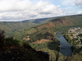
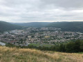
(3) Head back towards the inside of the ramparts, passing under the small stone tunnel. At the bus and coach car park, turn left. A few metres further on, take the path on the left and climb up to the orientation table. Enjoy the highest point of the fortified town and take in the view of the surrounding area.
(4) Return to the road and turn left onto Rue de la Percée. Then turn right after the wall onto the grassy esplanade and cross the road.
(5) Take the Sentier des Remparts opposite. Continue along the ramparts – some sections of which have a slight incline – until you reach the car park near the museum (S/E).

 Visorando Member
 Moderate