Country:

 City:
City:


(S) Start at the signpost for Le Bourg, in Bagnols. Head towards the castle and continue along the descending road. When you reach the signpost for Le Pigeonnier du Château, turn right towards Longchamp, then right onto the Route du Baronnat. Join the road – be careful, as it is very busy – cross it and take the path opposite. You will reach the Longchamp signpost.
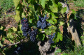
(1) Turn left onto the path towards the Ruisseau de Chanbonne. At the Fork in the road, turn right and immediately take a narrow path on the right. Pass through the hamlet of Longchamp, then continue to the right. Cross the road and take the path opposite. You will reach the vineyard.
(2) Take the path opposite. Continue along this path, ignoring the tracks to the right or left, until you reach a road. Here, you’ll pass very close to the runways of Villefranche Tarare aerodrome. Turn right, then left at the bend and left at the Fork in the road. Walk across the fields and then through the woodland until you reach a cross-path at the edge of a copse.
(3) Turn left and, at the junction, keep right, continuing straight on until you reach a road. Cross it and follow the path going uphill opposite. Head to the ‘Montée de la Calle’ signpost, then turn right towards Pont des Soupirs. Go downhill and then back onto the road. At the Pont des Soupirs signpost, turn left towards Les Coatières. At the first junction, turn right onto the Route du Ronzay. From there, begin a long uphill stretch on the road, emerging near the hamlet of Ronsay.
(4) Leave it on your right and take a path a little further down. Reach the signpost for Les Coatières. Take the road to the left, then quickly turn onto a path on the right. Reach a road and turn left to climb up to Charnay. Walk through the village.
After the church, turn right; at the end of the street, turn right and then left onto Rue du Pinay.
(5) Head towards Fontainebleau, then turn left onto Chemin de Buissy. Continue along it on the left. Descend quickly until you reach the power line.
(6) Take the path on the right, then turn right onto the road and follow it to the left. You’ll reach the Géoparc and the ecomuseum, at the signpost marked ‘Pierres Folles’. Go straight on towards Saint-Jean-des-Vignes. Pass the cemetery on your left and head downhill to the road. Turn left and then immediately right onto a path which joins another road.
(7) Turn right onto this road and continue on the left to enter Saint-Jean-des-Vignes. After the wash house, follow the Sentier du Fenouillard on the right. Pass beneath the village and rejoin the road at the exit, at the signpost marked ‘Saint-Jean-des-Vignes le Bourg’.
(8) Turn right towards Lozanne. At the sign marking the village exit, take the path opposite which runs between the houses of the hamlet of Les Parentes and then becomes a footpath. Follow it straight down, ignoring any turn-offs to the right or left, until you reach a road.
(9) Turn right onto it and, immediately, take the path on the left at the ‘Les Bageards’ signpost, heading towards Bois Don. At the ‘Bois Don’ signpost, turn right and you’ll reach the ‘Le Trève Gay’ signpost.
(10) Turn right towards the church. At the end of the path, turn left then right onto the Chemin des Roches. After this final steep slope, join the road, turn left onto it, and head down to the bottom of the valley.
(11) Cross the footbridge over the Azergues. Turn right, then left, to reach Lozanne station (E), the end point of this route.


 Visorando Member
 Easy
Easy