You are in the Mercantour National Park; there are regulations to be observed, and failure to do so may result in a fine of up to €1,500 – see the practical information.


 Country:

 City:
City:


Take the D902, the Col de la Cayolle road; there is a car park at the side of the road upstream of the Pont du Vieux Brec.
(S/E) Cross the bridge and immediately turn left onto theGR®56, which climbs up the Ravin de la Grande Cayolle. After the first hairpin bend, you’ll pass close to a shepherd’s hut. If the sheep are in the paddock, there may be guard dogs roaming freely. The climb then continues through the pastures to a fork at around 2,530 m.
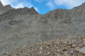
(1) Leave theGR® here and follow a well-marked path heading south, with the Pelat towering above you and, to your left, the pass you need to cross in sight. You will then reach a large scree slope; scattered cairns will help guide you more or less to the foot of the Pas de la Grande.
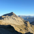
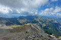
(2) This is the most difficult section, involving a 70-metre climb with a gradient of around 50 per cent, consisting of unstable gravel, sometimes smoother in places where you’ll need to rely on your walking poles even though they won’t sink in; mastery of this type of terrain is essential. The final section is easier, leading to the Pas de la Grande Barre at an elevation of 2,782 metres.
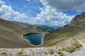
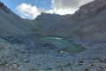
(3) A track through the scree makes it easy to reach Lac du Trou de l’Aigle.
(4) Follow the correct path, which leads to a fork at an elevation of 2,650 metres.
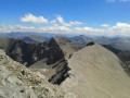
(5) Turn right to take the classic ascent to Mont Pelat. First, a section that is still grassy, then a long north-westerly traverse over entirely rocky terrain. The final section is steeper and rockier, but there are plenty of yellow markings. Do, however, watch out for the precipice; there are many walkers in summer, and a bit of discipline is required, especially at the summit of Mont Pelat, at an elevation of 3,051, which consists of a narrow ridge.
(6) Turn back and descend via the same route to the previous junction.
(5) Continue the descent due south. Pass the hairpin bend and carry on towards the Barre du Pelat, where there is a slightly exposed section but the path is wide enough that you need not fear the drop. Reach another junction at an elevation of 2,384 metres.
(7) Turn left towards the Col de la Cayolle and reach another junction at an elevation of 2418.
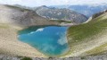
(8) Turn left onto theGR®56Btowards Bayasse. Climb the winding path to reach Lac de la Petite Cayolle at an elevation of 2,588 metres.
(9) Continue along theGR®56Bto reach the Col de la Petite Cayolle at an altitude of 2,639 metres.
(10) The start of the descent down the north face is quite steep and a large snowfield may still be present in June. After a few hairpin bends, you’ll reach a scree slope and a fork in the path.
(11) Leave theGR®56Band continue straight on, following the cairns on a long, gently sloping traverse heading north-east. This section is not maintained. Cross a few areas of runoff which may have carried large quantities of stones during violent storms. Join the usual, clearly visible path further down.
(12) Then turn left onto theGR®56B, which runs above the road in places, and take a few shortcuts to reach the Pont du Vieux Brec (S/E).


 Visorando Member
 Difficult
 Moderate