On the outskirts of Swiss Normandy

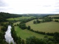
Discover the charms of the wooded countryside on the edge of Swiss Normandy, stroll along its shaded paths, follow and cross its streams, and be captivated by its architectural and rural heritage.

Details

9107163
Creation:
Last update:
Last review:
  • Walking
    Activity: Walking
  • ↔
    Distance: 4.91 mi
  • ◔
    Average duration: 2h 35 
  • ▲
    Difficulty: Moderate

  • ⚐
    Back to start: Yes
  • ↗
    Ascent: + 338 ft
  • ↘
    Descent: - 338 ft

  • ▲
    Highest point: 623 ft
  • ▼
    Lowest point: 423 ft

Photos

Description of the walk

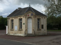
Parking is available at the car park by La Caine Town Hall.

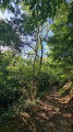
(S/E) From the car park, walk round the back of the town hall building, then turn left onto the wooded path. Follow the path downhill and walk alongside the River Ajon until you reach the road, near the Baronnie equestrian centre.

(1) Turn left, follow the road and head back up to the D36. Cross the road with the utmost care, continue to the left, keeping very carefully to the right-hand verge, and follow the D36 for about 100 metres until you reach the first road on the right.

(2) Turn right onto the C1 towards Ouffières-Bourg and Bois Cachy, then continue for about 1.1 km until you reach the junction. At the hamlet of l’Aunay d’Ouffières, turn left towards the Ferme des Épis and, via the hamlet of Grand l’Aunay, join the road on the left.

(3) Turn left and head back up towards the Ferme des Épis and the hamlet of Ronde Fontaine until you reach the S-bend.

(4) At the bend and before a farm shed, turn right onto the dirt track and head straight down for about 900 metres along the sunken path (which can be waterlogged, muddy and slippery during wet weather) until you reach the crossroads near the village of Ouffières.

(5) Turn left, take the gently ascending track, pass a large farm shed on your left and follow thePR® for about 1.1 km until you reach the D 213 road.

(6) Turn left, leave thePR® and, taking care, follow the D 213 for about 600 m until you reach the metal barriers on the left.

(7) Between two fields and after a metal angle bracket serving as a post, turn right onto the grassy path which descends to the Gragnon stream and then climbs back up towards the hamlet known as Le Val.

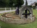
(8) Between the telephone pole and the hedge, continue straight ahead along the path running to the left of an old mill and a stream, heading up towards the village of La Caine and taking the Impasse de la Douiterie. At the junction with Rue de l’Église (D 213), turn right, walk past the cemetery and the church, then, at the top of Rue de l’Église, use the pedestrian crossing to get onto the pavement on the left. Using the pedestrian crossing opposite the Town Hall car park, cross the D36 with the utmost care to reach the car park. (S/E)


Waypoints

  1. S/E : mi 0 - alt. 581 ft - Car park at La Caine Town Hall. Towards the - Ajon (rivière)
  2. 1 : mi 0.53 - alt. 515 ft - The Barony
  3. 2 : mi 0.95 - alt. 607 ft - The Cropton Road
  4. 3 : mi 1.83 - alt. 459 ft - Le Grand Aunay
  5. 4 : mi 2.14 - alt. 535 ft - Ronde Fontaine
  6. 5 : mi 2.68 - alt. 430 ft - Ouffières Suburb
  7. 6 : mi 3.36 - alt. 522 ft - D 213
  8. 7 : mi 3.71 - alt. 538 ft - Grassy path leading to the hamlet of Le Val
  9. 8 : mi 4.35 - alt. 446 ft - A place known as Le Val
  10. S/E : mi 4.91 - alt. 581 ft - Car park at La Caine Town Hall

Notes

Given that certain sections can be waterlogged, muddy and slippery during wet weather, the use of walking poles is strongly recommended.

Worth a visit

Paths of Mont Saint-Michel
(7) Here you follow the paths to Mont-Saint-Michel. This route corresponds to the ‘Grand Chemin de Bretagne’, the successor to the ancient road from Vieux to Avranches, which was used to transport mail and goods and led some pilgrims and travellers to Mont-Saint-Michel. It was subsequently abandoned following the construction of the royal road at the end of the Ancien Régime.

Notre-Dame Church
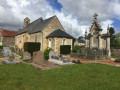
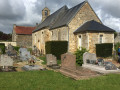
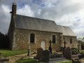
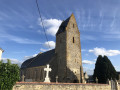
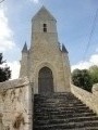
The church (14th century, Romanesque style) is situated to the north of the village cemetery. The western façade is a gable wall surmounted by a bell tower. The southern side wall has a two-storey elevation: the lower storey features a basket-handle arch doorway, whilst the upper storey has two basket-handle arch windows with tracery. The chancel features a small square window and a twin window on its south side. The chancel is flat.

‘The church, which remained a parish church until the Revolution and has now been deconsecrated, is partly in the Romanesque style (probably dating from the time of its foundation): it is of modest size and ends in a semicircular apse. The north wall is the one that has retained its original character. An open bell tower surmounts the west wall and houses the bell. ” (Arcisse de Caumont 1-157)

Priory
Near the church you can see the remains of a former priory. This building, founded by Roger de Malfillâtre, dates from the early12th century. It served as a retreat for the nuns of the Order of Beaumont-les-Tours.

“La Caine, prioratus de Cathenâ.
This priory was founded by Roger de Malfillâtre, Lord of Curcy-le-Malfillâtre, Ouffières, La Caine, etc...
The founder bequeathed his priory to the nuns of Beaumont-les-Tours. It was once inhabited by several nuns from that monastery, governed by a prioress… The prioress was Lady of La Caine and appointed the parish priest; however, the nuns subsequently withdrew to their abbey, which still received the priory’s income in 1790…
After the nuns withdrew to their abbey, the convent buildings had to be devoted solely to running the farm: the only remaining part of the original structure is the entrance, which, like almost all abbey entrances, features a large gate for carts and a small gate for pedestrians. Both are vaulted with low arches without columns, but are very solidly built and appear to date from at least the15th or14th century…’ (Arcisse de Caumont 1-156)

Battle of Normandy
In the early days of the Battle of Normandy, the German headquarters of Panzer Group West, commanded by General von Schweppenburg, took up position at Château de la Caine.
It organised a counter-offensive involving three armoured divisions, intended to halt the landings.
Quickly alerted to this presence by the local Resistance, the Allies mounted a lightning air raid.
On 10 June 1944, at around 6.00 pm, shortly after an inspection by Field Marshal Rommel, 400 RAF Typhoons attacked at low altitude in three waves, followed by 61 Mitchell bombers which dropped their bombs on Château de la Caine and the surrounding area.
The headquarters was decimated and all its equipment destroyed.
Most of the officers were killed, as were two children from the village.
The commander-in-chief was seriously wounded.
The attack destroyed the German army’s only command structure on the Western Front capable of directing a large-scale armoured offensive.
The counter-offensive was called off; the landings were a success.

Always be cautious and plan ahead when you're outdoors. Visorando and the author of this route cannot be held responsible for any accidents occurring on this route.

The GR® and PR® markings are the intellectual property of the Fédération Française de Randonnée Pédestre.

Reviews and comments

3.9 / 5
Based on 4 reviews

Reliability of the description
4.3 / 5
Ease of following the route
4.8 / 5
Route interest
2.8 / 5
User 12745548

Overall rating : 4.3 / 5

Date of your route : Jul 28, 2025
Reliability of the description : ★★★★★ Very good
Ease of following the route : ★★★★★ Very good
Route interest : ★★★☆☆ Average
Very busy route : No

July 2025: part of the hike was difficult to navigate (between numbers 4 and 5). The path was overgrown with vegetation, particularly brambles and nettles. My calves still remember it well. It is possible to bypass the path by walking through the fields.

Machine-translated

Lenorman
Lenorman

I completed this walk with a guide because I am visually impaired and unable to follow a trail. Once an audio guide feature becomes available, I will be able to manage on my own.
I must point out, however, that one path was flooded that day and we had to walk along the edge of the ploughed field.
Kind regards
Lenorman

Machine-translated

Caro14
Caro14

Overall rating : 3.7 / 5

Date of your route : Jul 07, 2024
Reliability of the description : ★★★★☆ Good
Ease of following the route : ★★★★☆ Good
Route interest : ★★★☆☆ Average
Very busy route : No

Part of the route – about 500 metres – hasn’t been maintained for a long time. Branches, brambles, nettles… in short, the vegetation has overgrown this little path, making it virtually impassable.

Machine-translated

jeangazon
jeangazon

Overall rating : 3 / 5

Date of your route : Oct 06, 2022
Reliability of the description : Not used / Not applicable
Ease of following the route : ★★★★★ Very good
Route interest : ★☆☆☆☆ Very disappointing
Very busy route : No

The route is good, certainly, but what’s the point of this walk? Half of it is on tarmac roads, the other half through cultivated fields stretching as far as the eye can see. The only slightly pleasant bits are the few paths through the woodland, but there are very few of them.
I’ll ask again: why post this sort of walk? It’s not the first one of this kind you’ve posted. In my view, it’s better to prioritise quality over quantity.

Machine-translated

jasy19481949
jasy19481949

Overall rating : 4.3 / 5

Date of your route : Jun 09, 2021
Reliability of the description : ★★★★☆ Good
Ease of following the route : ★★★★★ Very good
Route interest : ★★★★☆ Good
Very busy route : No

We went on this walk today. It was bright and sunny, but there had been thunderstorms over the previous few days. Between points 4 and 5, the path was barely visible because of all the grass, stinging nettles and brambles. The ground, covered in places with stones and roots, was very unpleasant. As a result, we didn’t walk the section between 7 and 8 for fear of encountering the same difficulties. We made our way back to La Caime via the small road. The other sections of the route were quite pleasant.

Machine-translated

Other walks in the area

For more walks, use our search engine .

The GPS track and description are the property of this route's author. Please do not copy them without permission.