A short walk along the sunken paths between Goupillières and the River Orne

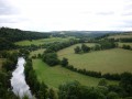
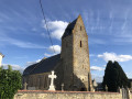
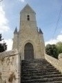
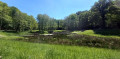
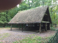
A short ride along paths through the woods and alongside a lovely little stream. The route reaches the River Orne, a lovely spot for a picnic by the water’s edge. The return journey follows a shaded path. The little village has a few attractions, notably the simple, rustic 17th-century church. The schist buildings stand in stark contrast to the usual Caen stone that dominates the region.

Details

5080931
Creation:
Last update:
Last review:
  • Walking
    Activity: Walking
  • ↔
    Distance: 2.38 mi
  • ◔
    Average duration: 1h 20 
  • ▲
    Difficulty: Easy

  • ⚐
    Back to start: Yes
  • ↗
    Ascent: + 308 ft
  • ↘
    Descent: - 308 ft

  • ▲
    Highest point: 390 ft
  • ▼
    Lowest point: 56 ft

Description of the walk

In front of the church, there is a small car park, ideal as a starting point for your ride.

(S/E) Take the main road heading north (towards Caen). Ignore the road on the right leading to the Pont de Brie.

(1) Don’t miss the signposted path on the right after a few traditional houses with their laurel and common eleagnus bushes. Head down towards the Ruisseau de la Vallée Fermante.

(2) Cross the stream: both the descent and the stream crossing are very muddy. The path that follows is very pleasant, lined with oaks, hornbeams, spruce and acacias. We were lucky enough to be accompanied by robins and titmice.

At the bottom, the path branches off to the right and runs alongside the River Orne to reach the Pont de Brie: there’s no way you can get lost.

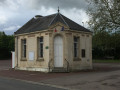
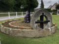
(3) Carry on straight ahead, passing the restaurant. The spot looks ideal for a picnic. Continue for about a hundred metres before turning right onto a path that climbs into the woods. Here again, wellies are essential during the rainy season. There is a small washhouse covered in sheet metal on the right: it serves to protect this water source, which we found rather charming.

Walk up the valley until you come out onto the main road.

(4) Turn right. A few of the houses have a certain charm – it’s up to you to spot them before reaching the car park in front of the church (S/E).

Waypoints

  1. S/E : mi 0 - alt. 364 ft - Car park at the - Église Saint-Eustache (Goupillières)
  2. 1 : mi 0.24 - alt. 344 ft - Marked path on the right
  3. 2 : mi 0.61 - alt. 226 ft - Crossing the stream
  4. 3 : mi 1.39 - alt. 69 ft - Pont de Brie - Orne (fleuve)
  5. 4 : mi 2.06 - alt. 361 ft - Return to the main street
  6. S/E : mi 2.38 - alt. 364 ft - Car park at the - Église Saint-Eustache (Goupillières)

Notes

(S/E) Another option for this ride is to set off from the Pont de Brie on the banks of the River Orne.

In the wet season, there is mud on much of the trails. So make sure you bring wellies, good walking shoes or studs for your horse’s shoes if the weather is wet. Sun cream isn’t necessary – you’re in Normandy, and what’s more, you’ll be walking through woodland.

There is a small restaurant offering very reasonably priced set menus.

Reviews and comments

4.5 / 5
Based on 2 reviews

Reliability of the description
4.5 / 5
Ease of following the route
4.5 / 5
Route interest
4.5 / 5
Bounty14
Bounty14

Overall rating : 4 / 5

Date of your route : Mar 23, 2026
Reliability of the description : ★★★★☆ Good
Ease of following the route : ★★★★☆ Good
Route interest : ★★★★☆ Good
Very busy route : No

A lovely little walk along a small stream, through the woods, in peaceful surroundings.

Please note: do make sure you wear waterproof shoes, as the path is muddy and there is a small stream to cross where branches have been laid down to help you get across.
There are two fairly steep climbs.

Machine-translated

Alain Re
Alain Re

I’ve lived in Goupillières since 1976; as a keen walker, I’ve explored every path in the village and the surrounding area.
The problem with this walk is that it starts from the church car park and follows the road. However, for the past ten years or so,
The Mayor, Mr Jean Paul Houdan, has planned to create a cycle and pedestrian path so that walkers do not have to use the road alongside the cemetery, which is dangerous as there is no pavement on either side; you have to walk in the gutter, and if a car comes along, you have to step out of the way.
The local council has therefore decided to create a cycle path, which will allow people to get about safely: children can ride their bikes, and so on… Normally, you can see this cycle path winding its way on the map; it’s located behind the cemetery.
I think that when you suggest a walk and expose walkers to a danger that could be avoided, if an accident happens, you’re in a bit of a pickle when it comes to insurance.
The organiser of this walk is taking a big risk.
Kind regards
Alain Re

Machine-translated

robyadad
robyadad

Overall rating : 5 / 5

Date of your route : May 02, 2021
Reliability of the description : ★★★★★ Very good
Ease of following the route : ★★★★★ Very good
Route interest : ★★★★★ Very good
Very busy route : No

Brilliant. A 2-hour walk. Perfect for less experienced walkers

Machine-translated

Other walks in the area

For more walks, use our search engine .

The GPS track and description are the property of this route's author. Please do not copy them without permission.