Country:

 City:
City:




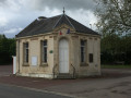
Park in the car park at the Trois-Monts town hall.
(S/E) From the town hall car park, head right towards the school and take Impasse de l’Orne on the left. Continue along the path which, further on, turns right.
(1) After 100 m, take the path on the right towards Château le Vaugroult. Walk up the road and past the hamlet of La Vallée.
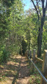
(2) Between the two fields, take the straight path on the left which descends slightly towards the forest. Once in the forest, go down a steep slope, following the handrail.
(3) Turn onto the path on the left which follows the Ruisseau de la Vallée Fermante. At the bottom, the path veers to the right and runs alongside the River Orne to reach the Pont de Brie. Carry on straight ahead, passing a restaurant. Then continue for about a hundred metres.
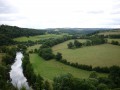
(4) Before continuing the walk to the right, I suggest you take a short detour to the left, down a cul-de-sac that leads to the River Orne, to admire the view. It feels just like Canada! This is a launch point for canoe clubs. Retrace your steps. Then carry on straight ahead along the path that climbs into the woods. Walk up the valley and you’ll come out onto the D212.
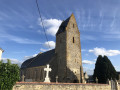
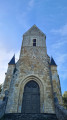
(5) Follow it to the right and walk through the village of Goupillières to the church.
(6) Just before you reach it, take a small path on the left which runs behind the church. This then leads back to the D212; follow it to the left until you reach the edge of the village.
(7) Turn right into the last small street in the housing estate. This turns into a narrow path which bends left and descends towards the Ruisseau de la Vallée Fermante; cross the stream to reach the junction from the outward journey.
(3) Turn left, heading in the opposite direction to the outward journey, climb back up using the handrail for support, and then continue along the path between two fields. You’ll come to another junction that you passed on the outward journey.
(2) Turn left and continue along this path until you reach the small Rue du Plein Air on the right.
(8) Walk up this street, then turn left at the bend. Cross the D212 carefully, continue along Rue du Jardin Morin, then cross Rue du Parc by first turning left then right, and carry on towards the church.
(9) Walk alongside it on the right and go down the path. Then follow the GR®36 alternative route to the right and rejoin the D212. Head back up to the left towards the town hall car park (S/E).
 Visorando Member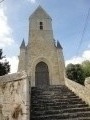

 Easy
Easy