Country:

 City:


Starting point: park in the church car park, at the end of Impasse de l’Église Romane.
(S/E) Join the D7 at the town hall.
(1) Follow the road to the left and take the first right towards La Perrière.
(2) At the entrance to the hamlet, take the path branching off to the right towards the hamlet of Le Verger. At the next junction, turn right. Walk through the hamlet of Le Verger until you reach a junction.
(3) Continue straight on and, after about fifty metres, take a path on the right.
(4) You’ll come out onto a small road; follow it to the right.
(5) Take the first left and cross the bridge over the Besbre. Immediately afterwards, at a junction, keep to the right.
(6) After a few dozen metres, take the path that climbs to the left towards the hamlet of La Crouze. Climb up a series of bends, pass through the hamlet and reach a junction.
(7) Turn sharply right onto a road that leads downhill. At the next junction, take the hairpin bend to the left. Cross the Besbre once more.
(8) Immediately take the road on the left towards the hamlet of Dugan. Pass through the hamlet and continue along the road.
(9) Take the path leading uphill to the left towards Mazotin. Just before the houses in the hamlet, take a path on the right. Join the small road and follow it to the left for about twenty metres.
(10) Carry on along the road for about fifty metres (ignore the path branching off to the left).
(11) Leave the road and take a good track branching off to the right.
(12) Further on, turn onto a path that climbs to the left. Go round the Rez de la Garde on the right and ignore all the turnings on the right. This will take you to the hamlet of Géranton.
(13) Follow the road to the left until you reach a junction you have passed earlier.
(11) Continue along the road for about fifty metres.
(10) Then turn right onto a path that leads downhill.
(14) Ford a stream and head uphill on the other side.
(15) Take a path branching off to the left. Ignore all the turnings on the left and head uphill to the hamlet of La Rape. Go past the hamlet and you’ll soon come to a junction with a small road.
(16) Cross the road and continue along the path opposite.
(17) At the end of the path, follow the D471 to the left.
(18) Take the first right, a small road towards Maison Neuve. Leave this hamlet on your left, continue along the road and pass the hamlet of Chaillat. You will reach the hamlet of Roc de Laly.
(19) Take a good track on the left.
(20) You’ll come out onto a small road; follow it to the left. Ignore a road branching off at right angles to the right.
(21) At the next junction, turn left towards Chaffaud. Walk through the hamlet and continue along a path. Further on, walk through the hamlet of La Chaise.
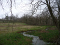
(22) As you leave the hamlet, take the path branching off to the right (this is the start of the botanical trail). Follow this winding path, passing a pond on your left.
(23) Return to the D471 and follow it to the right. At the Fork in the road that appears immediately, turn left.
(24) At a right-hand bend, leave the road and continue straight on along a path. Cross two streams in succession and come out onto a small road.
(25) Follow this road to the right.
(26) At the end, follow the D171 to the left for about 150 m. When the road bends to the right, take a path on the left. Continue along a track until you reach the village of Le Breuil. Return to the tarmac road and turn left twice to reach the town hall.
(1) Turn left into Impasse de l’Église and you’ll soon reach the car park (S/E).

 Visorando Member
 Easy

 Moderate