Country:

 City:
City:


Start from the Route de Ramille, south-west of the Croix des Chabannes. Park along the road.
(S/E) Continue along the tarmac road heading south and uphill. Follow theGR®3(red and white markings).
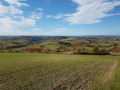
(1) Ignore a path branching off to the left and pass under a power line. Walk past the Ramille farm on your left and continue along theGR®3(lovely view of the surrounding area).
(2) At the forkin the road, turn left ontothe GR®3A. Follow the “Ramille” sign for the Allier walking trails and continue down the path. Join a tarmac road (elevation 603), follow it to the right for a few tens of metres, then leave it to take a path on the left (still on theGR®3A).
(3) After a good hundred metres, turn left onto the blue and yellow-marked path (let theGR® carry on straight ahead). Wind your way through the forest, go round the hill (elevation 584m) on the left and ignore a path branching off to the right.
(4) At a place called Barret, follow the road to the left (as you leave Barret, leave the Allier de Ramille route). Just after the junction of the two tarmac roads and directly beneath a power line, turn left onto a dirt track that climbs towards the top of the hill.
(1) You’ll come out onto the road you took on the way there; follow it to the right to reach the starting point very quickly (S/E).

 Visorando Member
 Moderate
 Association / Club / Walk leader
 Difficult