The Maquisards’ Wood in Châtel-Montagne

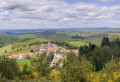
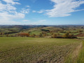
A walk offering varied scenery and beautiful panoramic views, starting from the Darots car park. And as a bonus for the children, there are plenty of farm animals along the route!

Details

n°44723304
Creation:
Last update:
Last review:
  • Walking
    Activity: Walking
  • ↔
    Distance: 7.36 mi
  • ◔
    Average duration: 4h 35 
  • ▲
    Difficulty: Moderate

  • ⚐
    Back to start: Yes
  • ↗
    Ascent: + 1,332 ft
  • ↘
    Descent: - 1,312 ft

  • ▲
    Highest point: 1,765 ft
  • ▼
    Lowest point: 1,125 ft

Description of the walk

Park at the Darots car park.

(S/E) From the car park, take the path that climbs through the forest to the Charnant farm.

(1) Carry on straight ahead, skirting the farm. Further on, turn right at the junction and head towards the hamlet of Le Plan.

(2) Turn left. Keep left at the Fork in the road immediately ahead, then turn right to enter the woods. Continue to the hamlet of Morel.

(3) Carry on straight ahead towards Mailland.

(4) Turn left just before the hamlet and follow the path to a fork under a power line.

(5) Turn right towards the hamlet of Chez Gade, which is visible across the plain.

(6) Turn left, pass a small pond on your right and reach a four-way junction.

(7) Turn right and continue along the edge of the woods until you reach the hamlet of Rez de Landier.

(8) Turn left, then left again at the hairpin bend at the next junction and carry on to the next crossroads.

(9) Turn right and head towards Peulong.

(10) Turn left, then keep right at the three-way junction to rejoin the path leading to the Charnant farm.

(1) Turn right and, following the route back in the opposite direction to the outward journey, head back down to the car park (S/E).

Waypoints

  1. S/E : mi 0 - alt. 1,191 ft - Les Darots car park
  2. 1 : mi 0.63 - alt. 1,617 ft - Junction of the circular loop
  3. 2 : mi 1.45 - alt. 1,617 ft - Map
  4. 3 : mi 2.32 - alt. 1,132 ft - Morel
  5. 4 : mi 2.58 - alt. 1,230 ft - Junction before Mailland
  6. 5 : mi 3.08 - alt. 1,440 ft - Three-way junction beneath the power line
  7. 6 : mi 3.72 - alt. 1,539 ft - Chez Gade
  8. 7 : mi 4.16 - alt. 1,542 ft - Crossroads
  9. 8 : mi 4.74 - alt. 1,627 ft - Le Rez de Landier
  10. 9 : mi 5.8 - alt. 1,640 ft - Crossroads
  11. 10 : mi 6.19 - alt. 1,444 ft - Peulong
  12. S/E : mi 7.36 - alt. 1,198 ft - Les Darots car park

Notes

The walk takes 3 hours without breaks and at a leisurely pace for experienced walkers.
It is possible to shorten the walk by taking shortcuts.

Reviews and comments

5 / 5
Based on 1 review

Reliability of the description
5 / 5
Ease of following the route
5 / 5
Route interest
5 / 5
tig
tig

Overall rating : 5 / 5

Date of your route : Aug 11, 2024
Reliability of the description : ★★★★★ Very good
Ease of following the route : ★★★★★ Very good
Route interest : ★★★★★ Very good
Very busy route : No

Hello,
A lovely walk, mainly along footpaths and trails, with some beautiful views. The route is very shaded, which is pleasant when it’s hot, and there are a few information boards telling us about the area’s history (the 1939–45 conflict).

Machine-translated

Other walks in the area

For more walks, use our search engine .

The GPS track and description are the property of this route's author. Please do not copy them without permission.