The Chestnut Route above the village of Arfeuilles

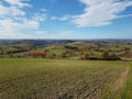
A short route above Arfeuilles, at the entrance to the Bourbonnais mountains, offering lovely views of the surrounding area.

Details

1616255
Creation:
Last update:
Last review:
  • Walking
    Activity: Walking
  • ↔
    Distance: 2.97 mi
  • ◔
    Average duration: 1h 40 
  • ▲
    Difficulty: Easy

  • ⚐
    Back to start: Yes
  • ↗
    Ascent: + 367 ft
  • ↘
    Descent: - 367 ft

  • ▲
    Highest point: 1,736 ft
  • ▼
    Lowest point: 1,365 ft

Photos

Description of the walk

Start from the fairground car park, opposite the holiday camp, on Avenue René Laclotre.

(S/E) Head towards the River Barbenan along the fairground (moving away from the holiday camp). Cross the bridge over the river and pass the small sports ground on your left.

(1) At the junction, turn right towards Guérande. At the first Fork in the road, take the left-hand dirt track leading up to the stadium. At the next Fork in the road, continue along the track on the right.

(2) Immediately ignore a turn-off on the right and head up towards the stadium. Pass the stadium (on your right) and you’ll come to a crossroads marked with a cross.

(3) Then follow the path on the left which runs alongside a meadow.

(4) At the end of the meadow, turn right and head uphill towards the forest. Continue eastwards along the edge of the forest (beautiful views).

(5) At the next junction, head down to the right towards the stadium and the village. On your left, pass the woodturner’s house.

(3) Turn left twice, pass the stadium and retrace your steps along the same path you took on the way there until you reach the fairground car park (S/E).

Waypoints

  1. S/E : mi 0 - alt. 1,368 ft - Car park at the fairground, Avenue René Laclotre
  2. 1 : mi 0.14 - alt. 1,378 ft - Junction
  3. 2 : mi 0.38 - alt. 1,470 ft - Junction
  4. 3 : mi 0.85 - alt. 1,522 ft - Crossroads marking the end of the circular loop
  5. 4 : mi 1.29 - alt. 1,617 ft - Fork in the meadow
  6. 5 : mi 1.79 - alt. 1,657 ft - Crossroads at the edge of the forest
  7. S/E : mi 2.97 - alt. 1,368 ft - Car park at the fairground, Avenue René Laclotre

Notes

An easy walk from the village of Arfeuilles; there is a 150-metre steep climb above the sports ground, which is the most challenging part of this walk.
Path leading to the village sports ground.
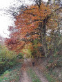
Part of the route runs through the forest.
No water sources or rivers to cross.

Worth a visit

Beautiful views of the surrounding area.
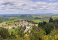
Start and finish in Arfeuilles, a charming little village in the Bourbonnais mountains (church, holiday camp, wood turner, etc.)

Reviews and comments

4.8 / 5
Based on 2 reviews

Reliability of the description
5 / 5
Ease of following the route
5 / 5
Route interest
4.5 / 5
Ballades
Ballades

Overall rating : 5 / 5

Date of your route : Oct 30, 2023
Reliability of the description : ★★★★★ Very good
Ease of following the route : ★★★★★ Very good
Route interest : ★★★★★ Very good
Very busy route : No

Some good climbs

Machine-translated

Azimut71
Azimut71
• Edited:

Overall rating : 4.7 / 5

Date of your route : May 22, 2022
Reliability of the description : ★★★★★ Very good
Ease of following the route : ★★★★★ Very good
Route interest : ★★★★☆ Good
Very busy route : No

A pleasant walk.
The climb to the summit from the west is very tough; it might be better to walk the circular route in the opposite direction, as the slope is gentler on the eastern side.
On the summit hill, there has been extensive deforestation on the north-facing slope; a shame.

Machine-translated

Other walks in the area

For more walks, use our search engine .

The GPS track and description are the property of this route's author. Please do not copy them without permission.