Autour du Sauvage starting from Vieillemaringe

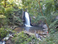
This short trail, dotted with markers and artistic signs, will take you on a journey through the unique landscapes of Corrèze. Huge chestnut trees, dry stone walls and enormous quartz boulders bear witness to a bygone era and await your visit.

Details

95438516
Creation:
Last update:
Last review:
  • Walking
    Activity: Walking
  • ↔
    Distance: 1.34 mi
  • ◔
    Average duration: 0h 50 
  • ▲
    Difficulty: Easy

  • ⚐
    Back to start: Yes
  • ↗
    Ascent: + 200 ft
  • ↘
    Descent: - 210 ft

  • ▲
    Highest point: 1,818 ft
  • ▼
    Lowest point: 1,608 ft

Description of the walk

Head to the village of Vieillemaringe, stay on the main road and stop at the first junction. On the right, a stone cross confirms that you are in the right place; on the left, a small path called “Chemin de l’école” also marks the start of this walk. A full map and a “Départ” sign are displayed on a noticeboard. Please park respectfully at the side of the road or continue on until you reach Place de Vieillemaringe (5), where you can park your vehicle. Then retrace your steps to find the crossroads and the “Départ” sign.

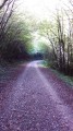
(S/E) Follow the “Chemin de l’école”, a narrow path that gradually leads you into the forest.

(1) About 250 metres further on, turn right and follow the sign for “l’Aiguillou”. The path is dotted with artistic markers depicting animals or flowers.

(2) After l’Aiguillou, a patch of land covered in hundred-year-old chestnut trees, a sign at the crossroads tells you which way to go next: follow “le Sauvage” to your left. The path continues gently until you reach the official hamlet of le Sauvage.

(3) There, you’ll find small yellow and pink arrows marking the path as it heads a little further into the forest. Follow the arrows until you see “l’Arche du Pradel” (a wooden structure) and pass underneath it.

(4) The arrows lead you back up to Vieillemaringe. The final few metres before the village are more challenging: plenty of stones and a fairly steep slope leading to the village’s public fountain, “Font Basse” (under renovation in 2026). The arrows take you a little further into the heart of the village, to the square (alternative car park).

(5) You have barely a hundred metres left on the road before you catch sight once again of the famous stone cross at the crossroads (S/E).

Waypoints

  1. S/E : mi 0 - alt. 1,818 ft - Crossroads with a cross
  2. 1 : mi 0.18 - alt. 1,752 ft - Heading towards L’Aiguillou
  3. 2 : mi 0.45 - alt. 1,755 ft - Heading to Le Sauvage
  4. 3 : mi 0.76 - alt. 1,670 ft - Le Sauvage
  5. 4 : mi 1.09 - alt. 1,683 ft - Le Pradel
  6. 5 : mi 1.23 - alt. 1,791 ft - Place de Vieillemaringe - Car park
  7. S/E : mi 1.34 - alt. 1,808 ft - Crossroads with a cross

Notes

We strongly recommend using walking poles for the "Le Pradel-Fontbasse" section (around 50 metres) as this is the most challenging part. The rest of the route is accessible, with fairly gentle slopes. There are plenty of facilities such as tables and benches, so do feel free to bring a snack and something to drink.

Worth a visit

L’Aiguillou is an area marked by ASPAS signs and open to walkers; admire the view of the valley opposite, have a picnic on the log table, or simply take in the sight of the tall trees that make up the area.

Le Sauvage (3) is “private” (marked off by wire fencing) but the walk continues, so do not stop at the sign; instead, discover a denser forest further along the route. Below, on the path, you’ll find “la source de la Louche bleue”, a little gem from the past.

(4) Le Pradel and its arch are always ready to welcome your best selfies!

(5) And finally, Font Basse offers a chance to catch your breath on its benches before continuing on to Vieillemaringe and its square.

Just a quick note: the trail is signposted and maintained by volunteers from the Association Autour du Sauvage (find them on Instagram and Facebook: @autour du sauvage).

Other walks in the area

For more walks, use our search engine .

The GPS track and description are the property of this route's author. Please do not copy them without permission.