Country:

 City:
City:


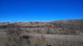
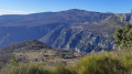
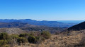
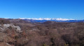
From the coast, head to the village of Courmes via the Gorges du Loup and then Bramafam. Park in the municipal car park at the entrance to the village.
(S/E) From the car park, facing the road, take the path on the right located on the access ramp. Walk slightly uphill to the junction, then turn right onto the track, which is closed off by two metal barriers to prevent motorised vehicles from passing. Continue to the wayside shrine and marker 251.
(1) Follow the GR®51, which climbs to the left of the wayside shrine, to join the track leading to the Domaine des Courmettes and marker 252.
(2) Let the GR®51 head off to the right and take a sharp left-hand bend to continue climbing north-eastwards. Reach marker 253 and rejoin the GR®51.
(3) Turn left towards the north to reach the Saint-Barnabé plateau. Pass marker 254 and reach the oratory at marker 255.
(4) Head right and continue eastwards to reach the hamlet of Saint-Barnabé and marker 263.
(5) Turn right and follow the D302 carefully (still on the GR®51) for about 1 km, until you reach marker 262.
(6) Carry on straight ahead, leaving the D302, then take the track that continues from the road until you reach marker 261.
(7) Leave the GR® and take the path on your right, heading south-west. On this section, the path is not very obvious: it crosses a small scree slope, climbs gently, then becomes steeper before reaching marker 177. Follow this path southwards until you reach marker 176.
(8) At the crossroads, take the path that descends sharply to the south along the mountainside for about 300 m, then turn right at the next junction, still following the mountainside. Follow this path for about 1 km until you reach the access track to Jas Vieux.
(9) Turn right onto it, pass marker 179 and continue along the contour line to the left, following the mountainside. You will reach the junction at marker 186.
(10) Carry on straight ahead, passing marker 185. Leave the woodland behind you, leaving the path on your right which climbs towards the Pic de Courmettes, and you will very quickly reach the junction at marker 187.
(11) Ignore the path on the left leading to the lookout post; carry on straight ahead towards the Domaine de Courmettes and continue to the next junction.
(12) Carry on straight ahead for about thirty metres, leaving the Chemin des Courmettes on your left, which leads to the estate’s car park. Then take the track on your right to join the botanical trail, marked in black, which climbs northwards: in this section, you can admire several hundred-year-old oak trees. Follow the botanical trail to the end. Please note: when you reach a dry stream bed, you will need to go through a metal gate to cross a grazing area. Make sure you close the gate properly and be careful of the sheepdogs guarding the flocks, as you are on their territory.
(13) At the last gate, turn right onto the track known as the Chemin des Courmes, which heads west at first and then climbs northwards to marker 189, which marks the start of the Pic de Courmettes trail.
(14) From this marker, continue straight ahead along the track which descends and then joins the GR®51 at marker 190, near the water tank.
(15) Follow the GR®51 as it descends straight ahead, heading due north, and rejoins the junction with the ascent path.
(2) Continue to the left, staying on the GR®51 in the opposite direction to your outward journey, to reach the car park and return to the Courmes municipal car park (S/E).
 Visorando Member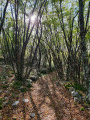
 Easy
Easy 
 Moderate